Monday, August 15:
Click HERE to view the remaining trip pictures
We are up at 6:45 once again, say goodbye to Patty before she leaves for school, pack up the trailer, say our goodbyes to Regan and Rachael, and by 8:20 we are on the road south.
From Edgewood to Socorro I pull back out the needlepoint and ALMOST finish a donkey before we arrive in Jed’s town. We gas up and switch drivers. I take a 75 mile stretch from Socorro down to south of Truth or Consequences and the turnoff on 152 to Silver City.
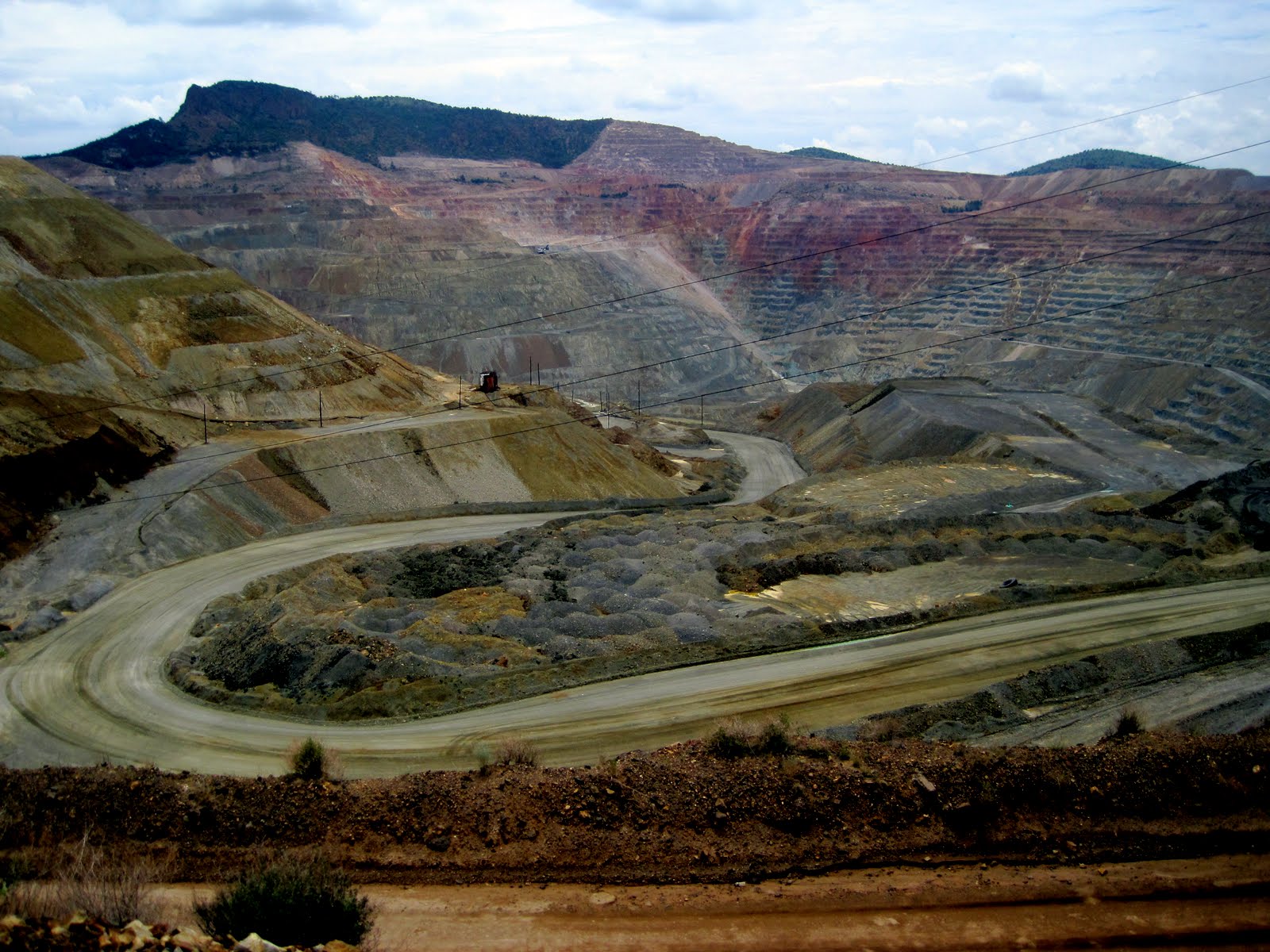 |
| Santa Rita Cooper Mine |
Our Silver City KOA is a model of how a campground should be run. I am greeted as I walk into the office with, “Are you Ginger?” She had seen the tent trailer pull in with the Oregon plates and knew she only had one tent trailer coming in with a reservation today! Wow! A very personable gal who shared her obvious love and joy of life in Silver City with us. Gave us good recommendations. Everything was ready to go, and we pulled into our site and set up the trailer. The campground is beautifully groomed and cared for. We are given a fresh baked cookie as a welcome gift. Ice cream is served by the pool evenings. So friendly I just might have to write the KOA people and let them know what a great job this couple does here in Silver City!
 |
| Our campsite in Silver City |
 |
| Entrance to CatWalk |
 |
| Ginger on suspension bridge |
Back the 5 miles of Whitewater Canyon to the main road and Glenwood. It is 6:10 and we still have over an hour to go to get back to Silver City. The KOA folks had recommended a café, The Bluefront, but we find it is closed. All that is open seems to be Mario’s Pizzeria, so we give it a go. Rick has a meatball grinder and I a Turkey, Bacon, and Avocado sandwich. A little slow getting served, as right after we order many locals come in for take-out orders, movies (it is also the local video rental store!), etc. But our meal is good and we are no longer hungry!
 |
| Mystery poppy - Prickly Poppy |
Tuesday, August 16:
Ah, shortly before we went to sleep last night, the rain quieted. This morning everything is damp and fresh, but the air is definitely going to be humid today as it warms up. We arise, shower, and shortly after 9 head the 4 miles into Silver City.
 |
| The Big Ditch Park down the middle of Silver City |
Main street is in a revitalization process over the past twenty years. There is some outstanding public art on the sides of buildings. One which intriqued us the most is a series of 5 panels, made to look somewhat like windows, which combine paint and mosaic to depict the five cultures which have merged in the Silver City history: Mimbres Indian, Apache Indian, Hispanic, Whites, and the last one celebrates all the others such as Jewish, Japanese and Chinese, German, etc.
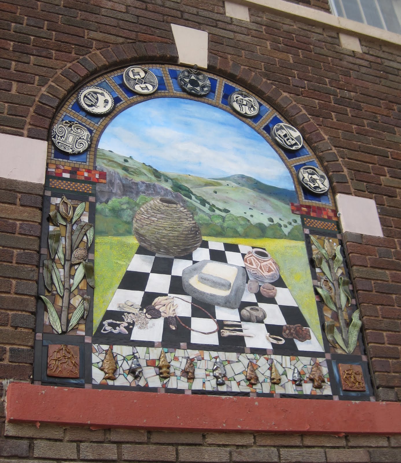 |
| The Mimbres Indian panel |
We cross the Continental Divide for the LAST time, elevation 6800’ this round, just 20 miles south of Silver City. I am going to figure out how many times we have crossed the Divide this trip, as well as how many mountain passes we have gone over. It is a lot!
 |
| Section of Texas Canyon just east of Benson, AZ |
We are running a little low on gas when we reach the Arizona border (didn’t find the anticipated Pilot west of Lordburg) so we stop in Bowie to put a little into the tank. (At $4.00 a gallon it is truly just a little!) I drive at this point from Bowie to Benson – a short stretch, but it gives Rick a little break. At Benson, we gas up again (not much cheaper at $3.67), pick up some groceries at Safeway, and a small bite to eat at the Wendy’s. While in the Wendy’s we are reminded that Arizona is on Pacific Time during the summer – we have gained an hour!
With time to “blow”, Rick calls Mom R and asks if there is anyone we might visit while in Benson. She suggests Gordie and Hattie. We drive back the few miles to Pomerene Rd, but cannot find the assisted living quarters where they are living. It was a nice try…..
On to Tucson! With the handy directions I made for myself at Randy’s, we go straight to the CHRPA headquarters and the Mennonite house located there. Drop off the trailer and drive in to downtown Tucson.
At 6th Avenue and 6th Street we pull over and call Luke. Seconds later he is right there! Evidently he was riding just two blocks away! We make arrangements for the evening and he takes off to shower! Rick and I find a parking space on 4th Avenue and mosey in the shops for an hour. Rick finds a place to get a 15 minute neck massage right out on the sidewalk, plus we pick up a hat Luke wanted to purchase for Cameron M. It is an eclectic mix of shops and restaurants down on 4th Avenue!!
 |
| YAVs at Brandon's |
 |
| Luke and Kyle Anderson |
 |
| Our "campsite" at CHRPA |
It is so warm and muggy, but Miriam gets the swamp cooler up and running again and the house begins to cool off. I will be glad to return to the Pacific Northwest weather!
G’night! Tomorrow we head for home!
Wednesday, August 17:
 |
| Final group shot of Tucson YAVs: Stevie, Meredith, Aly, Luke, Jacob |
We leave the CHRPA house at 7:20, having enjoyed conversations with both Miriam and Emma prior to their going to work. CHRPA operates from 7 to 3:30 during the summer months, so Miriam leaves early! We pick up Luke at the Borderlinks HQ, take a final picture, and head for the freeway north! Rick drives to Wickenburg, with Luke navigating through Phoenix while Ging sets up camp in the back seat and starts working on her needlepoint work. I haven’t done anything on this since the drive down to Boise!
I drive the stretch up to Kingman where we pull off to grab a bit to eat at Arby’s. Ging to Kingman. Heading out again, I make reservations for the KOA in Ely, but while that is happening we somehow miss the turn to Rte 93 north to Las Vegas. I am busy working in the back seat and Rick and Luke are deep in conversation, so it is 40 miles before we see a sign to Los Angeles and Needles, CA. I ask, “Why are we seeing signs to LA?” Quick check of the map and we realize we are on our way to California! Our little boo-boo adds 85 miles to our day. We have to continue to Needles and then north on Hwy 95 up to Las Vegas. End up visiting one more state and seeing the “New York Mts” – the skyline looks like a cityscape. Other than that the vista was very barren and dry!
 |
| New York Mts. I guess the skyline looks like a city! |
Around 5 we finally arrive in Las Vegas. Rick is disgusted with himself and HOT! He has been driving with the sun on the west side of the car. It is 106 degrees in Vegas. On the north side of Vegas, Luke starts driving and takes us three hours plus up Hwy 93 and 316 through the middle of Nevada. Smooth sailing and very few cars. Rick drives the last 30 miles into Ely over Murray Summit – one of two passes in Nevada. We arrive at the KOA at 8:40, get set up and finally eat some dinner!
 |
| One of our sunset pictures! |
The sunset driving up 316 was awesome. I said we only got this treat because we missed our turn earlier. God WANTED us to see this incredible a sunset. It covered half the sky and just kept getting darker and darker and darker
The KOA in Ely is a nice place – a movie was playing when we arrived. Couldn’t check out much more in the dark, but morning revealed nice playground areas, beautiful tent sites, etc.
We traveled 725 miles today – should have been closer to 640. Only nine hours tomorrow into Baker City!! We put over $125 worth of gas into the truck today!
THURSDAY, August 18:
Final day of our trip! We are ready to get home – apparent when everyone is up and ready to pull out of camp at 7:30 am! Gas up, coffee up, and on our way north! We are traveling again on Hwy 93, which will take us north through Wells and up to Twin Falls. Rick drives to Twin Falls, while I manufacture three sheep in the back seat!
 |
| Mountain vistas in northern Nevada. |
We stop in Jerome (just west of Twin Falls) for lunch at a Wendy’s, and I take over driving. My shift takes us to the Flying J at Caldwell, where Luke drives us into Baker City. Smooth sailing for the day, just a lot of highway to cross. 502 miles later, we pull into Baker City just 5 minutes before 5 pm, in time to pick up the mail at the post office on the way into town!!
What a great vacation! Beautiful countryside, time spent with Jed, time spent with Luke (unfortunately NOT together!), time with nieces and nephews and extended family. Visits with friends, and a birthday celebration for Rick’s mom. Plenty of adventures on mountain trails and a few FIRSTS: hitchhiking and chickens! And through it all – safe travels. Thank you, God!
TRIP FACTS AND FIGURES…..for the record!
**We traveled a total of 3902 miles, 3148 with the trailer in tow.
Luke received a stipend of $250 for transportation on his trip home. We spent $254 in gas on Wednesday and Thursday!
**We averaged expenses of under $100 per day over the 18 day vacation.
**Our Honda Ridgeline truck averaged 19 mpg over the trip – not bad pulling a trailer!
**We crossed or touched the Continental Divide eleven times.
**We went over 17 marked mountain passes, ranging in elevations from Texas Canyon Summit in Arizona at 4,975’ to Cottonwood Pass at 12,196’ in the central Colorado mountains.
No comments:
Post a Comment