WEDNESDAY, October 24
Nampa, ID to Baker City
111 miles
NO PICTURES :(
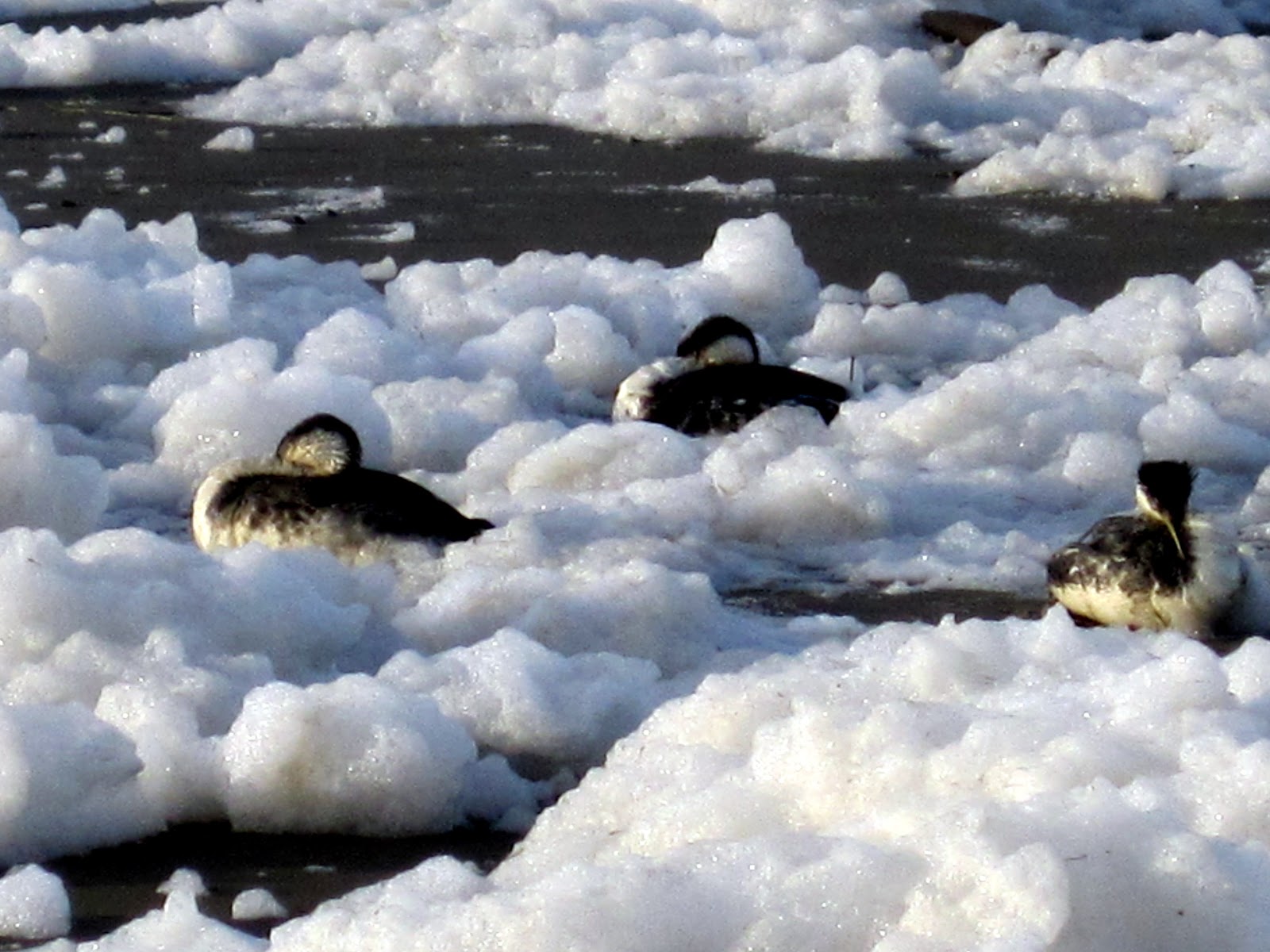
This will be short and sweet! We are home! Arrived at 9:45 PDT in the morning after getting the trailer winterized at Bish's RV in Nampa at 8am MT. That only took 45 minutes and we were on our way! Final stop for gas at Flying J in Caldwell, across the border into Oregon. Our last big switch was when we crossed back over into Pacific time...for good! (We were in Pacific momentarily yesterday going through the corner of Nevada.) The Elkhorn Mts did NOT cooperate and dazzle me with their snow covered visage as we drove around the corner at Pleasant Valley. Instead, we were greeted with foggy, overcast skies, and the beginnings of a few flakes of snow as we entered town! Total trip was about 5800 miles.
THIS IS THE FINAL POSTING FOR THIS BLOG PAGE.
TUESDAY, October 23
Wendover, NV to Nampa, ID
319 miles
Pictures Click HERE
We are like two horses heading to the barn now! Bypassed our intended goal today of Mountain Home due to weather reports of sub-freezing cold and even colder wind chill. Decided to take the direct approach and go straight to an RV park a block down the road from Bish's RV. Stopped to see if any chance they could take us today, answer NO. But have an 8am appointment for Wednesday morning and then we are on the road to Baker City!
We eventually pulled the back bed out last night when the wind apparently died down, only to have two more wind storms come upon us during the night. We figured we were anchoring things down at that point, so rolled over and went back to a 'somewhat' sleep! It also sprinkled a few times, but nothing major.
 |
| Snow on mountains south of Wells, NV |
However.....it WAS downright chilly this morning as we packed things up and hit the road by 8:30. Forecast for the day was 40% chance of rain and or snow showers, winds up to 25 mph in places. Time to get home!! As it turned out, God once again blessed us. No problem on either pass between Wendover and Wells (and the second was at 6900'). There was a dusting of snow on the ground on the higher pass and definitely up in the mountain tops. We stopped in Wells for gas...AGAIN...and continued up US93 toward Jackpot and Twin Falls. Skies went from sunshine and clouds to snow showers, but nothing major. Enough to see the flakes, but not be dangerous on the road. The winds were still an issue, however, and Rick ended up driving the entire way to Nampa.
 |
This isn't nearly as bad as the weather forecast
made it sound! |
We stopped in Twin Falls at a MacDonalds to try and get information as to camping possibilities in Boise or Nampa. After a successful log-in in Wells (to order our Bountiful Basket!), we couldn't get the Twin Falls system to work. I tried again at the Flying J, and finally signed up for their one hour $1.99 internet program - we can now go on-line at any Flying J or Pilot for $2! That's where I found the campground just down the road from Bish's.
 |
| Isn't this cloud awesome? |
A pretty drive much of the day as the clouds and sunshine were awesome! Course I wasn't driving, just admiring the views and finishing up the needlepoint on two kings for the creches.
Arrived in Nampa around 3:30, got set up, and then took a field trip back to WinCo to stock up on dry good supplies a bit. Attempts to have a rendezvous with Erin Lair failed so we spend a quiet evening cleaning up the trailer and preparing for HOME!!
PS. Boise has the most incredible sunsets, but unfortunately tonight's came mostly while I was in the shower. :( I missed it.
MONDAY, October 22
Glendale
UT to Wendover, NV
407
miles
Click HERE to view
ALL of today’s pictures
This has been a long, windy day! We pulled out of Glendale right on schedule
shortly after 8am. I have my “smart
camera” (as opposed to a smart phone!) – I put all the gas and lodging info for
our options from here to home on a Word table, and then took a picture of it on
my camera. Everytime Rick wants to know
how far, how much, or what were our options, I just tele in to the picture and
tell him the information! It’s almost like having internet at your
fingertips! ALMOST!
 |
| Beautiful canyon! |
We gas up
in Panguitch, so we can go all the way to Nephi south of Provo. Shortly after Panguitch, we change our plans
of going directly over to I-15 and decide to stay on US89 as it winds its way
through beautiful mountain valleys and canyons.
Traffic is almost non-existent – we think everyone must be out
hunting! Just before we hit I-70 for a
short 20 mile stretch to the east, we stop for a ‘potty break’ amidst a
beautiful canyon of rocks and golden trees.
I still have trouble getting used to having the ability to just pull
over and use our own facilities when necessary!
From I-70
at Salina, we take US28 north to Scipio and I-15.
Our route takes us up a valley between two 12,000 and 10,000 high
mountain ranges. In a few places to the
west, we spot traces of snow on the higher range. It has been windy all day, but we really feel
it when we hit the interstate and a bit more open area. Tumbleweeds are blowing across the freeway
and as I take over driving, I have to dodge a few! I only drive the 40 miles up to Nephi where
we gas up, and then 20 more to Exit 44 and lunch at the Subway. Our plan is to avoid Salt Lake City traffic
and take US6 west to Utah36 north to Tooele and then to I-80 west. The plan worked beautifully as far as NO
TRAFFIC was concerned, but the wind really played havoc! We stopped in Tooele to gas up AGAIN, and
made a quick call to Patty Eardley to say hi AND to get the phone number for
Road Conditions because we had heard that I-80 was closed to large rigs. Just warnings, especially for the area
directly south of Great Salt Lake. We
were going to miss most of that, so….onward we go!
 |
| Out on the Salt flats |
I was
going to drive the Interstate portion of this extra long day, but…too strong of
winds. Rick opted to keep the
wheel! (I was probably relieved!) It seemed like the 80 miles of interstate
took nearly two hours, as we had to slow down or run the truck at super high
RPMs. We just let everyone pass us by as
we plodded along at about 50 mph! I told
Rick if we could just catch up to one of the big semis and use them as a draft,
we would do better!
 |
| The Tree of Utah out in the middle of the flats! |
Somewhere
about 20 miles east of the Nevada border we passed a most unusual sculpture out
in the middle of the salt flats. It
looked like a series of brightly colored balls mounted on a stick, with a few
broken balls scattered around the base. Most odd. No sign. Nothing. I will google it later when I have internet
access. (Note: Called Metaphor: Tree of Utah, the sculpture
was erected in 2002. The description is
of a concrete square pillar with leaves of colorful tennis-ball like spheres,
the only vertical object for miles in the flatness of the Bonneville Salt
Flats.)
 |
| Wall of white |
A wall of
white separated us from Wendover at one point and we wondered just what in the
world was coming up. But we never really
drove through it – the winds were swirling all around at this far edge of the
flats. We passed the exit for the
Bonneville Speedway.
Wendover,
UT and West Wendover, NV straddle the border.
The gambling is in Nevada. But
mostly the two towns share everything, including Mountain Time Zone. Technically Nevada is Pacific Time, but the
Nevada side of this town sticks with its Utah counterpart. We find the Pilot to gas up (as per my smart
camera!) and then the KOA. Not a lot of
choices here – KOA or the casino and reviews of it weren’t good! The KOA is nearly empty – just four other
rigs. We ask to park next to one of them
for a little ‘protection’ from the wind!
A few sprinkles of rain as we start to unhitch and set up which quickly
stops so we can finish the task.
We opted
to leave the main bed up as the wind is coming from that direction. Instead we shall sleep on the front bed
tonight, but we don’t drop it down until later in the evening – closer to when
we will be helping to ‘anchor it down’ with our weight! Actually it feels like the wind is dying down
a little bit as the temperature cools down.
Phone
call from Annalea tonight to confirm when we are coming home. Evening spent watching TV and unwinding from
a long day of driving (more Rick than me!)
Hope we don’t blow away tonight! (Note: Internet not strong enough to add the pictures yet, so that will have to wait.)
SUNDAY, October 21
Cedar Breaks National Monument
Click HERE to view today's top pictures.
Each one of the past mornings has gotten lazier and lazier! Today we got up and moving to leave by 9:15, heading north to Long Valley Junction and then up to the Cedar Mountain area and Cedar Breaks National Monument. Rusty Munn had highly recommended this monument as a must visit. We are lookly closely at the skies, however, and we packed plenty of warm clothing. It is a cool and breezy wind blowing and dark clouds dot the skies. The forecast today is for rain showers possibly this afternoon. The nearest Presbyterian Church is 20 miles in the opposite direction and not until 11, so....I don't think I have gone this long without going to church on a Sunday ever!
 |
| Duck Creek Community Church |
And what should we find right away nestled on a side road of Duck Creek Village on the flanks of Cedar Mountain? We saw this awesome Scandinavian style church across the meadow and Rick drove around to take a closer look. We assumed it would be LDS because that is the only church in many of these tiny communities, but it sure didn't look like typical LDS style. And it wasn't! It was the Duck Creek Community Church - unfortunately we didn't stay because the weather was urging us forward and worship wasn't for another hour or more. The stained glass windows were covered with creation scenes - so appropriate.
 |
| Navajo Lake |
Past Duck Creek Village we came to a beautiful forest service campground nestled in an amazing grove of aspen trees - all had lost their leaves, but they were still impressive. One loop of the campground was still open and ONE campsite was in use! We then turned off to take a look at Navajo Lake, and saw another sign to Cascade Falls. Not having a map or any information about it, we followed the road down about 2 miles until we came to a broad valley and another sign. We decided we wouldn't drive forever and returned to check out the lake. The lake is dammed in the middle and we couldn't find an outlet. (Did a little internet research - there was a breach in the dam last winter during high water and the lake is losing water, much to the chagrin of the local economy. No outlet because it drains into two different drainages through sinkholes.)
 |
| I am loving the white aspen trees! |
Back on the highway toward the national monument! One of the surprising aspects of this drive is the presence of huge lava flows. I was NOT expecting this. We saw even more on the second half of the loop after the monument and I suspect that Brian's Head is some sort of dyke or plug - it is definitely volcanic. The aspens grow right in the lava, along with firs and a spruce forest devastated by bug kill. But young spruce trees are rebounding within the aspen groves.
We begin seeing patches of snow around Navajo Lake and more as we turn north on the road through the monument. Cedar Breaks NM is officially closed - all services are shut down. I couldn't get my passbook stamped, so I just wrote it in! The park will begin operating - with volunteers - a yurt during snowmobile and XC ski season. It's the backcountry, off season ranger headquarters. You can get hot chocolate!
 |
| Cedar Breaks National Monument |
For today, the wind and snow provided a very different look to the monument which has formations very similar to Bryce Canyon, only on a smaller scale. The wind was howling up on the first lookout and blowing the clouds so fast across the landscape that shadows and light just danced across the hoodoos. Pretty cool. Literally, actually. All the north-facing south slope of the 'breaks' was layered with snow; the south-facing north slope completely clear. The edge is formed by 10,000 cliffs on the eastern side and several canyons of rivers and streams finger down to flow west toward Cedar City and the valley floor. I took a couple of short movie clips to show the movement of the clouds and shadows AND as a panorama picture.
 |
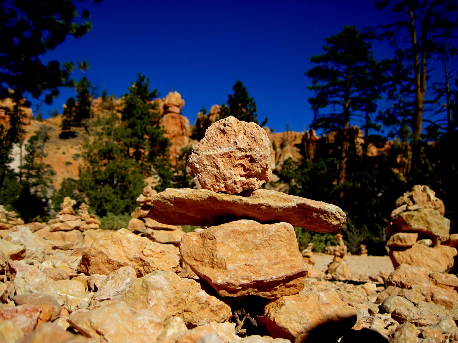
| Snow Inuksuk at Cedar Breaks NM |
We drove north on the road, stopping at all of the viewpoints (all 4 of them!) At the second one, Rick found a patch of snow and built a baby inuksuk. We moved him over to the edge of the viewpoint so a picture could be taken looking out over the breaks also. We didn't take any of the hiking trails - today was a day meant for "Sunday Driving" - too cold and windy out there for very long!
This entire area must be a blaze of color the end of September when the aspens are in peak yellows. It would be a key reason to come visit at that time of year.
 |
| Aspens in the lava flow |
Our loop trip followed the road toward Panguitch and then the Mammoth Creek Road. Mammoth Creek is a village at the bottom of the canyon - almost more of a town than Duck Creek! Mammoth Cave was also highlighted here, but we didn't know where or how far, so we didn't explore that option. Back to Hwy 14, following lava flows, and plenty of green trees.
We are back to the campground by 1:30 or so.... in time to hear rain drops fall on the trailer later in the afternoon. We planned and discussed our route home, got information, emailed Moms, and I got a chance to talk with Mike Braymen who is ready to take off in the morning and officially head east to Washington DC. We will miss him. Cook up spaghetti and meatballs for mid-afternoon dinner and in general get caught up and ready to return to civilization and Baker City!!
 |
| All bundled up at Cedar Breaks National Monument |
SATURDAY, October 20
BRYCE CANYON NATIONAL PARK
Click HERE to view today's top pictures!
I made a vow today to limit my pictures to a mere 200 after spending so much time last night editing over 300 photos! That meant I also deleted some bad ones as I took them, and spent some time deleting some that didn't erase after loading last night. With all that, I did delete my first picture of today - an awesome sunrise shot of the hoodoos just five miles north of our campsite! Rats! We left today at 8am, just after the sun had popped over the hill and into the campground. We headed north on Hwy 89 - destination? Bryce Canyon!
 |
| Red Canyon |
Long Valley is truly a beautiful sight - big pastures, orchards, ranches, and occasional views of red rock among the forested slopes. We climbed to Long Valley Junction, and then gradually descended to the town of Hatch where we bought some gas (3.99! We still have paid over $4 only once!) and Rick got a coffee. North of Hatch we turned east, through Red Canyon, which has its share of beautiful red rock hoodoos as well as Bryce!
Into the park and immediately to the Visitor Center. I wasn't going to be denied my stamp today! We also made up for missing the gift shop at Zion with purchases at Bryce! Ah well. Just after leaving the Visitor Center, we passed through a wide meadow - pronghorn antelope greeted us!
 |
| Pronghorns ran right in front of us! |
 |
| Natural Bridge |
Our plan for the day was to drive to the end of the Bryce Road - to Rainbow and Yovimpa Points and then work our way back up to Sunset Point and a good hike. We stopped enroute out to Rainbow at a few of the viewpoints. Our favorite one was Natural Bridge which was beautiful with the morning sun shining through the opening. Rick discovered that the bulk of the hoodoos are all in the main amphitheater - he had thought the whole canyon was like that. But various other formations are found along the Rainbow Point Road and we explored many of them. At Rainbow Point we took a short mile hike out to the Bristlecone Pine trees and to viewpoints over the southernmost hoodoos. We could see southeast to Navajo Mountain on the Utah-Arizona border, and east to the stairsteps of Grand Staircase Escalante National Monument. Lunch and we were ready to hike down INTO the hoodoos!
 |
| The main amphitheater from Bryce Point |
First a quick stop at Bryce Point where you get a superb overall view of the entire amphitheater of the heaviest hoodoo concentrations. There you find the Grotto rocks - deep holes and windows, which are also the homes of peregrine falcons. We saw one falcon soaring below us. I took a fairly large panorama but won't be able to stitch it together until I get home - Hugin isn't working on the laptop.
Then we drive to Sunset Point. We took this hike with the boys and Grandpa ten years ago during our last visit to Bryce. We can't remember what all we hiked then, but we definitely remembered the Wall Street part! Today we decided to do the three mile Navajo-Queen's Garden Loop, which started at Sunset Point, followed the rim trail to Sunrise Point, and then dropped down into the Queen's Garden. The trail was NOT well marked from the direction we approached and we walked right past the trailhead to Queen's Garden....we eventually walked back and found our trail, but not until we had walked an extra half mile probably!
 |
| Queen's Garden area of Bryce Canyon |
Queen's Garden Trail drops quickly down past a variety of tall hoodoos of various colors and shapes - a palette of colorful 'flowers'. I was constantly turning around to take pictures looking backward because the sky was SO BLUE behind us! We went through about three tunnels in the rocks, and several narrow slots.
 |
| Through one of the tunnels |
 |
| Baby Inuk in the Cairn Village |
The connector trail winds through Ponderosa pines on the amphitheater floor - past dry washes where you can imagine roaring waters at times of the year (the very waters that continue to carve and change the features of the park!) It was cool down in the shade of the pines. Rick suddenly started laughing in front of me, and I came around a corner to discover why: a whole field of rock cairns, looking much like Bedrock City outside of Phillips Lake in Baker City! Some had even been built in the tree branches! One was at least three feet tall. But all were cairns, not inuksuks, so Rick and I quickly grabbed a few rocks and built a VERY short inuk among the cairns!
 |
One of the fir trees at the entrance to
Wall Street |
The Wall Street portion of the Navajo Trail is one of the most amazing stretches of trail within Bryce - at least to our judgment! Rick said it is an OMG place! Three huge Douglas Fir trees grow up in the narrow slot canyon of Wall Street. The slot is so narrow and the rock walls so high - the shadows and lighting are incredible! The final part of the trail exits Wall Street through a series of switchbacks that climb and climb back up to the canyon rim. Pant! Pant! But we made it!
 |
| Fairyland with Sinking Ship in background |
 |
| Aspens! |
Our final stop of the day was at Fairyland Viewpoint, just before the exit from the park. This is a relatively 'new' amphitheater and smaller in size. But all the different types of hoodoo formations were there, including the Sinking Ship, which is really just a uplift block on edge. Much less crowded out at Fairyland!
We stop at Ruby Inn on the way out, get drinks, and then I drive back down to Glendale. Highlight of the return trip was the western sun highlighting all the aspen trees in the Long Valley region. This morning they were in the shade and not nearly as noticeable.
Back to the campground just before 5. Quiet evening as again it cools off quickly as soon as the sun sets.
FRIDAY, October 19
ZION NATIONAL PARK
Click HERE to view today's top pictures!
An early morning after listening to the wind blow all night! Both of us were concerned that it might be too windy to tackle our day's destination: Angel's Landing in Zion National Park. But the internet said it would be a BEAUTIFUL day in Zion....and it was!
 |
| Sunrise on the rocks |
With the time change, it was still dark when we left the RV Park shortly after 7am. Dark enough that we had to brake for deer several times and we came upon a flock of wild turkeys about 20 strong. Sunrise was scheduled for 7:44 and it began to touch the tops of the monolith stone mountains about the time we arrived! Soooo pretty - I had forgotten how magnificent the drive into the park is from the East Entrance. The rock formations just keep coming turn after turn.
As we were early, we find a parking spot in the small parking area at Canyon Junction. The shuttle will pick us up here and take us the rest of the way into the heart of the canyon. Zion operates a free shuttle bus system similar to Grand Canyon during the peak months of the year. The Scenic Drive road will be open to cars beginning on November 1. We take the shuttle up to The Grotto - a shaded cottonwood tree area nestled below a 3000' wall of rock. This is where the Angel's Landing Trail (via the West Rim Trail) takes off. The trail is marked by warning signs right from the start: Danger! Dropoffs! Narrow trail! Don't hike if you are afraid of heights! Not appropriate for young children! Six people have fallen to their deaths since 2004 on the trail. They have reason to warn well. Amazingly, Rick and I were stunned by the number of families with children under the age of 10 hiking up! Hopefully some of them were stopping BEFORE the really dangerous section at the end.
 |
Rick heads up trail: Angel Landing
dead ahead! |
It was cold in the shadows when we left at 9am, so we bundled up with gloves on our hands and Rick wearing his ear warmer band! The trail follows along the Virgin River gradually heading uphill toward a steep section that climbs to a notch between Angel's Landing and the canyon wall. This section of switchbacks was all in the shade climbing up and, while it was definitely uphill, it seemed much steeper coming down later in the day in the full noontime sun! All of the trail is 'paved' from the Grotto up to the top of "Walter's Wiggles" - and virtually to Scout's Landing. At this point the West Rim Trail takes off.
Once we got to the top of the notch, we entered a narrow slot canyon - no creek this time of year - but you could surely tell where water often flows! The canyon was cool, breezy, and level!! Wonderful holes and depressions, carvings and lines in the sandstone rock. At the far end of the slot canyon, we came to the famous 'Walter's Wiggles', named for Mr. Walter who helped build the trail back in the early 1900's. This series of 21 switchbacks, all about 20-30 feet long and built up with brickwork and a series of drain pipes, ascends a virtual vertical wall of rock. Luke has a picture of Walter's Wiggles from our visit here in March of 2002 - we couldn't climb Angel's Landing then as it still had snow on it!
 |
| Yes! The trail goes out this ridge of rock! |
At the top of the Wiggles, you come to Scout's Landing. A park service ranger had passed us on the way up and he was spending the day up at the landing - warning hikers of the dangers of the trail and giving talks on the California condor which has been reintroduced in Zion and is thriving here. Later in the day as we were riding the shuttle back down valley, we saw a huge black bird soaring on the updrafts - I suspect it might have been a condor.
From Scout's Landing the trail gets .... interesting! Basically it is a half mile out to the point - along the rock arete jutting out from the canyon wall. In places the trail is only 4' wide, with drops of 1200-1500' on either side! In other places you are rock scrambling up the sandstone, looking for steps carved in the rock or for blackened spots indicating good handholds. In the worst places, a thick metal chain was anchored into the stone and you could use it as a handrail. In several places, I literally pulled myself up by the chain because the step was too big for me. We had to work around several groups of hikers already coming down - they must have gotten a REALLY early start. This is definitely a one way only trail, so you have to look ahead for a good passing zone! I don't have alot of pictures from this area, except when we had to wait for people to pass, because I wasn't taking my hands off the chain long enough to take pictures!
 |
| On top of Angels Landing |
Finally we reach the long flat top of Angel's Landing and work our way out past several pine trees to the actual point. We are the only ones there for at least 10 minutes. How that happened I don't know because by the time we left, the point was crowded, and we passed hundreds as we hiked down.
 |
| Inuk and views down valley. |
The views from the top encompass the whole valley and are the most spectacular in all of Zion NP. The point is narrow enough that you can look north into the Temple of Sinawava (end of the road) or south down the valley toward the visitor center. Jutting out from a lower section of Angel's Landing is The Organ, a rock formation so named as it resembles the pipes of an organ. We can watch the shuttle buses snake their way along the road - little white trains on the valley floor. Yet we can also still look UP - to the tops of the formations that rise another 1500' above us. With Rick's help (he found the rocks), I built an Inuksuk and took a couple of good down valley pictures. (It was destroyed even before we left). Down from the point, Rick spied a number of rock cairns - perhaps the Inuksuk that Luke built three years ago is still there! If so, his mother is going to have words about the danger of where he built it!
By 12:30 we are back down to the Grotto. The hike down from the top was slow - passing a great number of uphill climbers. I found coming down easier than I anticipated. I made good use of the many chains! The worst part of the down hike was the steep section of switchbacks further down! That was hard on Rick's knee and my toes always feel like they are pushing through the end of my boots! But it was a great hike!! Total of 5.5 miles.
 |
| You can't miss the trail down! |
We refill our water bottles, grab a little more lunch, and then hop back on the shuttle for the rest of the trip into the Temple of Sinawava. There we hike the 2.2 RT Riverside Trail out to the Narrows - where the canyon narrows down on the Virgin River. You can continue 'wade hiking' up the Narrows Trail nearly 9 miles, but the footing is difficult and the water is COLD!! We opted not! The trail itself is beautiful, however, through cottonwoods still green, springs dripping off the rock walls, ferns and flowers. Evidently the valley floor doesn't really change color until the first weeks of November.
The park is literally crawling with people! It is October - where did they all come from?? Many, many families. We find out later that today is the Teacher Inservice Day for Utah - no school for the kids, and Monday and Tuesday are Fall Break Days, so many take an extended fall holiday this weekend! Nice timing, Rembolds!
Our plan was to return to the truck and drive down to the Visitor Center, get my passbook stamped and check out the gift shop, and then do a little Grocery shopping Springdale. When we got to the Visitor Center, all the parking lots were full - you were sent to Springdale to take the shuttle from there. But the entry station was packed with cars waiting to enter the park! What a mess! We drove around once looking for a spot and then I said, 'bag it, I'll just write our visit into the book!' We weren't going to Springdale and have to re-enter in that gridlock!
 |
| Another Zion look from Visitor Center area |
So, we slowly make the drive back out the East Entrance, again amazed at the cars and people everywhere. All the rocks that were in the shade this morning were in full sunlight. As we gained elevation we found more maples in red leaf, along with a mix of yellow color. We drop back down into Carmel Junction, and stop at a little grocery store in Orderville for salad makings. Back to the RV park for a short walk down to the river, apple picking in the tent area orchard, showers, and an evening of blogging and TV. I still am amazed at how fast the temperature drops as soon as the sun goes down! Hot one second and cold the next!
Tomorrow.....Bryce Canyon National Park!!
THURSDAY, October 18
Glendale, Utah
Click HERE to view today's best pictures
 |
| Check out the temp! |
BRRR!! A chilly morning! We went to bed last night early, knowing we would have the time change back to Daylight time today, and because it was cool in the trailer! When I got up around 6:45, the sun was just peeking through the trees, and the trailer thermometer registered 38 degrees! But we both slept relatively warmly! When Rick got up he turned on the propane furnace - that took the chill off quicker! In the meantime I wrapped myself up in the sleeping bag in the corner to do my morning devotion.
 |
| Changing trees as we descend from the Kaibab Plateau |
By 10 MT we are finally on our way! Into Jacob Lake to grab a coffee and then north on 89. We gradually lose elevation as we wind down from the Kaibab Plateau and into a huge valley, bordered on the north by the Grand Staircase Escalante National Monument. Somewhere out 'in the flats', our cell phone rings and we find Luke on the other end. I talk with him into Fredonia, where we get gas.
From Fredonia we head north into Utah and the town of Kanab. The cottonwood trees along the Virgin River (East Fork) are gorgeous against the deep red and white rock formations.
Today we drove all of 64 miles to Glendale and Bauer's Ranch RV Park, along the Virgin River and nestled between apple orchards. Friendly gal at the desk who hands us all sorts of materials about the parks. The cost is only 23.65 per night - full hookups AND free wifi. Rick is evening watching TV as I write - only a couple stations, but better than nothing!
 |
| Valley views near Glendale, UT |
We decided to take the rest of the day to catch up - I had blogs to finish, pictures to organize, and devotions to post. Rick took a nap! The sun was warm and felt good at first, and then it got a little too warm! We put up the awning! But....when the sun goes down, and it dips below the ridge behind us early, it gets cold fast! Not as cold as last night however!
Showers were in order for both of us and they felt GOOD!! Then we took the time to actually COOK a good dinner - a recipe I found while waiting at Lowe's in the book section. Can of cranberry jellied sauce and equal amount of salsa (Rick did not use equal as all we had was medium salsa!) as a sauce for meatballs. We served it on rice. Really good!
Early night tonight as we will be on our way early to Zion National Park. Our goal is to tackle the Angel's Landing Trail tomorrow!!! Weather looks to be great! Stay tuned tomorrow for the results!
WEDNESDAY, October 17
Vermillion Cliffs National Monument
Grand Canyon National Park – North
Rim
Click HERE to view
today’s best pictures
I took over 220 pictures today….does that
tell you what kind of God beauty we saw between sunrise and sunset today?
Up to pack up the trailer and depart from
Trailer Village. We made our get away
around 8:30 am…to a gorgeous sunny day and clear skies. Destination?
The North Rim of the Canyon ….a mere 215 miles away!
As Rick noted, the first 50 miles
backtracking along Desert View Road and then to Cameron was slow. We had already been over this way, the views
are few, and we were anxious to get on and see new country! When we arrived at Speedy’s Gas in Cameron,
Rick filled up while I made some phone calls to Jacob Lake and Bauer’s RV in Glendale. We finally had cell coverage! Good news and bad news. I couldn’t get any leads on campground in
Jacob Lake – everything has closed for the season as it snowed last Friday and
that was that! North Rim is still open
as far as the visitor center is concerned.
I called Jacob Lake back about the prices of rooms or cabins for the
night. It would be $100 at the least.
Ouch. The good news was I made
reservations at Bauer’s for four nights – it is centrally located amid Bryce,
Zion, and Cedar Break National Parks and will have internet!!!
 |
| Rock formations north of Cameron, AZ |
North from Cameron is all new road for
Rick and I! The first 40 miles up to The
Gap was dry, desert land. A few rock
formations, strata, etc. but mostly barren land. Reservation land – again we gave the Native
Americans prime real estate. (sic) At the Gap we found another reasonable gas
station, so we topped off the tank again.
Thank shall be our pattern for today!
 |
| Navajo Bridge over the Colorado |
Between The Gap and Bitter Springs (where
we part company from 89 and follow 89A AND cross the Colorado River), the road
was bordered on the east by a series of impressive rock outcroppings and
ridges. In the distance we could see
what I identified as Vermillion Cliffs National Monument, but it wasn’t until
we actually crossed the river and stopped at Navajo Bridge Interpretive Site
that I realized how impressive the cliffs are!
I wasn’t able to get my passbook stamped because the office was closed
for lunch! There really isn’t a Visitor
Center for Vermillion Cliffs itself.
The Navajo Bridge over the Colorado was
built in 1929 and at the time was the ONLY crossing in a 600 mile stretch of
river. The original bridge is now a
pedestrian crossing. A more modern
replica (and it is a carbon copy) spans the river just 50 feet downstream from
the original. The river was green here –
much prettier than the brown we kept seeing from the top of the South Rim.
 |
| Vermillion Cliffs National Monument |
The next 20 miles bordered the Vermillion
Cliffs – a 2000’ rock wall of varying colors and strata. In places rocks had broken off and were
located on the opposite side of the highway.
Not rocks – car-size boulders! At
the end of the cliffs, the highway climbed!
Near the river crossing we were at 4000’. By the time we reached Jacob Lake, we were at
7800’. The entire terrain had changed to
a Ponderosa Pine forest! It felt like
driving around Baker County, up near Anthony Lakes! Beautiful!
 |
| Boondock Campsite |
We arrived in Jacob Lake around noon and
asked about camping options. Basically
learned that it is ok to camp anywhere on Forest Service land, so tonight we
are going to Boondock for the first time!
Literally! We decided to eat a
good hearty meal for lunch and sidled up to the counter at the Jacob Lake Inn
Café. Rick had a bacon cheeseburger and
I ordered the Portebello Mushroom Burger.
(Unfortunately, I am developing a fond taste for these more expensive
burgers!) We gas up AGAIN at the gas
station to make sure we have a full tank going into the North Rim. Price was only
$4.22.
We take off around 1:45 from Jacob Lake
headed toward the North Rim. About 2
miles outside of town, Rick pulls over where a road takes off from the
highway. There is a flat spot and a
campfire ring! We make it home for the
night! We unhitched, grab some warm
clothing and continue on with just the truck south to the North Rim.
 |
| Slash burning adds to the eerie feel of the past burn. |
I
can’t remember when major forest fires burned in the North Rim region, but the
evidence lines the highway heading into the park. The aspen trees are making a comeback, however,
and in other places the ponderosa pines were able to withstand the flames and
still stand – charred, but whole. Aspen
groves cover the Kaibab Plateau region here.
Some were still in all their golden fall glory, but others have shed all
their leaves and were white lines against the green evergreens.
While we were driving through the burned
areas, we saw smoke in the distance – fire type smoke. We found out later as we entered the park
that they waited until the park officially ‘closed’ for the season to start the
slash pile controlled burns. The smoke will make viewing in the park
difficult, but you can understand why they are burning now – the recent snow
dampened everything down and it is cool.
 |
| North Rim Lodge, Grand Canyon |
As soon as Rick drove into the North Rim
area, he proclaimed “I will never go to the South Rim again!” This is beautiful! There were cars in the parking lot, but only
two small lots. That alone tells you the
North does not see nearly the number of visitors! The lodge is gorgeous, but also includes a
host of small guest cabins scattered over the grounds. We walked out to the end of Bright Angel
Point, got the passbook stamped, and filled our water bottles to guarantee
plenty of water for tonight’s dry camp.
 |
View from Bright Angel Point across canyon to
South Rim - smokey skies! |
I drove the 26 miles from North Rim
village out to Cape Royal. We stopped
several times at viewpoints, took a short hike, visited some Indian ruins (they
wintered down on a delta in the river and summered at the top of the plateau),
and then parked at Cape Royal and walked out to Angel’s Window Point and the
cape – the latter just in time for sunset.
Impressions from our drive out: --- North Rim is not as steep as the South Rim
(duh – we learned that last night at the geology museum!)
 |
| Angel's Window |
---- North Rim is much greener due to
more tree and shrub growth between the layers of rock.
--- From the Encantada Viewpoint, you
can see past the Vermillion Cliffs to Navajo Mountain.
--- Smokey skies make for eerie sunset
pictures!
--- Rick was happy as we walked out on
TOP of Angel’s Window, and got to see it from two other viewpoints.
--- Surprised to find a number of people
out on the Cape Royal point – several were more professional photographers
capturing the light on the formations.
 |
| North Rim sunset colors |
By 6:05 we were headed back to the
trailer, Rick driving again in the darkening skies. The drive back was spectacular as we watched
the setting crescent moon, first a silver sliver in the sky, then as it grew
larger and oranger as it passed through the smokey haze as it set. The stars were glorious and bright. We must have seen 2 dozen or more head of
deer, a couple right on the side of the road.
We had to watch carefully as we neared Jacob Lake to make sure we
wouldn’t pass our road and trailer!
 |
| Sunset glow on rock formations |
We drop the bed and get set up. Run just one light to conserve the
battery. None of the plugs work anyway
off the battery – lights only. Good
thing the computer was fully charged! And now….I am going to turn in – my feet
are getting cold! All this can finally
get posted tomorrow, perhaps, when we arrive in Glendale. G’Night!
TUESDAY, October 16
Grand Canyon National Park
Click HERE to view
today’s TOP pictures!
What a great beautiful day this has
been! Sunshine in the 70’s! A clear crisp morning.
 |
| Quick view of canyon while waiting for the shuttle |
We slept warm last night, setting the
heater for low just to keep warm enough for the water pipes. The trailer was 47 degrees when I got up at
6:15 – I heard the heater come on several times during the night. Quiet time early in the morning, although we
have no internet connection so I cannot post anything for several days! Maybe by Thursday!
After a lazy start to the day, we ready
ourselves for a bike ride along the canyon rim.
We bike about 2 miles down to the Grand Canyon Village – and the
transfer point for the Red Bus line out to Hermit’s Rest – the end of the
shuttle road. We are able to follow one
of the new greenbelt paths much of the way.
I was hoping to grab a little air for my front tire, but we never found
that spot so I just road all day with it low.
 |
| Entrance to Hermit's Rest |
Each shuttle bus has a bike rack on the
front that will hold 3 bikes. Rick said
it was a very slick and easy system to mount the bikes and lock them in place. We took the shuttle bus out to the end of the
road, unloaded, and filled up our water bottles at the free water tap (they are
not selling individual water bottles in the park, but do provide refill
stations in several spots.) Hermit’s
Rest is the site of a way station for a stage line that traveled from the Rim
Village west to a trail built as an alternate to the toll-fee Bright Angel
Trail in the early 1900’s. When the park
service removed the toll, the alternate trail was no longer useful and fell
into disuse. The Station, however, is
still popular!
 |
| Colorado River is visible from Hermit's Rest area |
 |
| Canyon views.... |
For the first 2.8 miles, we were able to
follow another bike path along the edge of the rim. For the last 5 miles we had to ride on the
road, with instructions to be completely stopped and off the road when a
shuttle bus passes you. They have first
priority! Most of the time, that wasn’t
a problem – the buses only pass by every 10-15 minutes. We stopped at several viewpoints, notably The
Abyss (where the canyon wall drops about 3000’ in a sheer cliff) and Powell
Point – a narrow promontory honoring Captain Powell. Great viewpoint up and down canyon from
there. We could see the river below in
several places, including a couple of rapids.
Overall, however, the Colorado looks very sluggish and brown down
below. Rick spent time panning the
canyon with the binocs. We were able to
pick out the North Rim lodge nestled below the rim. The Grand Canyon is just
so…..GRANDE! BIG! I started to grasp the size when I realized
the developed part of the park only encompasses maybe 60 miles of the 277 mile
length of the Colorado River that is contained in the park. You have to really gaze and look to
continually pick out different formations, colors, and shadows.
 |
| Up on top of Powell Point |
Saw some orange mallow flowers in bloom
and purple asters. I couldn’t believe
flowers were still in bloom, although for the most part, everything has gone to
seed.
There was plenty of up and down on the
road – my legs were telling me so by the end of the trip! Maybe I can just blame it on a semi-flat
tire! But tired enough that when we got
back to the village, we hopped on the Village Transfer shuttle for a ride back
to Trailer Village where we arrived at 3pm.
Threw together a quick ‘dinner’ of beans,
salmon, and tortillas while Rick put the bikes away and took the legs off the
dining table (we had decided while driving on Monday that the table would be
more useable sans the legs that stick out!) By 4pm we are off again via the
shuttle, this time bound for the Visitor Center and hopefully an internet
connection. We found the VC and a café
that we thought had advertised internet, and while I could get it to connect, I
couldn’t get Firefox, Chrome, or Explorer to load! Ah well – we just wanted to check with
Bauer’s RV Park in Glendale, Utah.
 |
| Sunset from Yavapai Point |
 |
| Sunset glow |
Rick found a book (National Geographic on
National Parks) this morning at Hermit’s Rest which he wanted to buy, but we
didn’t have room to carry it on the bikes.
We couldn’t get it at the VC, and they suggested Yavapai Museum. So, we changed our plans to watch the sunset
at Yaki, and took the Orange Shuttle out to Yavapai. Good little geology museum and we learned why
the South Rim is steeper than the North Rim, but no book. (The South Rim is only 3 miles from rim to
river, while it is 7 miles from North Rim to river. Difference is due to drier conditions and the
water running AWAY from the canyon on the south, hence less erosion. On the northside, all rivers run down into
the canyon and erode faster.) Book
should be available at the hotel gift shops.
So ….. new plan. We walk the 1.75
miles of the rim trail as the sun sets, snapping pictures and admiring the
changing colors and shadows of the canyon.
By the time we arrive at the village, it is fairly dark! The first stop didn’t have the book, Hopi
House had just closed, but Rick was successful at El Tovar Lodge! Whew!

Walk in the dark down to the Shuttle station where we got on this morning, and caught the Blue Line bus back to
Trailer Village. It is pitch dark with a
skyfull of stars! A crescent moon in the
sky which set just an hour after the sun.
Relaxing evening at the trailer and ready
to head to the North Rim in the morning!
G’night!
MONDAY, October 15
Holbrook to Grand Canyon Village
Sunset Crater National Monument
Wupatki National Monument
Click HERE to view today’s best pictures
A cool night! But the stars were BEAUTIFUL and we used the
sleeping bag finally as a cover so we kept snug and warm. The temperature in the trailer was a cool 45
degrees when I got up at 6am. And yes, I
finally turned on the little space heater we bought in Albuquerque! By 8, the trailer was warmed up to nearly 60
degrees.
We forgot about the free coffee and
muffins down in the office, packed up, and were on the road by 8:15. Rick had checked the truck tires and wanted
to find some air. We had to charge $2.00
worth in a machine, but we got our air (and coffees as well!)
 |
| San Francisco Peaks |
It is 85 freeway miles to Flagstaff, so I
drive! As we head west we see snowcapped
mountains in the distance. The only
peaks I can think of are the mountains right north of Flagstaff. And it turns out these are those peaks, the
San Francisco Mountains, and fresh snow fell on Friday night of last week. I love driving toward them for the next hour
plus!
Luke calls as we are passing through
Winslow (we sing the song for him) and Rick visits with him until we arrive in
Flagstaff and the turnoff for Hwy 89 north.
A stop for gas at Safeway and we are off for the National Monuments.
 |
| Sunset Crater |
Sunset Crater is first – we enter with our
Annual Pass and stop at the Visitor Center, where Rick realizes that our gas
can is leaking. A little bit of a mess
to vent it and then clean up, but all is well.
The Sunset Crater is a recently formed volcano – it erupted and was
created around 1000 AD – while native people were living in the area. The VC had some wonderful artwork done by
Hopi artists depicting the eruption.
Lava flows 100’ thick spread out from the crater. Damage to the sides of the crater and the
slow rate of regrowth due to lack of moisture led the feds to close the crater
to rim hikes in 1973.
Quick bite to eat and then we head off on
the loop road which connects the two monuments.
We take a mile hike out toward the crater and through a lava flow. Collapsed lava tubes, spatter cones, mini
cinder cones, aspens turning colors, rabbit brush, and apache plume seed pods
waving in the breeze. A really nice
hike! And we can still see the snow on
the San Francisco Peaks and Mt. Humphreys.
Eventually the road leaves the lava and
ponderosa pine forests and drops in elevation to the flat lands and views of
the Painted Desert in the distance.
Grasslands and some rock outcroppings, but very different from what we
have gone through and expected!
 |
| Wupatki Pueblo Ruins |
Wupatki National Monument is carved from land that was originally part
of the a HUGE cattle ranch north of Flagstaff in the 1800’s and the ancestral
home of Navajo, Hopi, and Zuni Puebloans.
Native Americans were living side by side with the National Park
employees as recently as 1940’s. In the
1950’s the natives were basically kicked off the land. The main ruins was probably more of a
gathering place rather than individual homes – it was multi-level (four
stories) and built among a rock outcropping.
Big slabs of stone comprised parts of the walls. A ball court, kiva, and plenty of storage
rooms for the corn, squash, and beans grown.
We didn’t stop at the other ruins and got back out to the main highway
around 2:30, ready to head to Grand Canyon!!
Just north of Gray Mountain we enter the
Navajo Reservation, and Speedy’s Gas at the junction of 67, the road west into
Grand Canyon South Rim. Speedy’s is
priced reasonably – we will stop again on our way “out” on Wednesday.
Amazed at the number of scenic vista
points that have been built on the road on reservation land – which then are
lined with the booths for selling jewelry, pots, etc. As soon as we left the reservation and came
onto forest land, the booths stopped – abruptly! The Little Colorado River gorge is pretty
awesome as it winds north to join the Colorado.
 |
Watchtower at East Entrance
of Grand Canyon |
We enter the national park – our annual
pass saving us $25 this time around! – and then stop at the Watchtower – built
in 1930’s to replicate ancient native spiritual towers. The view of the east end of the canyon is
awesome from here. We climb to the top
of the tower, admire the native Hopi designs drawn on the interior walls, and
watch the ravens soaring below us on the updrafts.
Twenty five miles from the Watchtower to
the Grand Canyon village. We struggle to
follow the signs to Trailer Village – the roads wind and twist here and it is
so confusing to figure out where you are!
But…we get settled into site B-8 and get all hooked up.
 |
| A quick pose in the darkening skies! |
Then a quick unloading of the bikes and a
ride out to the canyon rim to see the sunset.
We aren’t really on the right spot to face the west, but still get a
little color in the sky. We will make
sure we are in a better spot tomorrow night.
It gets dark so quickly AFTER the sun goes down, so we ride back
directly to the campground, arriving just as it was getting dark enough I
wouldn’t have wanted to be riding anymore!
Dinner and reading through the materials to plan our day for
tomorrow!!
SUNDAY, October 14
Las Cruces, NM to Holbrook, Arizona
Click HERE for today's pictures
 |
| Mts. north of Las Cruces |
Time to head NORTH!! And maybe BRRR! It was colder last night in Las Cruces - Rick actually got up and grabbed his sleeping bag during the night. I had put on longer pj's and a long sleeve shirt which made the difference for me - I was toasty enough.
We are up and packed and ready to pull out from the Habitat 'Park' at 8:15 am. Good thing we said our goodbye's last night because no one else was up and about! Into the Chevron station for coffee and I take the wheel for the first stretch of the way - it's interstate freeway after all!
A BEAUTIFUL morning! Sun is shining, the mountains looked gorgeous all the way up the Rio Grande Valley. We stop in Truth or Consequences, again, because I have to go to the bathroom!! Rick drives the rest of the way into Socorro, where we arrive at 11 am. Meet Jed at the Denney's - his favorite breakfast place! He was even able to report that his volleyball team won a match last night up in Albuquerque! Good meal for us all - Rick and I were ready to eat as we hadn't eaten much breakfast (just coffee!) I ordered a FitFare Meal from the Senior Menu - an excellent little omelet and big bowl of oatmeal with fresh fruit. It was good! Reminded me how much I enjoy oatmeal for breakfast.
 |
| VLA dishes strung out in north direction |
 |
| VLA dish |
A final gas up (including our spare 5 gallon tank) in Socorro and by 12:45 we are headed west on Hwy 60 across the central part of New Mexico. Not quite a green as when we made the drive in August one year, but still plenty of yellow bushes in bloom, and a green hue to some of the fields. We could find the Magdalena Observatory up on top of Baldy Mt., and then dropped down to the Plains of St. Augustine and the VLA. All the radio dishes were in the C position - stretched way out, but the dishes were pointed mostly straight up. I thought they looked like a series of funnels stuck in the ground, Rick thought mushrooms. Either way, they looked different from other trips!
Up over the mountain passes, across the Continental Divide at 2pm - elevation 7796' here - and through PieTown! We missed the Pie Festival earlier this month! Nearing the Arizona border the terrain flattens out more - the hills are gentler, the landscape drier. We cross the border into Arizona and realize it is now an hour earlier in the day - Arizona doesn't honor Daylight Savings Time! Mountain Standard Time here, which effectively puts us on Pacific Time for the next three days. Once we cross over into Utah, we will 'lose' this hour again.
 |
| Flat roads in western NM |
We decided to continue on up to Holbrook and put another 50 miles under our belt - mostly skipping Petrified Forest in lieu of Sunset Crater and Wupatki National Monuments tomorrow. They are between Flagstaff and the turn-off to Grand Canyon.
North of Springerville (we gassed up there), the terrain is back to dry with a layer of black volcanic rock underneath everything. Not what I pictured it to be. We past St. John's, where we planned originally to stay, never even seeing the Moon Meadow RV Park we had considered!
 |
| Sunset in Holbrook |
Two choices in Holbrook - we opted for the cheaper of the two: OK RV Park! Has everything we need, even though the connections for the hookups are weird - not all together so we had to rehitch at one point to back the trailer up 3 feet so the water line would reach! Guess it fits the big rigs better, but not so hot for us short little guys.
 |
| Our spot at OK RV Park in Holbrook AZ |
Beautiful sunset and a starry COOL night! We both call our Moms and then get ready to crawl into bed earlier. The clock may say one time, but our bodies say another!!


 Ginger gave a sermon in November
about counting your blessings. Ours are
too many to count! We are blessed with
health, family, and friends old and new.
The holiday season seems to always provide a pause so we can reflect on
God’s grace.
Ginger gave a sermon in November
about counting your blessings. Ours are
too many to count! We are blessed with
health, family, and friends old and new.
The holiday season seems to always provide a pause so we can reflect on
God’s grace.