FINAL POSTINGS NOW ADDED FOR THIS PART OF OUR TRIP!!!
SCROLL DOWN!!
FRIDAY, September 20, 2013
Mankato,
MN to Zion, IL (Illinois Beach State
Park)
 |
| Our route for today |
418
miles
Up
early this morning to a quiet calm of a campground. All is still.
Rick arises around 6:40 as well, and we quickly pack up the trailer and
are on our way out of ‘Land of Memories’ by 7:25. A stop at Clark’s Gas for coffee (we should
have remembered ice!) and we are heading out of town!
 |
| Crossing the mighty Mississippi |
Rick
drives east today through Rochester, MN (home of the Mayo Clinic) and nearly to
the Wisconsin border where we stop at the tiny town of Nodine and the site of
an amazing Quik Trip Travel Plaza.
Twenty five cent donuts and coffees and we are ready to push on! I take over the wheel and we head down
I-90/94 through the state of Wisconsin.
We crossed the Mississippi right as I started driving. I drove to Madison, where Rick took over
again for the blue highways which would take us to our campground. We stopped at a little town of Fort Atkinson
in southeastern Wisconsin to get a drink and grab a bite of lunch. Shortly after that we lost our highway
12! The Central States AAA Map does not
have many small towns and roads on it!!!
We ended up taking two sides of a triangle to get to the shores of Lake
Michigan. We stopped at a Walmart in
Antioch, IL to purchase a new US Atlas – large print and detailed!! Might be the best $10 purchase of the
trip! Finally pulled into Illinois Beach
State Park in Zion, IL around 4:30 pm.
 |
| One of many beautiful barns... |
So….what
did we SEE today? Amazing farms, barns,
silos, and rolling fields of corn, soybeans, and hay. Dairy cows! Lots of advertising alongside the
road for cheese places. Three Amish
horse and buggy wagons, two of them crossing over the interstate on the
overpass. We saw Christmas tree
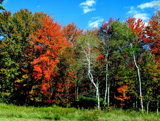
farms. We saw CHANGING COLORS in the
trees – not a lot, but a splattering of red and orange here and there. Lots of sumac alongside the highway has
already turned red. Mostly….more
beautiful barns and silos than I could count.
In Minnesota the land was flat was you could only see the ones right
next to the freeway. But in Wisconsin,
the terrain was much more rolling, the interstate dotted with clusters of hardwood
trees and occasional pines. Red barns,
gray barns, old barns, new barns. Silos
of metal, brick, and concrete block.
Beautiful old homes as we wound through the tiny villages on the road to
the state park.
 |
Our campsite among the oaks at
Illinois Beach State Park |
Illinois
Beach State Park is NOT one of the newer parks.
It has the look of a well worn friend – the sites are wooded and sandy
(there are dunes along the lake shore).
Electricity at most sites, but water is from frequent pumps and the dump
station is at the entrance. We picked a
site out of sight, but close to the bathhouse.
There is a section of sites that are ‘non alcohol’. We’ve never seen this in a state park
before. Not sure if it has anything to
do with the strong Muslim presence in the town of Antioch and Zion or
what. Along the shoreline (just behind
our campsite) are the concrete remains of old bathhouse and concession stations
– big structures! There are abandoned
cement shelters that once covered picnic tables along the shoreline. All is overgrown by beach grasses and yellow
flowers. There is a swimming beach at
the south end of the campground. The
park closes at 7pm at night for day use.
 |
| Abandoned picnic shelter of cement along lakeshore. |
Dinner….we
haven’t overeaten today and Rick is HUNGRY!!
We use the microwave to heat up a can of chili (Rick to make nachos) and
ravioli (Ginger with a salad). Rick
leaves a voice text for Matt with the details of where we are and how to get
into the park (we have his pass). We are
not sure when to expect him – haven’t heard back. But we figure we will be eating out tomorrow,
so tonight we can dine in!
We
take a walk along the bike path that borders the shore line for about a half
mile after dinner. Feels good to get out
and walk. The cloudy sky breaks to allow
the setting sun the opportunity to shine onto the vast waters of Lake
Michigan. All tucked into our cozy
little trailer tonight… prepared for whatever tomorrow may bring!!
 |
| Beach volleyball court in setting sun |
Note….Matt
was late in getting home from work. He
called later in the evening. Will be
coming up by train tomorrow morning, arriving here at 8am!! Early morning for him!
We
also gleaned some information about the park from the maintenance man who was
cleaning the bathrooms when we walked over around 9:30pm. Campground built around 1960’s when the
resort was completed and the southern end campground became the Nature
Preserve. The northern unit was a
training ground for troops prior to WW1….been around awhile! It is a nuclear power plant in the middle,
but decommissioned. Now….to bed!
Click HERE for today's pictures
SATURDAY, September 21, 2013
Visit
with Matt Rembold, Illinois State Park
Zion
and Waukegan, IL
Awoke
around 6:15 this morning to look outside and see the beginnings of a sunrise
coloring the sky over Lake Michigan.
Spent the next 15 minutes fooling around with the new camera to try and
figure out how to take color intense pictures (the Sunset setting on the old
one) and closeup pictures that are in focus!
Success on both!! Slowly I will
get this figured out! Practice on the
sunrise!
 |
| Sunrise through old bathhouse |
We are
up and moving as we have to find the train station in order to pick Matt
up! He texted Rick the address, so while
we don’t know where Eden St. is, we know it is 2500, so we’ll go to 25th
Street and take a right toward the tracks!
Success. We pull in at 7:55, just
enough time to look around briefly before Matt’s train comes racing in a few
minutes early! I happen to be standing
in front of the exact car from which Matt emerges! He looks great!
First
order of business for the day is breakfast.
We cruise the little town of Zion briefly, but Matt is equipped with a
Smart Phone and finds Emily’s Pancake House for us. The parking lot is crowded, always a good
sign in a restaurant. We have delicious
skillet breakfasts – mine a combo of avocado, bacon, tomato, and cheese on top
of hash browns and topped with scrambled eggs.
I did NOT finish it! Tasted so
good, but richer food than I have eaten lately so it filled me up
quickly!!
 |
| Rick and Matt |
Then we
wander a bit…out to the North Unit of Illinois Beach SP, to find the ponds, but
not the marina. We wander awhile out
there, noticing the shoreline up into Wisconsin, and the highrise skyline of
Chicago to the south. Sailboats are out
on the waters, as it is a beautiful sunshine morning with big puffy white
clouds in the sky. Much nicer than the
weatherman predicted a few days ago. I
am amazed to find waves breaking on the shore this morning because last night
the lake was so still.
 |
| Tugboat and load of sand |
 |
| Rick, Ging, Matt |
We
watched a tug boat pulling up a barge that looked to be skimpily loaded with
sand or dirt. It moved slowly in front
of us, and then, before reaching the marina area, turned and the barge seemed
to split in two and it dumped its load into the water. Evidently it was loaded full (MUCH more sand
below view!) and is part of the erosion control efforts along the
shoreline. We could see the brown of the
sand below the water as the barge and tug left – waves were breaking along the
 |
| By the shores of Lake Michigan at Illinois Beach |
top. Part of this was explained by a
couple of gals who wandered by as part of International Beach Clean-up Day. I picked up a soda cup where we were standing
and put it into her bag, so we participated in this international effort!! They asked me to take their picture, so I
returned the request and got a shot of the three of us! More erosion control is
the huge steel foundation pieces (Matt told us what they are called, but I
can’t remember it exactly!) that are buried deep into the sand to form a metal
wall.
Next step is
a drive down to the south unit and the Nature Preserve. This is the FIRST such designated area in the
whole country back in the mid 1950’s.
There is a staffed visitor center, open only on weekends this time of
year. We walked on about 2 ½ miles of
trails that took us out to the beach, and then along the dunes to where the
Dead River empties into the lake when the water rise high enough for it to push
through the dunes! Otherwise the Dead
River is …well, dead! It is more of a
long skinny lake, but prime habitat for wildlife and certain types of
birds. The whole area is covered mostly
with oak trees – a burr oak (rarer, but I loved it’s fuzzy acorn caps!) and the
black oak (pointed lobes on the leaves and smaller acorns). A few of the newly planted oaks are changing
colors in the campground, but mostly everything is still green.
 |
| Dead River |
Our wildlife
for the day? Not much, but we saw Canada
geese, gulls, sandhill cranes, chipmunks, grasshoppers, giant bees, and a frog
hopping across the road!
Back to the
trailer to make sure all is zipped up in case a storm comes in as the clouds
have thickened. Then down to Waukegan,
the next city along the shoreline and where Matt must catch his train to return
to Chicago. Waukegan has a big marina,
so we walked out to the end of the cement pier, checking out boats, fishing
families of all sorts along the way, and the buildings across the channel. Looking back up the hillside you could see
the old buildings of Waukegan. Much was
written in Spanish, and we later discovered that Waukegan seems to have a large
Hispanic population, mostly Puerto Rican.
Matt said that Illinois has the largest Hispanic population of any state
that DOESN’T border Mexico. That was
news.
 |
| Fishing pier and jetty at Waukegan |
Saw several
awesome old church steeples as we drove through town in search of somewhere to
pick up a light dinner before putting Matt on the 4:10 train. I love steeple photos, but it was a little
awkward as we didn’t stop at any of them!
We did finally find a Subway (thank you Matt and your Smart phone) for a
quick dinner. A fast drive back down to
the train station (we had found it earlier).
Matt has at least a couple minutes to spare! It was sure great getting to see him and
spend the day with him.
Showers and a
quiet evening of TV for Rick and computer work for Ging. We are leaving in the morning to drive
through the middle of Chicago. If you
can’t do it on a Sunday morning, when can you??
God can be assured that I will be in prayer in the morning anyway!
Click HERE for today's pictures
 |
| Our route for today |
SUNDAY, September 22, 2013
Zion,
IL to Swanton, OH (BlueGrass Campground)
279
miles
 |
| Sunday morning sunrise! |
Brr! It was a little cooler last night and I got
chilled before I went to bed. But around
midnight I threw my new denim blanket on top and that was instantaneous warmth! Awoke to a beautiful crisp first day of fall
morning! We packed up quickly and we on our
way south shortly after 8am. Through
Chicago today! We had a text last night
from Luke as he landed in Chicago at O’Hare!
Said it was probably the closest we would be to each other in the next
two months! He was right!
Made a
wrong turn getting on to Hwy 41, but we had our new map so figured it out! Smooth sailing down 41, which turned into
I-94. We just followed our way down the
Lake Michigan shoreline, through the heart of Chicago with its downtown towers,
and to a connect with I-80. We managed
to stay on non-toll roads until we got to Indiana. There is just no smooth way across the state
on the north side without using the Turnpike.
With the trailer, it costs us $12.30 for the 155 miles.
 |
| Welcome downtown Chicago! |
Rick
ended up driving most of the way across Indiana. I took over about 25 miles from the border,
where we jumped off the turnpike and picked up US 20A, a two-lane blue highway
that parallels the turnpike across northern Ohio. A nice change of pace….we rolled along at
about 55 mph, through some small towns, and passed numerous classic farms. More silos and barns!!
Desperation
for a restroom drove me to stop in Swanton, OH, about 25 miles west of Toledo (“Saturday night in Toledo, Ohio, is like
doing nothing at all! – John Denver!) From there, Rick spotted a MacDonalds where
we decided to check online for possible campgrounds. We found 3, one of which advertised wifi and
was just a few miles down the road.
Hence we are stopped at BlueGrass Campground, buried deep in the oak
trees at the back of what appears to be mostly permanent or seasonal
residents! All set up and know we only
have 150 miles to go to reach Shaker Heights, OH just east of Cleveland,
tomorrow.
 |
| Campsite at Bluegrass CG |
Rick gets his TV system all
set up to be ready for his Steelers game tonight! I get started coloring in some drawings so I
can post Chapter 8 of Luke tonight! It
is cooling down, with lows predicted in the low 40’s tonight. Tomorrow night….a real bed!
Click HERE for today's pictures
MONDAY, September 23, 2013
Swanton,
OH to Shaker Heights, OH
148
miles
 |
| Our route for today |
Our first REALLY lazy morning on the
trip!! We only have 150 miles to go and
we don’t want to arrive before 3pm! As I
awake this morning very early, the trailer was dark back in the trees and it
was cold outside, so I pulled the sleeping bag back over my head, burrowed down
and fell back asleep. …..until 8am! Unheard of for me! Probably partly due to the late night last
evening as the Steelers game didn’t end until 11:30 pm. Rick is appreciating the west coast time
schedule for games – they are NEVER this late out west!
 |
Crossing the Maume River....my GA roommate
lives near here! |
Leisurely
showers and pack up and on our way shortly before noon. We continue past Toledo, on freeway briefly,
and then back on US 20 which, since it is four lane divided might as well be
freeway, until we hit the outskirts of Cleveland. Scenery?
More corn, soybeans, and beautiful farms and quaint small towns. Many of the small towns have ONE large
manufacturing company or firm of some type.
We
follow the directions on my “Smart Camera” through Cleveland to the east side
and then exit the freeway to wind our way up to Shaker Heights. Glad my camera had the map on it, as we
couldn’t follow our intended route and had to adapt! The Shaker Heights area is on the outer rim
of the city…an area that Eva describes as still upper middle class, but could
easily fall into disarray, hence some fairly stringent city ordinances to
maintain the homes, etc. And high
property taxes! But it is beautiful,
thickly wooded and treed, roads and old classic homes.
 |
| Hurst home in Shaker Heights, east Cleveland |
We
park at a neighbors driveway about 5 houses away (they are on vacation), and
carry our packed bag down to the Hurst house.
Eva is the ultimate in hospitality, wonderful considering she and John
were gone since last Thursday and just arrived home on Sunday afternoon. Eva had gotten home from work just 30 minutes
earlier!
 |
| Eva and John Hurst |
John
was home for one night….to see us! We
had a wonderful evening of visiting….fire outside with hors d'overs. (Shrimp and roasted garbanzo beans which Eva
has promised the recipe for!) Then
inside for lasagna and salad and more
wine. Eva had called another college
friend, a fraternity brother for Rick whom Rick hadn’t seen since
graduation. He came over after dinner
and conversation was even livelier then.
Bill (Wee Willie to the frat) is a doctor in town. Conversation ranged from jobs, to kids, to
retirement…..the typiucal gamut!
 |
Tropical mendevilla plants in
Hurst backyard |
A
little online time after everyone left and then into a REAL bed for the
night! Ahhhh!! We are upstairs in one of the bedrooms. This is a classic older home with little nooks
and cranny rooms everywhere. A sleeping
porch off the upstairs, sitting porch downstairs, formal dining room, etc. The flowers out back are beautiful. Eva said the deer are plentiful in the yard,
and the dog has even had giardia this summer from deer poop!
Tomorrow…..Chesterland!
Click HERE for today's pictures
TUESDAY, September 24, 2013
 |
| Our very short route for today!! |
Shaker
Heights, OH to Chesterland, OH
15
Miles
Up
around 7 this morning to have a cup of coffee with Eva and John before they
have to leave for work. John is off on a
three day road trip (he is a salesman).
They leave Rick with instructions for where to hide the key after we
lock up the house, and we have another leisurely morning – a real shower, and
some more internet time!
 |
| Laundry time!! |
We
take off around 10:15 to find a Laundromat out near the Chesterland, Hwy 322
exit. A load of laundry is in
order!! And we have time to kill, so
what the heck! We thought about heading
into town to visit the Rock and Roll Museum and Hall of Fame, but decided we
didn’t really want to go through the hassle for the reward. So…..laundry time as I write!
 |
| Gazebo in Chesterland City Park |
After
laundry, we head out to Chesterland and park at the city park, a beautiful
little spot at the corner of Chilicothe and US 322. We ate a little bite of
lunch and relaxed for a couple hours in the sunshine of the park. Rick picked up a birthday card for Robin,
talked with his mom, and we both read.
 |
| Austin's mailbox |
I thought
Austins lived on Chilicothe, but around 3 when we went to find the place, all
we found was the office for their accounting firm. Back into town to call, but Rick just got a
voice mail. I went into the little
coffee shop to search for a phone book, found the listing, and located address
on map. As we headed out, Karen returned
the call and confirmed our find! They
don’t receive mail at the house (pictures will show why!), so the only address
I have ever written down for Christmas cards is the office! Anyway, we find it….and all looks much more
familiar to what we remembered from previous visits!
 |
| Jim 'Meat' Austin and Rick |
A
delightful evening spent reminiscing, visiting, and eventually driving up to
Red Lobster (about 6 miles north) for dinner….a late dinner as we left the
restaurant at 9:30 pm! Rick had his
seafood stuffed flounder and I tried the roasted vegetables and tilapia – all cooked
in a parchment. It looked quite strange
when brought to the table, but very tasty!!
Artichokes and asparagus and fish!
 |
| Tilapia dish at Red Lobster! |
Click
HERE for today's pictures
WEDNESDAY, September 25
Chesterlands,
OH to Shippensburg, PA via Greenville
312
miles
 |
| Our route for today |
We are
up and going early after a late night, but Rod is now on night shift at the
tubes plant and is waiting up to have breakfast with us! We leave Austins about 8:20 and head west on
322 toward Jamestown and Greenville.
Have to stop several times for construction which slows us down! And we
crest a hill and have to slow down suddenly for an Amish wagon cantering down
the highway in front of us! More small
towns, beautiful farms, silos, and trees starting to change colors.
 |
| We pass an Amish horse and wagon! |
Past
Pymatuning State Park where Rick worked as a lifeguard on summer and down into
Greenville. I called Rod and confirmed a
10 am meeting time at Perkins Restaurant.
My phone was weird….it is on Emergency setting. Rick’s is out of juice and needs to be
plugged in!
Breakfast
with Rod and a good visit. I enjoyed
just listening to the stories and tales of growing up years, etc. Updated on Denise’s kids and Rod’s grandkids,
life at the factory, and life in general.
 |
| Rick and Rod |
At
noon, time for Rod to go to bed and for us to be on the road! We are bound for Shippensburg down near
Gettysburg. We stop at Jackson Center at
the cemetery to check on Pop’s burial site.
Pick a few weeds and clean up the nice flower bed that Ran and Rob
planted last spring/summer. All looks
good.
 |
| Pop's gravesite in Jackson Center, PA |
I take
over driving at this point and we soon head off on new road – Hwy 422 which
cuts through the middle of the state. We
are avoiding the toll road and freeways, mostly for diversity and because we
have plenty of time to make arrival in Shippensburg, which is about 4.5 hours
by freeway. The highway is divided four-lane
for sections and then two lane. This is BEAUTIFUL countryside. Rolling hills covered with hardwood forest,
interspersed with wide expanses of grass and fields. The
trees are beginning to change, the sky is blue with puffy clouds. What a glorious day!
 |
| National Historic Site |
With
the need for a bathroom and the lure of a stamp for my passbook, we pull off
near the top of a hill (we are crossing the Alleghany Mts.) at the Alleghany
Portage Railroad National Historic Site.
I never knew this existed! It
operated from 1834-54 as a means to move people and goods quickly across the
state. The average time was previously
23 days and it was now 5 days. The route
combined the canal method with an incline railroad in 10 sections over the
mountains. Pretty interesting. We stopped and looked around and watched the
20 minute video.
 |
| A typical scene on the road! |
Rick
drives the last couple hours into Shippensburg – down the I-99 connector to our
Rt 30 over a last section of mountain.
THAT was a very winding and steep route but gorgeous!
Phone
problems complicate things as we pull into Chambersburg. Pam had left a message earlier on both phones
which we didn’t get (we were in the VC) My phone is stuck on emergency and won’t
call out somehow! Rick’s is almost dead,
but I get through to Pam and get directions quickly to their place! Whew!
We
pull into Pam’s son’s house our west of Shippensburg around 7:15pm to a
beautiful sunset! Good conversation and
catch up with Pam and her son Chris before Chris heads off to his night job
doing computer IT at a hospital 45 minutes south of here.
G’night!
Click HERE for pictures from today
THURSDAY,
September 26, 2013
Shippensburg
Area: Covered Bridges and Gettysburg!
Wow! What a beautiful fall day for a drive in the
countryside searching for covered bridges and then a visit to Gettysburg (the
short kind of visit!) Got up this
morning around 6:30 to get updated in the journal. All up by 7:30ish, Chris home around 8:30,
and by 9:30 we are on our way for a day of adventure!
 |
| Franklin Co,. Habitat house |
Pam
had done a little research online for Franklin County covered bridges. With the aid of her GPS and my ‘Smart Camera’
we headed off to seek the bridges and then drive over to Gettysburg, about a
half hour (the direct way) away.
Along
the way, we stopped in Chambersburg with a short detour to see the two Habitat
houses Pam has been working on some Tuesdays and Saturdays over the
summer. Both two story homes with
basements, but when we saw the size of the lot, we understood why! And the two stories matches the other homes
in the neighborhood better.
 |
| Pam and Ginger by Martin's Mill |
 |
| Martin's Mill Bridge |
Down
to Greencastle and then west to find our first bridge – Martin’s Mill (C), a
207’ span built in the mid 1800’s. The
drive through the farm countryside was worth it, but the bridge itself was
great. It was washed off its supports in
1996 during a flood, but has been restored.
It is no longer used for anything except foot and bike traffic.
 |
| Witherspoon Bridge and pond |
From
Martin’s Mill, we headed a little further west, now under the guidance of Pam’s
GPS system. It led us to the Witherspoon
Bridge (D), which we could drive through!
A beautiful pond and rockwork foundation made for a gorgeous
setting. This bridge has a Burr Arch
truss system which was very different from the first bridge. It also was only 87’ in length.
 |
| Sachs Bridge |
Back
through Greencastle and east to Waynesboro (E) where we stopped for a bite to
eat at the Subway! Still heading east on
Hwy 16, we wound up to Sachs Bridge, just outside the Gettysburg Battlefield
area. (F) This bridge was walk through
only, but very open with a XX design on the walls which allowed for large
openings. We saw a blue heron in the
pond.
 |
| Blue Heron |
 |
| Sachs Bridge and reflection. |
On up
to Gettysburg. This is the 150th
anniversary of the battle and in honor they have completely rebuilt the Visitor
Center (most everything now has a fee L ) but we
checked out the free stuff, the gift shop J, and then drove up to the Peace Memorial as we drove out of town. There were lots of ‘old’ people visiting the
Military Park (plus a school bus of middle school age youth!) – guess that
would be typical of a September mid-week visit!
I thought of Chris Rodgers while we were there! He has family that lives nearby.
 |
| Short visit to the new Visitor Center at Gettysburg |
Up and
over the ‘mountains’ (all 2500’ of them, and through the state forest (all
deciduous) and Caldonia State Park (Appalachian Trail passes through here) and
back to Shippensburg. We are going to
explore the state park and trail tomorrow.
Should be a beautiful day as the woods are spectacular right now.
 |
| The Peace Memorial |
A
little quiet time when we got home (I am writing now!). Rick is napping and Pam is reading. I so enjoy spending time with Pam. She is one adventurous mid-60’s woman. She has signed up for Mason TX and Cruces, NM
Habitats in the spring, will be going to Florida later in October to dog sit
for friends, volunteers locally for Habitat and her church, has taken up wood
carving, and is helping her son remodel and update parts of his home! She has also signed up to volunteer for two
months outside Austin TX next spring at a state park refuge (I can’t really
remember!)
From
Pam’s Peace Corps stint in Jamaica, she learned to make jerked chicken – a peppery
spicy version. Chris is a gourmet cook –
he LOVES to cook. So…tonight’s dinner is
jerked chicken, a fancy avocado tomato salad, fresh green beans, and a little
garlic bread prepared on the grill also.
The beans were grilled in foil as well.
Topped it all off with apple pie and ice cream later in the
evening. But first, after dinner on the
back porch, we built a fire and enjoyed a little time gathered round it. Beautiful evening.
A
little TV watching together and then bedtime!!
Chris again left for work around 10pm.
Click
HERE for pictures from today
FRIDAY, September 27, 2013
Caldonia
State Park hiking and Pam’s 67th Birthday!!
Up and
moving early! We have a plan today. Actually I think we are a good excuse for Pam
to do some exploring she has wanted to do!
We are heading back up to the state park area just east of Shippensburg,
but Pam would also like to find “Ridge Road” – we know it is a gravel road
along the top of the mountain! With a
little research we have a general idea of what we are seeking! The Appalachian Trail cuts through the park
and there are a number of other trails for us to explore.
 |
| Crossing of Appalachian Trail |
Today
is Pam’s 67th birthday. We
will be heading out to dinner later this afternoon. Chris does not work on Friday nights, so he
came home to sleep for a shorter while!
On our
way around 9ish to travel through downtown Shippensburg and east….We quickly
leave the city, then farmland, and into the woods. The road winds up and down through shady
stands of mixed forest. There are more
coniferous trees than I expected – white pine and hemlock mostly. We find a turnoff that indicates it connects
WITH Ridge Road so we take it! We pass a
crossing of the Appalachian Trail – 7 miles to Caldonia, 12 miles to Pine Creek
Furnace SP north of here. There is also
a cabin at the crossing for trail usage….with reservations. Eventually we come to a huge intersection
with roads heading off in several directions.
We program the GPS to return us to Caldonia State Park HQ, and follow
it!
 |
Pam at Trailhead for Charcoal
Hearth Trail |
 |
Trying to make the trail
look steep! |
We
enter the state park from the back way and find our trailhead. We are taking the Charcoal Hearth Trail,
which begins at 1000’, climbs up to the top of the ‘mountain’ at 1500’ and then
drops back down while circling around 4 areas where the charcoal was formed
from slow burning piles of timber.
The
day is overcast and cool – very pleasant for hiking. Many of the trees seem to be just turning
brown, but we find stands of reds and golds, and plenty of acorns. These are a different variety also: some have
red ‘targets’ on the end of the acorn! I
will have to find a chart of acorn identification! The trail proves to be fairly mellow, but
enjoyable and lazy! We see no wildlife
(deer and turkey enroute in and out, however!).
 |
Red leaf caught in the
pine needles |
 |
| Posed atop the 'mountain'! |
Over
to the Visitor Center/HQ (and site of one of the campgrounds) where Rick and
Pam pick up a tree identification book and I find the Smokey the Bear Fire
Museum! Interesting! We didn’t go into the museum, but I got a new
copy of the Smokey the Bear song! (Just
what everyone needs!)
 |
| Trail along the channel |
Back
through town….Pam points out where the Methodist Church she is attending is
located and the buildings for the Methodist and Presbyterian she ‘tried out’! Pam needs an active mission church – one that
is DOING something in which she can be involved!
 |
Pam opens her
Scribble book |
Lazy
time now….many of us are falling asleep.
Time for a shower before we leave for dinner!
Pam has received a package in the mail from her
Texas daughter and Chris has a package wrapped up as well. I used our Colorado/ Wyoming map to wrap up a
copy of my Advent book. Pam opens all
the presents before we leave for Chambersburg and the Montezuma Mexican
restaurant there. Good meal – Pam and I
both have Fajitas Texana – beef, chicken and shrimp fajitas. VERY good, but I am stuffed!
 |
| Chris and Pam at Montezuma Mexican |
An
incredible orange ball of fire setting in the western sky as we come out of the
restaurant. Evening of a few games, and
then a movie. We’ve had a grand time
here with Pam and son!! Head out in the
morning.
Click HERE for pictures from today
 |
Our route for today
|
SATURDAY, September 28
Shippensburg,
PA to Corning, NY
Corning
Museum of Glass
208
miles
Today
begins 12 days of personal adventures! We say our goodbyes to Pam (Chris last
night) and are off from southern PA by 8:10, armed with two coffees purchased
at Sheetz with our newly acquired card.
Our route today takes us almost directly north through the middle of PA
along hwy 15, which is being improved to become I-99. It is four lane the entire way except for a 4
mile stretch just across the NY border.
 |
| Half Falls on Susquehanna River |
` What a beautiful
drive! At Harrisburg we followed the
Susquehanna River north. Then the West branch of the river in places. The road
followed the curves and bends of the wide (and not very full) river, passing
through tiny towns struggling to survive in a new culture that isn’t river
dependent. So many quaint churches,
parks. The river is dotted with islands
and wildlife refuges. We stopped at a rest
area at McKees Half Falls – a broad cascade of roads that extended nearly
across the mile wide river. While there,
looked up to see a gorgeous maple tree in mid color: green, yellow, red and
orange all wrapped into one.
 |
| COLORS! |
In
fact, the hillsides in this middle section of PA were a pleasant surprise. We had not expected to see such intense
colors this soon, but for at least one area, the hills were dotted with reds
and oranges. Sumac was in full red glory
along the road all the way.
Williamsport
PA is nestled in a broad valley of the West Branch Susquehanna. We passed the Little League International
offices and Hall of Fame. Rick remembers
that Carney Landsford recalled playing here when he was a child [boys’ little
league coach] The town is ready for baseball!
It is
the hillsides between Williamsport and Mansfield PA that are especially
beautiful. We are a little higher in
elevation perhaps as we have left the rivers and cross over into another
drainage. We stop in Mansfield as we
have heard that gas is higher in NY and it is the last major town before the
border. What do we find? A Sheetz!
We gas up for 3.46, still cheap but not the 3.29 we saw at one place in
Shippensburg (cheapest gas of the trip so far!)
Filled up car and bellies as we had to try out their ‘Make Your Own’
computerized order system. Pretty cool
and reasonably priced. And now we are just
4 drinks away from a freebie!!
 |
I know....this isn't a steeple, but it
is such a classic barn! |
Mansfield
north….the hills are beginning to color, but not quite as much. This section of road is incredible….obviously
close to being opened as the interstate.
Just as we cross the border we drop down to old US 15 for a short
stretch that is definitely being rebuilt.
But I find a few more church steeples in the process!
Corning,
NY is just 18 miles north of the border.
We stop at the Glass Museum and I investigate the chances of taking a
class. Lots of opportunities. Rick visited here as a young kid and weighs
his options, finally deciding to leave me to play while he goes on up to the
campground and sets up shop. So….entry
tickets in hand and tickets to a sandblasting class and a windchime fusing
class I enter the museum and Rick drives north to find Ferenbaugh Campground
(only 6 miles up the road).
 |
| Glass Museum entry |
The
Glass Museum is huge: downstairs gift shops, coffee shops, etc….all catering to
the multitude of tour buses who stop here.
The museum has no link to Corningware, although is was Corning
glassmakers who developed that glass process.
The town itself has been a center for innovative glass for many
years. The museum houses the largest
collection of glass in the world: from every country and century. There was a special exhibit called LIFE ON A
STRING – the history of beads in cultures throughout time. I barely touched the tip of the museum part.
 |
No scale for comparison,
but these are 70lb, 3-4' diameter
glass pumpkins!! |
Right
after Rick left I had to find the studio where the classes are held. It was housed in a separate building across a
courtyard where they hold outdoor exhibits in the summer time. Several people were at some outdoor ovens
taking a glass blowing workshop. The
‘hands on’ aspect of the mujseum is what draws manyh people – there must be
over 25 class offerings, ranging in price from $12 to $35, and scheduled every
40 minutes all day long. Bead or pendant
making, glass blowing, fusing, sandblasting….each one with a wide variety of
options within that technique. Right
now, glass blowing pumpkins was popular.
 |
| Busy making my windchime! |
Two others
were in my fusing class: a 6 year old boy with his mom who was making a frame
and a man making a clock. His wife was
with him and did the honors of taking my picture. I had selected a wind chime to make: four
strips of glass to decorate ranging in length from 6 inches to 12 inches. It took me a while to get the idea of how to
cut and break the class and I started with the 12” piece forming pine cones and
pine needles. I was slow and didn’t
finish before our 40 minutes were up!!
But fortunately my next class was in the same place! The little boy made a Darth Vader and Yoda on
his frame. He was so cute! The man was making a black clock with white
stripes and orange. It looked very
cool. Our handiwork will go into the
kiln tonight to be fused and then must cool slowly to room temperature, a
process which strengthens the glass. (I
learned more about that in the demonstrations!
) We will drive back into
town Sunday evening to pick it up…before
5 pm!!
 |
Finished wind chime, minus
shortest column and mount! |
Because
I took so much time on the windchime, I rushed decorating my bowl for the
sandblasting. I wasn’t very happy with
my results there. But, I did get to
sandblast it myself, a process that was mujch faster than I thought. You
put your arms into these heavy lined sleeves with special gloves on the
end. One hand holds the glass, the other
the garden hose like noozle from which the sand coming out at high
pressure. Keep the two a foot apart for
best results! That was kinda fun. The teacher then takes it to finish off and
make sure it is even and cleans it up for you.
The sandblasting is the only project you can take home that day.
From
the classes I went to the demonstrations: I watched flamethrowing, which is the
glass critter making with two pieces of glass rods and a torch, glass breaking,
fiber optics, glass blowing. All very
interesting! I learned the term Internal
Reflection during fiber optics and why glass fibers make such good conductors
of information. I learned about stress
in glass and annealing the glass.
And I
visited the gift shop!! Mostly perused
the discount counters….maybe they sell the stuff that doesn’t get picked
up! Bought a little Santa votive holder
and a set of glass icicles for the Christmas tree – both for under $10. Rick drove back into town around 4:30 to pick
me up.
 |
| Campsite at Ferenbaugh CG outside Corning |
In the
meantime…..Rick drove out Rt 414 toward Watkin’s Glen and found our
campground. He was hoping to perhaps
update us to a full hookup site that also had cable TV, but it was going to be
$22 more for the two nights. He opted
not! Besides those sites were out in an
open field, and we are tucked into a forest of trees with a carpet of fallen
leaves on the ground. And surprise for
Rick? With the antennae outside, he
managed to get the stations he needed to watch his football game! We don’t have
good cell phone coverage however!! And
Luke kept texting me questions that I had to wander all over to get an answer
out. I finally gave up after 14
tries. Later in the evening we received
a phone call from Mike Braymen, but it only lasted 20 seconds! Will try calling everyone from Corning
tonight!
Quiet
night scrounging for dinner, watching football, drawing scribbles. I went down to the lobby to get on line
between 7 and 8, so I know it is possible!!!
Will try to post Sunday evening.
Click HERE for more of today's pictures
SUNDAY, September 29
Watkins’
Glen State Park, NY
I
should have looked for a Presby church in Watkin’s Glen, but I didn’t, so I
think we will be attending the “Church of God’s Creation” this morning. We have to get hiking early so we can drop
back into Corning by 5pm to pick up my wind chimes!
 |
Eerie fog of morning
from campsite |
We
awaken to the sound of a light mist falling on the trailer. When Rick goes outside he can see the clear
skies above the clouds. The trees are
holding the cloud in and it is foggy and misty!
We shall have to watch our steps on the rocks of the glen, but it is
forecast for the mid 70’s today and clear skies!
 |
| Entry sign |
On our
way at 9:30….the fog is thick for about…10 minutes and then we slowly emerge
into a glorious morning – Sunshine hitting the brightly colored hillsides. We drive about 20 miles and then drop down into
the town of Watkin’s Glen – know mostly as the home of the Grand Prix of Auto
Racing. The state park is located right
in the heart of downtown – across the street from the County Courthouse with
its bright color dome. A casual viewer
would never know that behind a wall of limestone strata, a magical canyon of
waterfalls and pools exists. We pay our
$8 at the entry station, park, and prepare to walk the trails.
 |
| Entry bridge and waterfall. |
It is
only 1.5 miles from one end of the gorge to another, but over 800 steps mark the
path from east to west – uphill! That
explains the shuttle bus that runs visitors up to the north entrance so they
can walk DOWN! We opt to walk both ways
naturally!
 |
Entrance tunnel center
bottom. |
What a
beautiful cool and shady slice of heaven!
I can imagine the park is a mecca in the summer months to escape the
heat of cities and plains. You enter the
canyon through a tunnel in the rock wall, emerge on a stone bridge, and then
begin the staircase trail that winds from one side of the gorge to
another. Pool upon pool, waterfalls
everywhere connecting them. The water
has cut deep channels in the rock, shale shallows, ponds. It is amazing. There is a suspension bridge that connects
the rim trails from north to south sides.
Plenty of trails to link the rim to the bottom of the gorge. At one mile bridge you basically leave the
narrow slot portion of the glen and the walls of the canyon open up
somewhat. And then…..163 steps up to the
rim edge and the north entry station, restrooms, and concession stand! We treated ourselves to a shared bowl of
purple cow ice cream – blackberry with bits of nut and chocolate! Yum!
 |
| Rick captures a view through the waterfall. |
 |
This was Rainbow Falls just dropping
off the edge of the rim. |
 |
| Along the stone and step trail! |
 |
| Camera balanced on the rocks! |
 |
| Series of waterfall pools |
 |
| Reflections of the fall colors in the pool |
 |
| Along Indian Trail |
We
took the upper level Indian Trail back along the north rim – few views into the
gorge, but a gorgeous walk through changing trees, mostly oaks and hemlock,
across the Suspension bridge to the south side, and then down Couch’s Staircase
to the Stone Bridge where we started. I
can’t even begin to describe each part of our walk! Isolated leaves along the path of orange and
brown, waterfalls dripping from the rock walls, ferns and flowers…. In a few
places we could walk behind the waterfalls.
Everywhere the trail was wet and not from recent rains!
Rick took the old camera with him today and I have never seen him take so many pictures! This is probably the best documented hike we've ever taken! However, it will take me longer to sift through them and get it down to the best shots from both of us!! So the link to ALL of today's pictures will be awhile in coming!
 |
| Beautiful sailboat out on Seneca Lake. |
A few
moments in the gift shop and then we drive in search of some brunch. We head up the west side of the lake about 5
miles, hoping to find a little restaurant lakeside. Sailboats are coming out to dot the lake with
white triangles. We stop to photograph
one that had three sails and was most impressive! Finally we drive back to Watson’s Glen, find
a Subway and take our sandwiches out to a park on the east side of town right
on the lake. Beautiful.
 |
| After lunch on Seneca Lake |
Back
south on Hwy 414 toward Corning. We
bypass our campground and head on down to Corning to pick up my windchimes at the
Studio shop. We park, I get my chimes,
and we use the next hour to visit on the phone with Moms, Mac, Luke, Ran, and
Mike Braymen. All necessary since we can’t
talk out at the campground!
A
quiet evening catching up, planning our next route, and watching football
(Rick!) Tomorrow we head north to the
Adirondacks!
Link to all pictures later!!
 |
| Our route for today |
MONDAY, September 30
Corning,
NY to Wilmington, NY
Lake
Placid/Whiteface KOA
344 miles
 |
| As we leave Ferenbaugh CG in the morning |
What
an absolutely gorgeous day for a drive!
We decided last night to take the ‘fast’ route (eg. Nearly all
interstate freeway) which still meant a 6 hour drive to get clear up to the Lake
Placid region of New York. We left this
morning around 8:30, heading back into Corning and then east on I86 to
Binghamton where we cut north on I88 to Schnechtady and Albany. I drove the 135 miles from Binghamton up past
Albany. We were on I-90 briefly, a toll
road, but it was so brief they don’t even charge you! Then north on I-87 to Exit 30 and a gorgeous
drive into the Adirondacks to the community of Wilmington – just east of Lake
Placid and the closest town to the Whiteface Mt. Ski area, the ski venue for
the l980 Olympics.
 |
Please remember most pictures are
taken from the truck windows! |
Early
this morning we were socked in by low clouds.
It was actually clearer at the campground as we left than the morning
before, but when we dropped into Corning, we dropped into clouds! Foggy in the valley for the next hour or so –
in and out, the river looking like it was on fire at times, and the shifting
clouds in all the low spots. It was
pretty neat, but didn’t help any far reaching vistas!
Naturally,
as I started to drive the sky turned clear and the trees began to shine! Hill upon hill of glorious hues of orange and
red against the green. Little villages
and towns scattered everywhere. We passed
the turnoff to Cooperstown, the Baseball Hall of Fame. But….I’ve been there twice and I hadn’t been
to the Adirondacks! Priorities! Rick took a few pictures, but I had to figure
that I would get more opportunities north of Albany and….we certainly did!
 |
| Rest stop weather vane! |
Lunch
at a reststop on I-87 where we switched drivers as well. It was a lean lunch of crackers or tortilla,
cheese, and a handful of grapes. Good
enough! The rest area had all sorts of
information on the Lake George area, which is a popular vacation retreat south
of Lake Champlain. But we were wanting
info on the central Adirondacks!
 |
| Near the Adirondacks...we see a mountain! |
We
arrived at our KOA campground (we had made reservations the night before which
helped give us a definite target for the day) just west of Wilmington, NY and
at the base of Whiteface Mt. It is an
award winning facility, but since we took a back-in site with just electric
(and WiFi!), we only are paying $34 a night which is under our budget
limit!! It will be worth it! The internet works, and although we don’t
have cell phone coverage, that isn’t the campgrounds fault!
 |
| KOA Campsite in Adirondacks |
We
took an hour or two to set up the trailer, I made a salad, and Rick read
through material on the area. I also
restocked the ice in the cooler and picked up some more postcards. AT that point we decided to go on in to Lake
Placid and see what was there this evening.
What did we find? The drive was
beautiful along the Ausable River and at the base of Whiteface. The sun was brutal in our eyes! And Lake Placid was a zoo….and this was a
Monday night! We talked with a young dad
later who said the weekend was chaos with triple the people! Augh!
We drove through, trying to find a possible restaurant, gave up, went
back along Mirror Lake, and highballed it back to the campground. We did find where our trailhead was for
tomorrow’s hike.
 |
| Along the Ausable River near L.Placid |
 |
Mirror Lake next to Lake Placid (the
zoo is on the far shore) |
 |
Ah, nothing like outdoor dining!
(And a glass of wine!) |
 |
Does this guy look like he is enjoying
his retirement or what? |
The
Hungry Trout Restaurant is about a third of a mile from the campground and we
decided to go there and check out the basement pub – what a perfectfully
wonderful way to end the day! A walk
through the woods down, seating on the patio outside overlooking Whiteface Mt.
and all its colors and the Ausable River as it tumbles through a little gorge
and over big boulders. A glass of wine
for me, a new beer for Rick, and two appetizers that were delicious beyond
compare! (Picture the perfect pulled
pork pizza and a spinach/artichoke dip!)
We might just have to come back tomorrow night….if we can afford
it!
Back
to the trailer and a very quiet campground to write, download, etc. and prepare
for a big day tomorrow. Both of us are
somewhat regretting that we only have a day to spend here on the trails,
exploring the lakes, etc. But our
reservation for the White Mts. also calls and it will be equally
beautiful!
Click HERE to view today’s unedited pictures!
TUESDAY, October 1
Whiteface
Shelter Hike and Veteran’s Memorial Highway
Adirondack
State Park, NY
Another
day in paradise! We arise lazily this
morning – no need to pack up, and no need to hurry as it takes awhile for the
morning clouds to burn off. However,
after we check the weather forecast, we decide to switch our plans from
Whiteface Mt. summit FIRST and THEN the hike, to hike FIRST and then the
mountain. It means we could be looking ‘into
the sun’ from the summit, but at least our chances of seeing something will be
improved as the summit won’t be in a cloud!
 |
| Whiteface Mt. Ski Area in morning light |
So….we
leave the KOA around 9:30 and head west again toward Lake Placid. The trail takes off just after the road cross
the Ausable River and about a mile or two from Lake Placid. This trail is a popular cross country and
snowshoe trail in the winter. Our plan
is to hike the 3 miles to Whiteface Landing, a boat dock on Lake Placid, and
then another mile to the Whiteface Brook Shelter, on the trail to the summit
from the west side. The summit hike
would climb about 2800’ in 2 miles after the shelter. We are skipping that part!
 |
We start out on a road, then it
narrows down to a trail. |
 |
| Our destinations! |
While
the hike didn’t afford any long ranging views, it was a definite ‘walk in the
woods’! We hiked on a carpet of leaves,
the trail covered with reds, golds, oranges, and browns. Sometimes the leaves make things exciting
because you couldn’t see all the rocks beneath your feet! Lots of interesting fungi on the trees –
feathery petaled whites to white rimmed chocolate brown. Pretty neat stuff. (How neat is that?) The trees made a canopy tunnel over our heads
often. The sunlight filtered in and out
all day – clouds and sun, clouds and sun.
The grade was ultra gentle – a bit of climbing and then descent, but overall
we hiked at a 3 mph pace, so fairly level!!
 |
| Connery Pond |
The
first .6 mile took us to Connery Pond (I have a question! What is the difference between a pond and a
lake? It can’t be size because we have seen some huge ponds and some tiny
lakes!) The pond has several private
residences, so there were plenty of signs posted to keep you off their
property. Overall trail is very well
marked with red metal “foot trail” disks attached to trees often. On the far side of the pond we reached public
land and the entry to a wilderness area.
 |
| Some of the many awesome fungi we saw! |
 |
| The trail was a canopy of trees much of the way! |
 |
| Lake Placid and Whiteface Landing |
We
hiked the .1 mile down to Whiteface Landing – a boat dock with a man and his
dog and a campfire pit. That was
it. We could see some private homes on
the far shores of Lake Placid.
 |
Fall leaves in the waters of
Lake Placid |
 |
| The shelter on the west flank of Whiteface Mt. |
The
one mile up to the shelter took us through an area of flooding and
upheaval. Seemed like the trail was very
convoluted as it passed through swampy areas, over boardwalks, and past trees
upended roots and all. What happened
here? Finally a well maintained lean-to
shelter came into view. This was the
first of the Adirondack style lean-tos that we have seen. It is open on one side, with a large fire pit
on the open side. We found a log book
tucked into the side wall, complete with pencil for signing! On the other side was a wad of fresh
newspaper and a firestarter twig (soaked with oil?) Under the shelter a large tarp, a shovel, and
a pair of work gloves. The site is
maintained by various Adinrondack Hiking clubs who “adopt” a shelter
nearby. We ate a little snack for lunch
and headed back down by 12:15.
 |
Ausable River between
Lake Placid and Wilmington |
Return
trip over the same terrain, but it seemed the sun was shining through a little
more often! We arrived back at the truck
at 2pm, stopped for a couple of pictures at Monument Falls, and then headed
back to Wilmington for our journey to the top of the mountain!
 |
| Tunnel entrance |
Veteran’s Memorial Highway, was constructed at the beginning of the depression to the top of Whiteface
Mountain. Five miles and about 2500’
elevation climb, the road is pretty bumpy with some ‘rough spots’! It is a toll road, probably somewhat because
that monitors and meters the name of people on top at once – there is only so
much parking available! With the rocks
blasted out to form the road, the “Castle” restaurant and gift shop was
constructed, as well as the stone house at the very top summit. (There is also a weather station doing
research on cloud pollution for some universities.) The Adirondack Mts are rock – solid rock in
many places and very OLD rock. As part
of the road project, a tunnel was blasted 475’ into the core of the mountain
about 275’ from the top. An elevator was
installed that carries you up 27 floors to the Stone House at the summit. It was very COLD in the tunnel as we walked
into the heart of Whiteface Mountain.
 |
| Inside the tunnel! |
 |
| View north from Whiteface |
They
said the visibility today was 30 miles, so no views north to Montreal, and we
could barely make out the lines of Lake Champlain to the east. The sun was in and out of the clouds, which
made Lake Placid sparkle below us, but picture taking was difficult! We did notice that the colors seemed
predominantly yellow on the west side of the mountain, while largely reds on
the south side. Interesting. We spent about 45 minutes up on top. They had a number of interpretive displays
discussing the rock history, life in a hostile climate, weather, etc. Lots of binoculars stationed about (at 25
cents a look!) for people to use. Rick
had remembered his so he spent a lot of time scanning the vistas.
 |
| Alpine Trail follows a spine of the mountain to the top. |
Whew! We are done for the day. A quick drive through Wilmington on our
return and a stop at the flume of the Ausable River (near our outdoor patio
from last night). Back to camp to shower
and kick back for the evening.
 |
| Waterfalls just before flume |
It appears I have reached my download max for tonight on the internet. I had a few more hike pictures to add, but look for them later when I add the link to all the pictures!!
WEDNESDAY, October 2, 2013
Wilmington,
NY to Lincoln, NH
 |
| Today's route! |
Ben
and Jerry’s Ice Cream Factory Tour
152
miles (plus a Ferry Trip!)
Well,
today we did a little bit of everything!
Packed up to a foggy morning (glad we did Whiteface Mt. yesterday
afternoon!) and on our way around 8:30 am.
We drove back through Wilmington, picked up some coffee at the grocery
store from last night, and on through Jay and up to I-87. Down one exit and along a country windy road
to Essex. We got behind a slow moving
tractor trailer and thought we would miss the 9:30 ferry and have to wait the
hour for another. Well….we pulled into
the landing at 9:31, the ferry was still there, and $25 later, we were
on…barely by time, barely by length!!
 |
| Gorgeous skies as we board the ferry! |
Lake
Champlain is soooo big! We said goodbye
to the little town of Essex that we didn’t get to explore (not disappointed),
and watched the birds skim across the waters, and a gorgeous sky of diffused
light and rays as we sped across the waters.
There was a tour bus on board, so lots of seniors on a Fall Foliage
tour! Imagine that! Just a 25 minute crossing and it saved us 60
miles of driving, not to mention it was fun!
We thought we would get by with only an $19 charge, but the truck and
trailer total MORE than 27’ in length!
Oops!
 |
| Rick in the front of ferry |
From
the ferry landing we took back roads to Waterbury, VT, home of Ben and Jerry’s
original Ice Cream Factory. We stopped
here 15 years ago with the boys and its was one of the funnest tours we’ve
taken! I especially love all the mural
graphics on all the walls. I think it
would be fun to volunteer just to paint walls!
The factory hosts over 200,000
visitors a year, most during the summer and fall foliage seasons! We walked in and got right on the 11:15 tour,
no waiting at all! I remembered some of
the tour from 15 years ago, including the little movie theater, even some of
the ‘jokes’! But it was still so much
fun. The flavor of the day was Triple
Caramel Fudge, after a ruse of Broccoli Cheddar Cheese! The latter was a April Fool’s joke that they
haven’t been able to retire! Especially
during the summer months when lots of kids visit! I visited the ‘graveyard’ later and enjoyed
the many rhymes about flavors that didn’t last.
We decided to eat lunch at the factory – ice cream of course. I tried some of their new Greek frozen yogurt,
Raspberry Chocolate Chunk, and Rick had mint chocolate chunk. I am watching my food, however, so I just had
a small! J
 |
| Entry sign to Ben and Jerry's Factory |
 |
| Our free sample for the tour: Triple Caramel Chunk. YUM! |
 |
| This sign reminded me so much of Keith Haring style artwork! |
 |
| You have to love a graveyard for our flavors!! |
 |
| Another classic church! |
From
Waterbury we jump on the interstate for just a few miles to Montpelier and a
road over to Barre, VT, where we connect with Hwy 302 which will take us into
New Hampshire. What a beautiful road
through small towns, along a river, and through hills of beautiful color.
Across a bridge and into New Hampshire at the town of Woodsville.
 |
Typical view as we wind down Hwy 112 toward
Lincoln NH |
We then follow 112, a rather narrow country
road along the Ammonoosue River, through Kinsman Notch (and the Appalachian
Trail) into Lincoln. I forgot to pull up
my Country Bumpkin information last night, but Rick finds a phone number,
calls, and we drive the 2 miles up Hwy 3 to find the campground.
 |
| Our Country Bumpkin campsite |
We get
all settled into Site 32, about 10 feet from a pond with at least 6 white
ducks, and reflections of trees across the lane. We have to borrow an adapter for the
electric, as it is 30amp only, but the office provides one for a deposite which
we will get back next week. The ducks
are a little obnoxious at times, but so far haven’t proven intolerable! The weather is unseasonably warm – nights are
not forecast for anywhere near the 30 degrees predicted earlier. More like 45-50!
Rick
and I spend the rest of the day reading up on information, exploring
possibilities and weather forecasts and trying to plan our week here in the
White Mountains of New Hampshire. Since
it is Fall foliage time, predictions for high tourism numbers are great for the
weekend – the weather forecast is good as well.
Rain is possible on a few days, but we are holding on to the Hobo Train
for that option.
 |
The pond behind our site provides
spectacular reflections! |
 |
| Practically taken from the trailer! |
This
is the end of the East to New Hampshire blog!
We are here in New Hampshire! It
is time to begin a new phase of our trip!
Thanks be to God for safe travels to date and His constant presence and
guidance! Earlier today when we got on
the ferry and I looked up to see the radiant light of the sky, I thought to
myself, yup, God is right here!


 Naturally,
as I started to drive the sky turned clear and the trees began to shine! Hill upon hill of glorious hues of orange and
red against the green. Little villages
and towns scattered everywhere. We passed
the turnoff to Cooperstown, the Baseball Hall of Fame. But….I’ve been there twice and I hadn’t been
to the Adirondacks! Priorities! Rick took a few pictures, but I had to figure
that I would get more opportunities north of Albany and….we certainly did!
Naturally,
as I started to drive the sky turned clear and the trees began to shine! Hill upon hill of glorious hues of orange and
red against the green. Little villages
and towns scattered everywhere. We passed
the turnoff to Cooperstown, the Baseball Hall of Fame. But….I’ve been there twice and I hadn’t been
to the Adirondacks! Priorities! Rick took a few pictures, but I had to figure
that I would get more opportunities north of Albany and….we certainly did! 


