Thursday, July 28, 2011
Lakes Lookout
Ging & Rick
Click HERE for pictures of this hike
It is an absolutely GORGEOUS day with perfect temperatures for hiking as Rick and I take off for Anthony Lakes and a second attempt to get to the top of Lakes Lookout. We tried this once before on the 7th of the month and were "snowed and stormed" out - lots of snow and a thunderstorm rolled in! Today is perfect!
We park in the ski area lot and hike up Road Run - a nice gradual grade as opposed to the Hoffer Lakes trail which we have taken many times. The hillsides are thick with green and wildflowers: paintbrush, bluebells, lupine, shooting stars, marsh marigolds, buttercups, etc. The higher we climb the better the views of the Anthony Peaks: Van Patten Butte, Gunsight, Angel and Lees Peaks, and Lakes Lookout.
At the top of the ski run, the vista is magnificent and I comment to Rick that the view is what would get me to ski again! He reminded me you can always get a one trip lift ticket and we could snowshoe up here and then back down. What a great idea! We stop to scout out the best places to cut down from the top to drop into the Hoffer Butte area and on down to the lake.
The grade steepens considerably when you start up the actual Lakes Lookout trail, but it is only 3/4 mile long. I am trying out one of Rick's hiking poles today - practicing for our Rocky Mt. hikes coming up in another week!
There is still so much snow tucked into the pockets on the north side of Lees Peak and Lakes Lookout. Way too much for a normal almost August weekend! But while the snow has made early hiking difficult, it does make the views of the mountains awesome!
Finally we pass through the "notch" (between the two peaks of Lakes Lookout) and up the final ascent to the pole at the top. We find another couple from Washington there, friends of Molly and John Wilson! They leave shortly after and Rick and I spend about an hour on the summit gazing at the peaks, looking for mountain goats, and enjoying the sunshine!
 Quicker descent back down, scrambling down some of the ski runs rather than taking the road all the way. I did take a moment to use the hiking pole to etch a little message to my husband in the last remaining cornice at the top of the ski area!
Only about 4 miles total, but a good climb and a beautiful day on the mountain!
Monday, July 25, 2011
Pine Creek/Maxwell Butte
Jed & Rick
Click HERE for pictures of this hike
Rick and Jed took a LONG hike from the bottom of Pine Creek up past Baisley Mine and up to the saddle between Pine Creek and Cougar Basin. Jed then went on to the top of Maxwell Butte. Total mileage was between 11 and 12 miles with over 4000 feet of elevation gain. They were too tired boys when they returned to the house late that afternoon! But reports were of spectacular flowers, incredible views both down and up valley, and questionable "road" conditions in places!
Thursday, July 14, 2011
Lakes Lookout
 |
| Rick & Ging atop Lakes Lookout; Van Patten Butte in background |
Click HERE for pictures of this hike
It is an absolutely GORGEOUS day with perfect temperatures for hiking as Rick and I take off for Anthony Lakes and a second attempt to get to the top of Lakes Lookout. We tried this once before on the 7th of the month and were "snowed and stormed" out - lots of snow and a thunderstorm rolled in! Today is perfect!
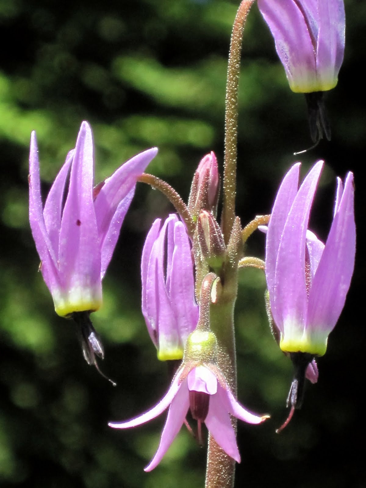 |
| Shooting stars |
At the top of the ski run, the vista is magnificent and I comment to Rick that the view is what would get me to ski again! He reminded me you can always get a one trip lift ticket and we could snowshoe up here and then back down. What a great idea! We stop to scout out the best places to cut down from the top to drop into the Hoffer Butte area and on down to the lake.
The grade steepens considerably when you start up the actual Lakes Lookout trail, but it is only 3/4 mile long. I am trying out one of Rick's hiking poles today - practicing for our Rocky Mt. hikes coming up in another week!
 |
| Such green meadows and snowy peaks! |
Finally we pass through the "notch" (between the two peaks of Lakes Lookout) and up the final ascent to the pole at the top. We find another couple from Washington there, friends of Molly and John Wilson! They leave shortly after and Rick and I spend about an hour on the summit gazing at the peaks, looking for mountain goats, and enjoying the sunshine!

Only about 4 miles total, but a good climb and a beautiful day on the mountain!
Monday, July 25, 2011
Pine Creek/Maxwell Butte
 |
| Jed & Rick atop the saddle between Pine Creek & Cougar Basin |
Click HERE for pictures of this hike
Rick and Jed took a LONG hike from the bottom of Pine Creek up past Baisley Mine and up to the saddle between Pine Creek and Cougar Basin. Jed then went on to the top of Maxwell Butte. Total mileage was between 11 and 12 miles with over 4000 feet of elevation gain. They were too tired boys when they returned to the house late that afternoon! But reports were of spectacular flowers, incredible views both down and up valley, and questionable "road" conditions in places!
Thursday, July 14, 2011
South Shore of Phillips Lake
 |
| Two cute hikers! |
Click HERE for pictures of this hike
Rick and I both ran away for the morning to enjoy what will probably be our last hike for the summer around Phillips Lake. The upper elevations are finally opening up and we’ll be able to explore more in the “real” mountains, rather than at the lake. But…..it is a glorious morning, not too hot, and the wildflowers are still out – due to the lateness of the spring!
 |
| An Inuksuk for Luke |
We mostly just walk down the South Shore trail from the upper parking past the dam about 2 miles plus to the picnic table on the point. The mountains are clear at times, but as the day progresses, the clouds begin to roll in! Even in the past two weeks the lake has begun to drop from its high water mark of over 80,000 acre feet. The high water killed the branches of trees that were submerged – even though it was only for a few weeks in places! At the point I realized all the Inuksuks that we built last May after Erin’s wedding were probably under several feet of water, so I built a new one overlooking the lake and the Elkhorns! Tagged for Luke if I ever figure out how to tag it!
 |
| Wildflowers, reflections, and the Elkhorns! |
Flowers, flowers! Lupine were starting to fade, but still glorious in the shady spots! Yellow balsam root, paintbrush, pinedrops, yarrow, wild iris, wild carrot, wild strawberry, wild geraniums, pussytails, and lots of “unidentified yellow daisy like flowers”! Blue skies, and puffy clouds – what more can you ask for?
What more? No ticks, but no such luck. However, we only uncovered one each, so the season is improving from the 5-6 we pulled off in May!!
Tuesday, July 12, 2011
Bourne to Cracker Creek Saddle on Elkhorn Crest Trail
 |
| Old mine entrance |
Click HERE for pictures of this hike
Rick took off today to explore and hike from Bourne up to Cracker Creek Saddle on the Elkhorn Crest trail, near where the side trail takes off to Summit Lake, where we backpacked a couple of years ago. We had wondered if you could shorten the route to Summit via the saddle, and from Rick’s report the answer is YES! A steep final section just below the saddle, but probably only 5 miles from Bourne, rather than a 9-10 mile hike in from Anthony basin.
Just above Bourne, Rick passes the remains and remnants of the E&E Mine, and in the first part of the hike passes the railings of ore cart lines, old buildings, flumes, etc. all reminders of the mining days.
 |
| Cases's Fitweed! |
The wildflowers are glorious! Columbines, marigolds, mountain bluebells, shooting stars,and a new species for us – Case’s Fitweed. When I first saw the picture I thought it was a type of corydalis, and it turns out that was correct, just not the kind I thought! The fitweed is of the corydalis genus, however. They are not common flowers, but one hillside was covered with the tall white plumes.
The road ascended at a fairly gentle grade for most of the miles, only getting steep at the very top of the valley. Right near the top Rick encountered fields of snow, and one very imposing cornice! He could see Mt. Ruth, Red Mt. and of course, the trail to Summit Lake, the Elkhorn Trail as it continued to Rock Creek and Twin Lakes, and down the valley back to Bourne.
No comments:
Post a Comment