SUNDAY, September 13
Kalispell to Waterton Park, Alberta, Canada
177 miles
Up and
packing this morning, although I took the time for a final shower that I didn’t
get late last night (the hot water had blown out!) Rick fired it back up and it was good and
toasty this morning. We are all folded and
packed up and on our way by 7:45. The
group is meeting at 8 in C-Falls. We
arrive a little late as we stopped to gas up at the corner Exxon. Ron was following us, so….he was late
too!
 |
Tom and Birthday girl Diane with her
new cartoon from Clint |
Montana
Coffee Traders is not Rick’s favorite place to eat, but others love it, so we
went with the flow. We would prefer the
Cimarron any day! The fare is just as
good and it isn’t so crazy! Diane was
presented with her Clint original cartoon, plus the stack of rocks Clint put
together from everyone’s contributions.
It looked pretty cute. I tucked
in a copy of my Advent Devotions for Diane to have, which led to Arletta asking
me about my books and purchasing a copy of the Advent book for herself! Another sale!
If I had brought more of the Gospel of Luke I think I could have sold
more.
And then a
group hug in the parking lot, the Habitat CAV cheer, and lots of individual
hugs as people part company. This has
been a very amicable group! We are on
our way by 9:30a headed east on Route 2 toward the east side of Glacier.
I take the
opportunity to load a new SD card in my new camera and use it for the trip over
Marias Pass. Unfortunately, I seem to
have been hitting the delete button as often as not, and by the Canadian border
had deleted pictures twice. ARGGGGHHH!!!! Perhaps I will read the manual tonight to
figure out what I am doing wrong. Back
to the phone for a few pictures as we dropped down into Waterton….to guarantee
I had something!! (Note: SC Card was corrupted and I threw it away!!!)
 |
Crossing the international border
at Chief Mountain |
We debated
on routes, but after gassing up in East Glacier, we headed up 49, with
reservations because I remembered reading something about vehicle restrictions
on the windy portion of the road north of the Two Medicine turn-off. Sure enough, we drive the 4 miles up to
discover the restrictions are to 21’, so Rick turns around and quietly drives
back to East Glacier and we head to Browning for a rendezvous with US 89 into
St. Mary’s. Again, we had debated about
another Route 464, but I wanted to see the section of road right along the
foothills. But….it began with 6 miles of
very rough construction. Miserable
driving or as Rick said, ‘Use a capital H with Horrible!’ The trailer was pretty shook up! The rest of the way was beautiful with the
fall colors, but winding up and down and all around. Between the CutBank campground cut off and
St. Mary’s we went over a major ridge, which I think is the divide between the
Atlantic watershed and the Hudson Bay/Arctic watershed! We dropped way down to St. Mary’s. God at least rewarded us with some stellar
views of the peaks, as the clouds were dancing around here and there with the
blue and/or cloudy skies. (PS….we never
did see where Road 464 took off, but we did see where it rejoined 2!))
 |
Looking south toward Waterton Park as we
near Waterton Springs campground |
A final USA
gas up in Baab and then past Chief Mountain to the border crossing. We breezed through, answering yes to a half
box of wine, bear spray, and nothing else!
Didn’t even want vehicle registration or proof of insurance. Just the passport check, a couple questions,
and on our way!
To say the
east side of the Rockies is where the prairie meets the peaks is an understatement! I look out the window from the trailer and on
the west I see a ridge of jagged peaks.
To the east, waving, rolling hills of grasslands and short outcroppings
of trees and bushes. Amazing.
 |
View of campground from top of hill on
interpretive walk. Looking west. |
We get a
site for three nights at Waterton Springs Campground, about 10 miles north of
the Waterton Park village. We will have
to pay the entry fee to the park each day we go down. Unfortunately the weather isn’t going to cooperate
with beautiful sunshine each day of our visit, but at least tomorrow looks
passable – we might see the sun a little!
We’ll make the best of it. Got
full hookups here and a wifi hotspot.
Can get on inside the trailer, but it will be faster if I go into the
store and sit at the tables there to actually post everything. (Later...not an option usually and the wifi got worse as the week went on - never could post this blog until we got to Fernie!)
The Canada
Nature Conservancy has bought up a huge section of land north of Waterton Park
to preserve the prairie ranch lands here (developers were salivating in the mid
90’s for subdivisions). A wonderful
little children’s museum at the campground main building and a half mile
walking interpretive trail just east of the campground. Well done and a good way to stretch the legs
after a day of driving.
An early
dinner, text conversation with Luke (to solve some phone issues!), and a chance
to catch up with photos before a big day of hiking action tomorrow. The sun is poking through the window of the
trailer as I type, warming my heart and spirit.
Yet..... it
starts to sprinkle just as we are crawling into bed….Hmmm.
 |
| Our Crypt Lake Trail....#1 Hike in Canada Rockies! |
Monday, September 14
Crypt Lake Trail
10.6 miles; Circa 2400’ elevation
Wow! I am cozied up in the trailer with the heater
on full blast as we are warming things up from the 46 degrees it was inside
when we returned from today’s hike. And
we were wet and a little chilly, but….in spite of a dismal looking morning,
MOST of the hike went beautifully!
We headed
down the road the approximate 10 miles, stopping at the entrance gate. We purchase a two day pass which actually
allows us entry into the park until 4pm on Wednesday! That seals it….we will stay another
night! Only $32 Canadian, so not as bad
as we feared. Past the regal Prince of
Wales hotel sitting high on the bluff and we find the marina for the Shoreline
Boat tours. The clouds are socking in
the peaks, it is cold and a little breezy.
Not the kind of weather I anticipated for today’s hike! But…we are committed. The forecast for rain isn’t until later in
the day, so maybe….
 |
Lower trail is LUSH with
thimbleberries in gold |
We found an
ATM and got $100 in Canadian money, thankful we had made the call yesterday to
advise the bank that we were out of the country!
 |
| Shifting clouds in the valley |
We thought
for awhile we might be the only ones going on the Crypt Lake Hike, but by the
time the boat was ready to sail, there were 21 of us on board! A variety of young people and us old retired
folk. Many just hoping to get as far as
they could, others booking at a very fast pace.
But since the hike is dependent on the boat shuttle to the trailhead,
you HAVE to finish within the time frame of boat drop off and boat pickup. We had exactly 7 hours to complete the
hike. I gave myself the time of 2:15pm
to be heading back down. We got to the
lake at 1:40 and had a half hour to eat lunch and relax!
 |
| Upper portion of Twin Falls |
Basically
the weather improved as the day progressed.
I quickly shed my sweatshirt as we climbed steeply at the beginning,
passing through lush forest of thimbleberry and lodgepole. The colors this time of year are in much
bigger splotches of yellow and orange and red, mixed in with the greens and
grays of the rock. We saw the remnants
of fireweed, with their white tuffs of hair and deep maroon red leaves. Three paintbrush still red, a few asters and
harebells, and plenty of cinquefoil still in bloom. Vibrant colors of huckleberry bushes in red,
sumac in red-orange. The vine maples
seemed to be yellow here, rather than the deep orange I am used to. All along the way, wisps of clouds drifted
here and there amongst the mountain valleys and peaks.
 |
I plod my way up the switchbacks
near the top |
 |
| Crypt Lake lies in the basin above the upper trees. |
The trail
leveled out somewhat as we entered a
valley and turned a corner around a towering peak. We traversed the side of this valley,
climbing steadily but at a gentle grade.
We past at least 4 waterfalls on the hike plus two creeks with water and
an uncounted number of dry creek beds.
Some of the creek had the stair stepping grottos reminiscent of the
Weeping Wall at Glacier – tier upon tier of wide stair steps of water.
 |
| Fall colors |
 |
Victory at the top of the ladder
and about to enter the tunnel! |
Rick and I
basically were the second to last in the line-up, although I think I heard one
couple turned around fairly early along the way. We met a young couple from Breckenridge, CO,
who were full of energy – they were way ahead and then stopped to follow some
side trails among the waterfalls. I
think they could have hiked all day and maybe climbed Mt. Vimy besides!
 |
Rick approaches the tunnel - panorama of the valley we just came up. Boat landing way down
below those clouds. |
This trail
is ranked by TripAdvisor as the premier hike in the Canadian Rockies. I can see why. In the summer months the hillsides would be
cloaked in fireweed, beargrass, and abundant wildflowers. In the fall, the colors change to golds and
reds. You have waterfalls, towering
mountain peaks and rock
 |
I wind my way along
the cable - drop off! |
walls, forest trails and scree slopes. AND you have the challenge of a steel ladder
upon which you gain access to a natural tunnel through the rock wall that leads
to Crypt Lake on the other side. Coming
out of the tunnel you travel along a very narrow ledge, made safer with a steel
cable for a handhold. Either way, I
would not want to be in the tunnel area or ledges during a rain storm. The rocks would be very slippery, and the
dropoff must be close to a thousand feet.
 |
| My miniature inuk |
At the lake
we ate some more (Rick had been eating his way up the trail!) and I made a
miniature inuk from the perfect flat rocks on the shore. I could see a stone cairn out on the point,
but it wasn’t until we were
 |
Life size inuk we found
on the shoreline! |
leaving that I walked over to see what it was
exactly. Glad I did – it was a life size
Inuk Suk (with a bunch of odd rocks on top of the head – I suspect people just
thought it was a rock pile and added more.
Rick took them off!) It was
impressive!
 |
| Crypt Lake photosphere. Mts behind the clouds are in the US! |
The hike
back down went quickly, especially since we talked to a couple from Ontario for
half of the way. They veered off at the 1.4 mile mark to check out Hell-Roaring
Falls. That was going to involve a
little more uphill and I didn’t have it in me!
Glad we didn’t because the rain started in earnest shortly after that
and the report was the rocks got very slippery.
I was grateful that Rick had put our Niagra Falls ponchos into the pack!
 |
Coming back down
the ledge |
 |
| Here comes our boat! |
We arrived at the landing 40 minutes ahead of the boat, finding 4 others
already there. (The rest MUST have gone
to Hell Roaring Falls instead!) We
huddled under a copse of trees that provided enough shelter to keep off most of
the rain. More good conversation with
another couple! Gradually the rest of
the hikers arrived.
I write
tonight concerned about a couple from Louisiana who didn’t make the boat
pickup. They were slowing down at the
end and I hope didn’t slip on the wet trail.
We both left the lake at the same time, but they stopped right away to
take a few pictures and we didn’t see them again. The boat captain was going to have the other
boat, due in another 15-20 minutes, stop at the landing to see if they were
there. Of course, they had no way of
knowing that another boat would be coming….Hopefully if the second boat didn’t
find them, the rangers would go looking.
We drive
back to the trailer, turn up the heat, have warm soup for dinner, hot showers,
and anticipate a sound night’s sleep!
Tired and already stiffening up! G’night!!
TUESDAY, September 15
Waterton Shoreline Cruise and Kootenai Lakes Hike
5.5 miles RT, minimal elevation
We had
decided last night, after consulting all the weather channels we could get, to
wait until this morning to make a final decision. We had originally planned to take the
Shoreline cruise today plus a hike at the Goat Haunt end. Then the weather reports made it sound like
Wednesday would be a better day!
 |
Fresh snow on hills above
campground! |
Well…..after
listening to a gentle rain off and on all night, we awoke to first snow on the
high peaks! Beautiful. It was also windy and cool! But the sun was supposed to break through
later in the day, more so than on Wednesday, so we bite the bullet, make the
decision, and head down to the park at 8:45am.
We purchase our RT tickets for the 10am boat and then return to the
warmth of the truck heater to wait until loading time! Also bought some discounted t-shirts at the
boat dock for the Crypt Lake Trail!
 |
| Leaving Waterton Park marina....Prince of Wales hotel on bluff at left. |
 |
| The landing for Crypt Lake trailhead from Monday |
We opted
for the downstairs covered seats on the way up – too cold and a few rain drops
on the upper level!! I noticed a
uniformed US Customs agent looking very bored opposite us. I wondered how many times a summer he has to
take the boat and listen to the ‘spiel’ of the narration! (Later
as we went through customs he seemed very personable so I asked him if he gets
weary of the ride. He said he had been
working this post for 8 years and often wore ear plugs and listened to music,
but that today’s guide had ‘mixed it up’ some!
There are barracks at the Goat Haunt end of the lake, so I will assume
they don’t have to make the trip every day! There were only a few of us stupid
enough to hike in the rain, so when I asked if we had to check back in on the
return, he said, “No, I’ll remember you!” and he did!)
About
midway south on Waterton Lake you pass the international
 |
The swath at the boundary extends
for thousands of miles! |
boundary between
Canada and the US. Again, a swatch of
cleared land about 25’ wide marks the line of the 49th
parallel. They had just recleared the
west side and you could tell! The guide
said they do it all along the line every 3-4 years. There are stone markers at the water’s edge
and he said there is also one at the summit of every ridge the line
crosses. Wow. At least no wall as some would propose!
 |
| Boat dock at Goat Haunt |
We arrived
at the Goat Haunt end of the lake, now back in US territory around
10:45am. It had started raining, so we
donned our yellow ponchos once again, showed our passports at the trailhead,
and headed up to Kootenai Lakes, advertised as a good chance to spot some
moose. If you were just walking around
the landing and returning on the boat, no need for passports. Just hikers leaving the area had to sign
in.
 |
| We are back in the US! |
 |
| A forested hike in rain gear! |
 |
Sorry!
Pine Marten got reflective eyes! |
The 2.6
miles up to Kootenai Lakes was fairly ordinary compared to the sights and
experiences of yesterday. Relatively
level, the trail heads up the Waterton Valley through thick old growth forest. The understory was again a carpet of
thimbleberry, beargrass, cow parsnip, etc. – all in shades of golden yellow and
greens. There was one hiker ahead of us
– we saw his tracks in the fresh mud and a group of 4 women behind us. We passed three trail crew people going the
other way as they returned to the ranger station. The last one apologized for the tree blocking
the trail, yet when we returned later in the day we saw fresh sawdust at that
spot and the tree gone! They had come back
to take care of it!
 |
| Cool fungi |
 |
| Along the creek crossing |
We did see
a new animal sighting today. After a little
Google research, we are pretty sure it was a pine marten up in the tree. Cute little fellow!
Midway to
the lakes the rain abated and we were able to shed our ponchos.
We were
able to see some of the peaks around the lakes, most notably Porcupine Ridge,
which also is The Citadel on one end – a
 |
I love the colors of
Rocky Mt rocks in the stream! |
ridge of spikes and pillars. All the peaks had fresh snow. Behind us was the tallest peak in Glacier
Park at over 10,000 feet, but the top was constantly in the clouds. The lakes are prime moose habitat – shallow,
rimmed with willows. But….no moose. We walked all along one side of the larger
lake. We saw lots of ducks on the water,
but no moose. We had seen a large moose
track right in the mud heading up the trail, and we saw more on the return
trip. Those moose just like to tease
us!
 |
| Kootenai Lakes - Porcupine Ridge and the Citadel peaks |
 |
| Another view of lake |
We decided
we had hiked enough in two days and to take the earlier boat back down rather
than hike to Rainbow Falls and then have to wait 2 hours for the 5:25
boat. So we got back to the landing
around 2:15, just in time to catch the 2:25er!
And by then the sun was honestly trying to break through the clouds and
we caught a few moments of sun on the peaks on the return trip. We also sat up on top. For the most part the wind was behind us, but
by the time we arrived at Waterton Village we were getting a little
chilled!
 |
| Leaving Goat Haunt |
 |
| Big horn sheep graze on lawns |
Rick asked
about a grocery store from our pilot of yesterday as we debarked and then asked
if the Louisiana couple got picked up.
Affirmative! That made me feel
better! We drove around the small village
and found the General Store which is as close to a grocery store as they
have. Picked up some bananas and
bagels! Saw some Rocky Mt. Sheep grazing
on someone’s lawn as we left town.
 |
| Goat Haunt ridge |
Back to
camp and a relaxing evening! Tomorrow we
will check out a drive to Cameron Lake, possible bear sightings, and a stroll
around the village.
Wednesday, September 16
Exploring Waterton Park Townsite and Akamina Parkway
Brrrr!! It was 44 in the trailer when I got up at
6:30am. I turned up the heater but it
didn’t hit 50 degrees until 8:45!! It
was right about freezing outside. Should
be cold again tomorrow night as well.
Hold our little heater holds out …. I don’t think it shut off once
during the night!
A bit of a
lazy morning. Rick finally went over and
paid for another night and we decided to go out to breakfast first! We drove into the park and found Zum’s which
he had read was pretty decent.
(Amazingly the best rated restaurant in town was the Subway!) The place was covered with license plates
from EVERYWHERE in North America it seemed (plus Rio de Janiro!) Lots of fun stuff on the walls and a nice
gift shop which we perused while waiting for our meal.
 |
| Fall foliage and peaks along Akamina Pkwy |
Then it is
time for a drive up the only road in the park open – the Akamina Parkway which
leads to Cameron Lake. Chances to see a
bear are relatively good along this road, but no luck for us today. Beautiful fall colors, narrow canyons, a few
cascades along the creek, and towering mountain ridges on all sides! Cameron Lake, like Crypt Lake, is bisected by
the international boundary at the south end.
A massive headwall on the west side forms the border between Alberta and
British Columbia, the Continental Divide, and the edge of Waterton National
Park as separate from Akamina Provincial Park.
Custer Peak at the south end of the lake is in the US. The avalanche chutes coming off the peaks are
prime grizzly habitat, so the trails do not go more than halfway around the
lake. It was COLD at the lake – a chilly
wind blowing down off the mountains.
 |
| Cameron Lake - the far end is once again in the US |
 |
| At the falls! |
 |
The trees looked like they were in sand, only rocks
from avalanche! |
Back into
town and we stop at Cameron Falls, right at the edge of town. A beautiful waterfall of multiple levels and
lines as the creek passes through VERY OLD layers of rock. Then we drive down to where the creek flows
into the lake and the site of an avalanche some twenty years ago that deposited
gravel around the base of the trees.
Found a really good display about the changes forces of nature: fire,
bugs, avalanches, floods, etc. All ultimately recharge the environment in
positive ways. Left alone the earth can
heal itself.
 |
| I loved this little bear bench! |
We check
out a few of the gift shops in the ‘downtown’ area, making ONE purchase, and
then drive up to the famous Prince of Wales hotel perched high on the terminal
moraine of the Upper Waterton Lake. We
had considered going to lunch here and the prices weren’t as bad as I
feared. High Tea was $20 plus for
 |
Looking down on the gap
between Upper and Middle
Waterton Lakes from PofW |
each
person, however! The highlight for me
was a harpist who was playing in the main lobby, tea
 |
| Prince of Wales Hotel |
room. Such beautiful sounds came from her hands and
they were songs I recognized. So
pretty. Of course, the prime seats were
right at the windows overlooking the view up the lake. After checking out the gift shop, we walked
out to the bluff. A blast of cold icy
wind greeted us, as the wind is again coming in from the south. Rick, not having on his windjacket,
immediately went to the truck. I
wandered down to take a few pictures, both of the lake and of the hotel. The sun was finally shining and we had
patches of blue sky!
 |
| I found a rock cairn....almost an inuk....overlooking the lake from PofW Hotel |
Enroute to
campground we turned into the Bison Paddock and took the loop through the
prairie in search of buffalo. Alas,
NONE! But we did see the site of a
wallow, so they must hang out there sometime.
 |
| Beaver ponds near upper campground |
Back to the
trailer around 3:45 for an early dinner!
Finally finished up the veggies I had cut up before we left Baker! I confess I had to trim some of the zucchini
and throw out a few chunks of squash.
They were slimey!
 |
| Rick investigates the beaver dam |
Before the
sun set, we wandered up to check out the beaver ponds on the upper level of the
campground. This morning Rick discovered
water pouring out over the lower road.
When he asked about it, the owner said he has to dismantle a part of the
beaver dam EVERY DAY because the beavers keep rebuilding their dam. If he lets them be, the water will flood the
tent sites at the upper camp area! They
are busy little guys. We didn’t see any,
but the lodge was pretty obvious.
Heading for
Fernie tomorrow….two hours away!
Thursday, September 17
Waterton Park, Alberta, to Fernie, BC
93 miles
 |
Look at those clear blue skies
as we pull out of RV park! |
It wasn’t
quite so cold last night! Or maybe we
were just better prepared! I arise at
6:30 and enjoy my coffee while writing up the last devotion from Garry Genser’s
book. I get the picture started while
Rick is relaxing prior to our getting ready to leave. It is a gorgeous morning! I watched the eastern sky slowly light up and
then the mountains to the west turn a deep orange with the sunrise
alpenglow. Not a cloud in the sky at
that point, although a few are drifting in by the time we leave at 9:30a.
 |
| Mountains southwest as we head north to Pincher Creek, AB |
Up Hwy 6
north to Pincher Creek, through rolling fields of cut wheat, straw bales and
hay bales, cattle, and distant vistas to the southwest of jagged peaks, dotted
with tiny lines of snow. Much of this
was oil country at one time, but not the energy we find near Pincher Creek is
wind. Turbines everywhere! And all turning in the constantly blowing
wind. Amazing. We pass one area where the turbines are black
with white spinners and much smaller.
Wish Ryan was here to ask – our former neighbor and Wind Energy expert.
 |
| Dropping down into Pincher Creek |
After
gassing up in Pincher Creek (1.06/liter) we head west toward Crowsnest
Pass. I read that this is the lowest
elevation pass over the Rocky Mountains between Jasper to the north and New
Mexico to the south. It may be low, but
the mountains are mighty! Coal mining
dominated the region at the turn of
 |
| Massive landslide down Turtle Mt killed 90 in 1906. |
the century and Crowsnest is the site of
Alberta’s 3 worst disasters. In 1906 a
massive landslide wiped out the town of Frank and killed 70. Two more mine explosions took another 200
plus people by 1914. The area of the
landslide was staggering. Rocks are
still piled 10’ high along the road. Not
rocks, boulders! The slide basically
flattened the town in 90 seconds during the night. No warning.
 |
A favorite peak as we head through Crowsnest
Pass - it looked like a smoking volcano! |
A long
downhill run from the pass into Sparwood and then we drop south to Fernie. The mountains to the east of Fernie are not
massive, just good 5-6,000’ ridges. The
peaks to the west are jagged peaks and ridges of 7,000 to 9,000 feet. The fall colors are beginning to paint the
hillsides with patches of gold and red.
 |
| Nearing Fernie |
Just north
of Fernie we find Snowy Peaks RV park and decide it looks just
 |
| Our spot at Snowy Peaks RV |
fine. Our other option was a 10 site park next to a
motel right in downtown Fernie. While we
are very close to the highway here, it is much less busy and the massive rise
of Mt. Hosner is right above us!
 |
| Oil derrick |
We head
into town after grabbing a bite to eat and explore. First the Visitor Center for information on
hiking trails. We check out the only
remaining wood oil derrick in BC outside the VC. We stroll the downtown section, poking into
shops and art galleries. Find a bakery
that advertises a $5 item Happy Hour from 4-6pm. We’ll come back for dinner!
 |
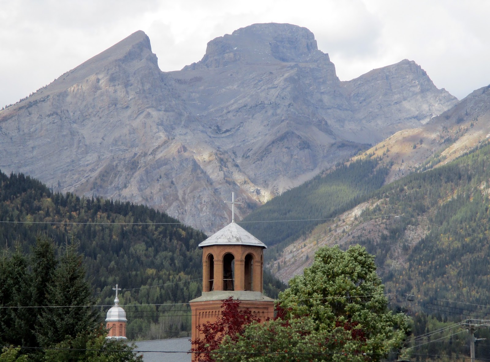
| Three Sisters and top of Catholic Church |
 |
| Aspens along road to Island Lake Lodge |
Drive up
the road aways toward Island Lake Lodge and then decide this is where we want
to hike tomorrow, so no need to drive clear up today. Check out the Provincial Park campground (no
hookups but still $27 a night) and then back down to town. Some neat buildings like the courthouse with
its slate roof and gorgeous flowers.
 |
| Courthouse |
Dinner at
the Loaf Bakery and we select two entrees: Bread and Dip and the Beer Battered
Fish with Tartar Sauce. The bread was
good, although fairly ‘white’, but the dips were unique. Olive Tapenade, Beet with Cream Cheese, and
Arugula Pesto. Aren’t we
 |
| Our bread and dip - the beet dip was so colorful! |
fancy?? The best taste was mixing all three on the
same piece of bread! I liked the beet
one the best by itself. It was a little
sweeter. Rick tried out one of the local
beers and I had a glass of wine.
Back out to
the RV park for a quiet evening and joy!
The internet is fast enough that I will FINALLY be able to post my blog
from the past few days!
Friday, September 18
Baldy Loop, Island Lake Lodge
6.3 miles, 2000' climb (10.7 km, 630m)
 |
I catch a quick blast of sun this
morning on Hosmer Mt. |
What happened to the sunshine??? A week ago, Friday was supposed to be a prime beautiful sunshiney day! (And Thursday horrible!) Well, yesterday was beautiful and today...well, we did see the sun a few times! The forecast was for 20% rain at 4pm. We saw rain on the trail at 1:30pm! Oh well, the hike was still good, but the views and pictures would have been stellar with blue skies!
 |
We took the Baldy Loop which is the orange
trail at the upper left. |
We head back down to Fernie around 9:30, up the winding and narrow mountain road to Island Lake Lodge, arriving shortly after 10. The lodge consists of 4 separate buildings, all in fairly pristine condition. I have to think they have been rebuilt or reconditioned since 1920's when the area was first developed for tourism, This is a private enterprise and most of the land in the valley is privately owned, but open to hikers and bikers, etc. The trails are well marked with big signs. You really can't get lost!
 |
| Island Lake |
Island Lake is very shallow, dotted with green algae blossoms. They are aerating the lake to keep the oxygen levels higher to prevent further growth. The island is a dense copse of trees in the middle of the lake. It sits in a huge glacial valley, marked by several smaller ridges of glaciation and a series of peaks called the Three Bears: Mama, Baby, and Papa. A huge white mass of rock is called Big White Mountain! Further
 |
| The main lodge building |
down the ridge is Lizard Mountain and the alpine ski resort. Island Lake Lodge is know for its wintertime activities: snowshoeing, cross country, and primarily snowcat skiing. No lifts here....they take you to the top of the ridges by snowcat.
 |
Looking back down at the island in the
lake from above on the trail. |
Our trail basically is three miles of constant UPHILL - in a series of switchbacks that winds the way up a dense hillside of spruce and fir, a scattering of larch trees, and thick undergrowth of thimbleberry, sumac,
 |
| sumac colors |
huckleberry, vine maple and ferns. The foliage is beautiful in color - golds, oranges, and reds. We occasionally had views back down toward the lake - it always seemed still so close considering how much climbing I felt I had done! With two hours of moving right along (I didn't take THAT many pictures!) we finally reached the top of the Baldy Ridge - to find ourselves on the path of the snowcat skid road! We could see down into the valley between Hosmer and Fernie Mountain - the Three
Sister Mountains I think. It was quite windy up on top and cold! We had already put our wind jackets on and the clouds were low and swirling around the peaks. Decided we wouldn't stay up on top for very long!
 |
| Colors on the hillside |
 |
| Success!!! The top! |
We could have taken the same route back down (BORING!), but opted for the loop trail instead, which took up to Lizard Pass and then down another snowcat skid trail before veering back to the lodge and lake. Lizard Pass opened up the entire upper bowl of the Cedar Valley before us. I could see why they said this was prime grizzly and bear habitat - the hills were open and wide and covered with low vegetation. Reminded me of the avalanche chutes at Cameron Lake. (In fact, there had been warnings on the hiker's sign board at the beginning of the hike: a mama moose and baby had been bluff charging hikers on the Spineback Trail and a black bear mom and cubs had been hanging around the Lakeshore Trail! We had our bear spray with us and made noise and didn't see anything other than a few birds and a squirrel!
 |
| View from ridge top of Baldy |
 |
| The big 'bump' in the middle is Hosmer I think |
I enjoyed the openness of the broad valley with patches of snow high above, rock chutes and scree slopes, and the bright colors of green, gold, and red on the slopes. The tops of the peaks we couldn't always see - the fuzzy white of shifting clouds blurred them much of the time.
 |
| Upper Cedar Valley and wide expanses |
 |
| Trail heading down |
Back down to the lodge by 2:15 - we took exactly 4 hours! I felt good about that because the hike was described as Moderate to Advanced, 4-6 hours to complete. However, my feet are sore again from all the downhill and I am tired and hungry!
 |
| Rick and his cedar trees |
We stop at the Old Growth Cedar Grove Trail enroute down from the lodge and wander a quarter mile through the thick woods of this old forest. Some of the cedar trees are 800 years old here. Majestic and huge, with the twisted roots that Rick thinks look like arteries going down into the ground! I especially like the picture of Rick in the middle of a stand just starring UP!
 |
| Cedar roots |
Back into Fernie a half hour too early for the 4-6 Happy Hour! But we blow a little time in a Hemp shop and the chocolate factory! We order the breads and dip again (supposed to be different dips but they sure looked familiar!) and the mini pizza. I shall have to learn to make these fancy little dips since I love to bake bread! We spend most of the rest of our Canadian money getting a treat at the chocolate shop after dinner!
The shower feels VERY good tonight, I catch up on pictures, contact our RV park in Kalispell about tomorrow's arrival, and drop dead into bed!
SATURDAY, September 19
Fernie, BC to Kalispell, MT
93 miles
 |
| Sunshine on north end of Hosmer |
 |
| Can almost see the top of Hosmer! |
Back to Kalispell today. I had a confirmation email from RMRV that we could come! And it's a travel day, so of course the sun is shining on the mountain peaks and the skies are blue (well, most of the sky is blue - we still have clouds!)
 |
| View along Elk Valley south |
 |
Road turns through canyon west
to Elko, BC,. (Not Nevada!) |
We are packed up and on our way by 9:45. Beautiful peaks to the west all the way down to Elko....and one loooong downhill run! From Elko to the border we are in a broad forested valley. Lake Koocanusa is off to the west. Forested hills around us, but no rocky peaks.
 |
Border swath is not so distinct or visually
attractive here! |
A long line awaits at the border crossing and eventually they open up an other lane. We hand over our passports, answer a couple questions (Yes, we have fruit purchased in Canada...one banana!) and are on our way. Have a great trip!
A stop in the little western community of Eureka, MT to get gas. We managed to only fill up once on Canadian prices (about $4.50 gallon!) Gas must have dropped again during the past week, as we paid just $2.59 in Eureka and it was $2.51 in Whitefish!
A fifty mile drive down Tobacco Valley to Whitefish. The valley was named by explorer David Thompson who found the local Indians to be using a form of wild tobacco. (I had to look that up - we were wondering because the climate certainly isn't similar to southern tobacco plantations!)
We locate a window blind shop (The Blindman!) between Whitefish and Columbia Falls on the way home. Both of our blinds are now broken and need to be re-strung or replaced. Will make some calls and do a little research. Rick watched an online video about restringing them ourselves which looked rather complicated! Blindman is closed on Saturdays, however, so we can't get an estimate today!
We pull into Site 73 at the RV park, 4 north of where we were earlier and 2 north of last spring! Apples are still abundant! Doesn't anyone pick these?? A quick lunch and then before unpacking the trailer, we wash both truck and trailer!
Afternoon spent relaxing, phone calls to Mom Mac and Luke, football game, etc. New Kalispell Blog starts tomorrow!!


No comments:
Post a Comment