PART 6 – Exploring Montana and Yellowstone
NP
Thursday, October 2
Columbia Falls to White Sulphur Springs, MT
278 miles
We finally left our comfortable
little home at LaSalle RV Park today!
Turned in the cable TV box, said goodbye to Howard and Joanie, and were
on our way by 9am. Gas (at 3.43 we
thanked the station for dropping over 15 cents in price while we were here!),
coffee, and a stop at LesSchwab to have the trailer tires checked.
 |
Typical ranch along east side of
Flathead Valley |
What a day of variety!! Trees, plains, sagebrush, sunshine, hail,
snow, winds! ( I am typing Friday
morning from White Sulphur Springs.
Temps in the trailer are 45 degrees – with the heater running full blast
– and my fingers are very cold!! Excuser
all the mistakes I didn’t catch!)
 |
| Swan Mountain peaks |
We left Columbia Falls via the bypass
road 206 down to BigFork for the Swan River valley on Highway 83 south out of
Big Fork. New highway! Between CF and Big Fork we passed some
gorgeous ranch spreads. Then a turn at
BigFork and into the valley of the Swan mountains. The clouds were scattered
enough that we got some decent views, although for awhile I thought we wouldn’t
see much because all the trees were in our way – a thick corridor of larch and
fir. This stretch of road is well known
for the wildlife, but all we saw were a couple of deer crossing the road. The valley widened toward the end and we got
some great views of both the Mission Mts. to our west, and the peaks of the
Swan Range to our east….lots of snow on the tops!!!
 |
| The clouds were glorious! |
As we left Seeley Lake – we stopped
there for gas and coffee and restroom – the terrain changed suddenly. Grassland and rolling hills. All golden and dried. This was typical for the next 40 miles or so
as we turned easterly toward Helena. Right
before Helena we crossed the Continental Divide (NO SIGN!!) in the middle of a
snowstorm! The pass is only 6300’ and we
figured we’ve come out of the snow soon on the other side. No….there was still snow in Helena 2300’
lower!! The east side of the mountains
had been much colder, windier, and the snow dusting they got wasn’t
leaving. It wasn’t much and the road was
ok, but it sure made all the trees look pretty!!
 |
| Snow over the Continental Divide pass west of Helena |
We were in thick clouds leaving
Helena and then just as suddenly in bright sunshgine as we near Canyon Ferry
Lake to the east. A huge reservoir on
the Misdsouri River. We had to go around
the southern end to get to White Sulphur Springs. We were following US Route 12 since 30 miles
west of Helena. We wound along a small
creek and canyon and up over another pass and then had another broad view of the
White Sulphur Springs area. Golden
grassland! We had seen a couple herds of
antelope, lots of Mother Goose style haystacks,
We are spending two nights with some
CAV friends we met down in Las Cruces last spring: Pam and Steve
Sundstrom. They are retired nurses and
great people. Rick got the trailer all
set up in the yard with Steve’s help.
There was a dusting of snow, and the wind was COLD!! We got our heater plugged in quickly, but it
will drop below freezing for sure tonight.
Evening spent visiting (Rick and
Steve went out to their 5th wheel to watch a football game and
visit) with Pam and her mother Barbara, a good enchilada dinner,and scotcheroos!!! I said, they are good people!
I’ll let my pictures and maps tell the rest
of the story of what we saw and where we went today….
 |
| Dropping down off the pass between Helena and White Sulphur Springs |
 |
| Second half of today... |
 |
| First half of today's travels.... |
 |
| Another view of wide open spaces! |
FRIDAY, October 3
Cruising Around White Sulphur Springs
BRRRR!!! A cool night and we had the heater on ALL
night long I think. The temp outside was
20 degrees this morning – 45 inside the trailer. But overall we slept warm enough. The sky was a brilliant blue and the sun was
shining when I went inside around 8am. I
had arisen around 6:30a to finish up my prayer drawing and get yesterday’s blog
written. The good news is that it is the
coldest predicted for the next week or so…even in Red Lodge and Mammoth!
 |
| Enjoying time with Steve and Pam |
Coffee and a wonderful breakfast
together. Cherrie will be glad to know
that Rick ran back out to the trailer to bring in her raspberry jam to
share. It was a big hit!
We lost the cover to our trailer
battery during yesterday’s drive, so Steve and Rick ran down to the local auto
store and found a replacement. Had to
make a couple adaptations to accommodate a smaller battery in a big case, but
they made it work! And the price was
only $14!!
 |
| Newlan Reservoir |
We took off around 11a for a drive
around the city. White Sulphur Springs
sits at about 5000’ in elevation and has under a thousand people. This is ranching land – the town is
surrounded by large spreads of cattle, wheat farms, etc. We drove east on Hwy 12 briefly then north
toward Great Falls (which is 100 miles away)
We quickly turned off on the road to Newlan Reservoir, a small lake that
holds irrigation water for the valley.
Lots of nice camping spots in the area.
We followed the creek outlet along another road and made a loop back
into town from the west.
 |
| The Castle |
Took some pictures of ‘The Castle’ –
a home built by an easterner for his wife when she moved west. Quite the fancy place, but since it has no
heat, it is not open for public viewing after September. Saw the little tiny house Pam’s folks moved
into when they first moved west from Minnesota – only 2 bedrooms for a family
of 6 children! Fortunately they only had
to live there for a few months!
 |
| Big Belt Mountains from WSS |
We went to the Truck Stop Café – the
kind with a sign that simply says EATS out front. Today was the Friday Comfort Food buffet – we
were just going to get a bowl of soup, etc. and Pam was going to cook some
dinner. No chance. Everyone opted for the buffet and we would
skip a formal dinner! Meat loaf, meat
balls, lasagna, spaghetti, mac and cheese, mashed taters, veggies, gravy, and
rolls. I also had a little salad and a
bowl of broccoli cheese soup! Oh, and a
chocolate cupcake! Not exactly WW fare,
but it was comfort food!
 |
| Castle Mts. |
We took a bit more of a tour south
of town after lunch, seeing the Castle Mts with their distinctive rocks, senior
center housing, schools, etc. The
complete tour of WSS!!
Afternoon of good conversation,
showers, wine, and snacks for supper.
Rick took a walk and Steve played a round of golf. Back out to the trailer by 9:30.
More good news for the day – the
Beartooth Highway has reopened!!
 |
| Sunset in White Sulphur Springs |
SATURDAY, October 4
White Sulphur
Springs to Gardiner, MT
127 miles
What a beautiful drive today!! Scattered clouds, but clear enough to see
LOTS of mountain peaks!
 |
| Crazy Mts. |
We had a yummy oatmeal, fruit, and
toast breakfast with the Sundstroms, packed up the trailer, and were on our way
shortly after 10am. Quick stop for gas
and a coffee and we are headed south on Rte 89 toward Livingston, Montana. We have the Crazy Mountains to the East
(highest peak is around 9500’, the Big Belt Mts. to our west, and the Bridger
Mts. to the southwest. And then, as we
near Livingston, we find the Absaroka-Beartooth Mts. to the south. The dusting of snow from earlier in the week
just makes the views even more spectacular.
Picture taking wasn’t always ideal, but hopefully they will be enough to
remind us of just how pretty it was!
 |
| Bridger Mountains |
This is Montana ranch country. Huge spreads, cattle, hay, etc. Tiny little villages nestled along the rivers
at key crossings. None of the ‘I’m
feeling claustrophic because the trees are hemming in the road’ emotions I had
last fall on the east coast. Wide open
spaces, rolling golden hills of grassland.
Wow.
 |
| Absaroka Mountains, Yellowstone River in foreground. |
We stopped in Livingston for a few
groceries and to top off the gas tank. A
quick call to Gardiner to confirm we would have no problem securing a camp spot
at the RV park and a message left at the Inn of the Beartooth.
The drive from Livingston south to
the north entrance of Yellowstone is equally spectacular. The Absarokas are right to the east, one
jagged snowy peak after another. The
Yellowstone River winds through the broad valley marked by beautiful ranches
and pricey homes. As we neared Gardiner,
the canyon narrows and the peaks of the Gallatin Mts. began to appear in the
west.
 |
| Yellowstone River views |
 |
| Yellowstone River as we near Gardiner |
Our RV park is right on the
Yellowstone River just north of Gardiner.
We got set up, ate a little lunch, and then unhitched to drive into Yellowstone
and check out the situation at Mammoth Campground.
 |
| River is right behind the trailer. |
We found the main street through the
center of Gardiner totally torn up and closed!
(Reminded us of the Resort Street mess!)
We were detoured onto a bumpy, potholed side street with a steep uphill
climb, then back and through the Roosevelt Arch and into the park. (On the way back we followed the truck detour
which didn’t pan out, but we did find a route through the school parking lot
that will be smoother!)
 |
| Part of the Upper Terrace formations |
You climb steeply along the Gardiner
River up to the Mammoth complex – visitor center, hotels, gift shops, etc. Many of the buildings are part of the
original Fort Yellowstone that helped protect the park from poachers and others
with profit on their minds in the early days.
Mammoth Campground is primitive with
no hookups, although there are water spigots scattered throughout and enough restrooms
to be convenient. I checked with a
ranger who assured me that sites would be available in the morning. We found at least a dozen still open at 3pm
today. We should be in luck in the
morning.
 |
| Mammoth Hot Springs mound |
On up toward the hotsprings. We took some quick looks, but then drove on
up to the Drive Loop at the Upper Terrace.
A narrow little one-way lane but very pretty and we found some good
views. The sunlight was gorgeous in the
park and it was a crowded place on a beautiful Saturday! In the
course of our drive we saw a buffalo, antelope, elk, and mule deer! Not bad!
Back from our ‘scouting trip’ around
4 to clean house, shower, pack for our Beartooth trip, and then relax for the
evening!
 |
| Elk and antelope...two in one pix! |

SUNDAY, October 5
Beartooth Highway: Mammoth Hot Springs to Red
Lodge, MT
125 miles
 |
This map is the actual Beartooth portion from Cooke City
to Red Lodge, MT. |
What a glorious day!! We left Gardiner around 9:15, picked up ice
and coffee (we are turning off the fridge and decided we would just put a block
of ice in it – old fashion time!) Then through the arch and into the park. We had plenty of spots to chose from at the
campground, opting for #45 which gave us a view back down the Gardiner River
valley toward the town. Under a big pine
tree. Got the trailer set up, paid for
three nights, and by 10:15 we were on our way toward the Beartooth!
Technically, the Beartooth Highway
is specifically US Route 212 from Cooke City, MT to RedLodge, MT – a distance
of about 65 miles. First we had to
travel about 65 more miles from Mammoth to the NE Entrance to the park. This area of the park is wide open valleys,
sagebrush and grassland hills, and pockets of trees amongst rocky buttes. Eventually we crossed the Yellowstone River
(it went east from Gardiner) for awhile.
 |
| One of hundreds! |
The
Lamar Valley, just west of Tower Junction, is vast and broad with the Lamar
River cutting through the heart of the wide channel. Other river courses wind a different path. This is prime wildlife viewing country. Everywhere we saw buffalo! We figured we probably saw nearly 500 head by
day’s end! Also saw a fair amount of
pronghorn antelope, elk, and a few white-tail deer.
 |
| Nearing the North Entrance |
The cottonwood trees in the Lamar
Valley were turning golden. On the high
slopes, both cottonwood and aspen trees had shed their leaves, but there was
still enough yellow to turn the vistas magic.
 |
| Any takers? |
The NE entrance to the park is
heavily wooded with nearby Silver Gate and Cooke City. Both towns are rustic old mining communities,
linked with several upscale log homes along the highway. We stopped briefly next to a For Sale cabin
in Cooke City to grab a bite to eat.
 |
| Pilot and Index Peaks |
And then we officially began the
Beartooth Highway. The road is
exceptional in terms of width and grade.
It has been well maintained. October
14 it will close at 8am for the season. As
you leave Cooke City view back to the west of the Absarokas are stunning,
especially Pilot and Index Peaks, both in the 11,000 foot range. Pilot looks like the Matterhorn – a jagged
finger in the sky. Rick read an
outstanding interpretive display that educated us as to the difference between
the Absarokas and the Beartooth Range.
The first is volcanic in nature, then cut by the glaciers. The Beartooth is a massive uplift, then cut
by glaciers. The Beartooth plateau is
riddled with glacial lakes and tarns.
The Absarokas are deep cut valleys, waterfalls, rivers, and very few
lakes.
 |
| Northern range from the lookout butte |
We stopped and took the road up to
the Clay Butte Lookout. Unfortunately,
the lookout is closed and the upper gate was also closed. So we drove up about two miles and then had to
turn around. But in the meantime, we got
some great view to the mountains just north of Pilot and Index Peaks – a whole
range of them!
 |
| Beartooth Lake |
Just past the lookout we came to
Beartooth Lake. It has a ‘mountain’
behind it of white, yellow, and red stone.
The wind was blowing fiercely and it was cool! From Beartooth Lake we wound up and around,
over and amongs the plateau lakes, climbing into the barren alpine tundra of
timberline. In places the hillsides were
just covered with small rocks – almost a lunar scene. Once we got to the pass, after a series of a
dozen switchbacks, we stayed ‘on top’ for several miles, twisting along the
summit area.
 |
| Top of lift |
There is a late spring-summer use
ski lift up on top. We couldn’t figure
out the access, etc. Apparently you arrive at the top and ski down. Lift brings you back up to your car!
 |
| Inn on the Beartooth |
The Inn on the Beartooth B&B is
located about 2 miles south of RedLodge along Rock Creek. It is a large log structure, built as a
B&B. All the rooms have log
furniture. It is decorated with a rustic
feel, yet very comfortable. This is our
first B&B experience. One other
couple from Texas is here, and when we got back from dinner and our hosts had
built a fire, we sat and visited for awhile with them. Definite Texas accents! They live near Dallas. As we went to bed, we could see 4 places
neatly set at the table for breakfast!
 |
| Our room |
 |
For Mark and Patty! We didn't eat here, however;
too upscale prices for us! |
We drove into RedLodge to walk around
and grab a bite to eat. A neat, but
older downtown, restored in many places like Baker City by a historical
district. In its heyday, Redlodge
numbered 6000, but now just 2000 residents.
The city had the typical western reputation of dozens of saloons, a
rough coal mining crowd, etc. The
Beartooth Highway designation and the local ski area keep the town going. We
finally ended up at Logan and Foster’s Pub and had a satisfying meal.
Chat with Luke later before
bed. We could finally give him a date of
our return!
 |
| Pano from top of pass area |
I don't have alot of pictures edited yet, but will post a few that are ready. We will be out of internet for the next week!!
 |
| Summit area of pass |
 |
| Official summit sign! |
 |
| One of the multiple lakes that dot the summit area |
 |
Alpine tundra area! Lake in distance!
 MONDAY, October 6
Return Beartooth: Redlodge to Mammoth Hot Springs
Total Beartooth Trip: 248 miles MONDAY, October 6
Return Beartooth: Redlodge to Mammoth Hot Springs
Total Beartooth Trip: 248 miles
|
Considering the weather a week ago,
we decided well to wait in Columbia Falls for abit. Today was originally forecast absolutely
clear. Well, that changed a little to
partly to mostly cloudy, but the temps are in the low 60’s, and there is blue
sky in places. Beautiful outside!!
 |
| Heading out of Red Lodge |
We sleep in a little and then
downstairs for breakfast. Sarah has ham
slices, scrambled eggs and cheese, French toast (coconut and regular), and a
bowl of fresh fruit: bananas, strawberries and raspberries. All that in addition to our orange
juice and coffee. Delicious. We didn’t dawdle over the meal long, however,
as John and Vickie were anxious to hit the road. They are driving to beyond Denver today – a
good 450-500 day for them compared to our 125 miles!
 |
| View from Vista Rest Area |
On our way at 9, having seen Sarah’s
jewelry making efforts and learning a little more of her background . She grew up in Miami-Fort Lauderdale, but
spent summers in Utah or Red Lodge.
Finally came out here permanently 6 years ago and bought the
B&B. She works as a waitress in the
winter season up at the ski lodge.
Outgoing gal and very excited for her first hunting season!
We tried to make stops today at the
places we skipped yesterday, along with the rest-area viewpoint both times –
the sun was different! The wind was
pretty fierce today. I am going to cheat
and include some of the write up for the Highway going in this direction from
the National Geographic Guide to Scenic Highways and Bi-ways:
 |
| Beartooth Plateau |
“The road follows Rock Creek, winding through grassy hills that soon
give way to heavily forested mountains.
Rocky outcrops interrupt evergreen forests, and an occasional spire juts
over the trees. About 13 miles from Red
Lodge the road climbs steeply away from the creek [in a series of tight
switchbacks!] and suddenly the vista opens out toward the 1800’ cliffs that
bend around the head of the valley in a tight semicircle.
“After 5 miles of dramatic
switchbacks, stop at the Vista Point scenic overlook. Here, at 9200’, a shot path leads to the tip
of a promontory with spectacular views across Rock Creek Canyon to the high
rolling country of the Beartooth Plateau.
 |
| Flat summit plateau on left, canyon on right |
“As you continue on 212, the trees
give out entirely and you begin crossing a landscape of low rounded hills
covered with grasses, sedge, and lavish summer wildflowers. Soon the road cuts
back to the rim of the canyon and from the narrow turnouts you can see a chain
of glacial lakes, including Twin Lakes 1000’ below. ….As you pass the ski lift, the Absaroka
Range breaks over the southwest horizon in a row of jagged, volcanic peaks.
Wildflower meadows lead to the west summit of Beartooth Pass, at an exalted
10,947’.
 |
| The 'beartooth' is the small jagged peak at right. |
“The brutal climate at this
elevation – frigid, wind-hammered, dry – deters the growth of trees and shrubs,
and the plants that do grow here have adapted in remarkable ways…..Only
marmots, squirrels, pikas, and mountain goats live here year-round.
 |
| Island Lake |
“From the pass you descend to a
landscape where scattered islands of pine and spruce eke out a living among
knobs of granite and fields of wildflowers. Hundreds of tiny ponds and several
small lakes shimmer in glaciated depressions.”
That’s enough from National
Geographic. We went in to Island Lake
Campground, thinking we were the only ones there and finding 5 trucks with
boats following us in. They must have
come from the other direction! All going
out fishing together. The wind was cold
and strong. It wasn’t a fishing trip I
would have enjoyed today! But the vistas
were magnificent. Two peaks of the
Beartooth Range rise from the end of the lake in the distance. The fall colors of the sedge and thick
grasses were a blaze of gold and deep reds.
We wandered the closed campground for a few minutes and picked up a
piece of firewood to take back to Mammoth.
(OK, it is a huge log and we HOPE to be able to split it!)
 |
| A stop at a waterfall along an old section of roadway |
 |
| Lamar Valley |
 |
| Buffalo wallow |
As we returned to the Lamar Valley,
the skies were lightening and more blue was poking through. We stopped first to look at the Soda Ash
Butte, a mostly dormant hot spring formation along the road. Right before the butte, a buffalo at the side
of the road entertained us as he wallowed and then arose to stare at us. The valley itself was still magnificent:
broad, open, and covered with copses of aspen trees and herds of buffalo.
We also saw Rocky Mountain Sheep
today, but didn’t recognize them because they were all females. We didn’t realize just the males got the big
horns. Females and young have little
spike horns that look very much like domestic goats. But the coloring was totally right for
sheep! After passing a number on the
hillside, we encountered a straggler group right on the road. About a dozen moms and kids and they were
spooked. Plenty of places to veer off,
but they kept running right in front of the truck down the highway. I felt sorry for them. Eventually cars came in the other direction
and we were able to get passed.
 |
| Buffalo butting heads! |
 |
| Rocky Mt. sheep in roadway |
We will be traveling the Blacktail
Deer Plateau portion of the loop from Mammoth to Roosevelt Tower Junction again
later in the week, so no further stops.
Back to Mammoth around 1:30pm.
Now we set up ‘camp’ – not really
much to set up as NOTHING can be kept outside the hardsided trailer except
maybe your lawn chairs! We even locked
all the food baskets into the truck cab later after dinner just to be
safe.
Phone calls with Moms and then a
hike up the hill to the ‘city’ to visit the Visitor Center and pick up a few
postcards to mail out in the morning along with Tommy’s birthday package. A light dinner and an evening reading – I finished
my book! Early to bed. We have to
conserve our battery in the trailer! And then....the first of many moonrises over the ridge to the east.
TUESDAY, October 7
Hiking Around Mammoth Hot Springs
 |
| View above Mammoth Hotel |
What a beautiful morning, the birds
are singing in the trees, and the skies are lightly scattered with a few
clouds. The sun, however, does not rise
until 8:40 from behind the ridge! It was
getting light enough at 7am, but no sunshine!
Trailer was a brisk 44 degrees when I got up, and the forecast is for
slightly cooler nights (upper 30’s), but no freezing temps, so we will be good!
 |
| Rick starts up the trail |
We didn’t get moving too quickly
today. I made a cup of tea when I first
got up to wait and try out our new French Press coffee maker when both of us
could enjoy a cup from it. It worked
well!! Thank you Steve and Genia for the
good Montana Coffee! Otherwise we
wouldn’t have had any to try out!
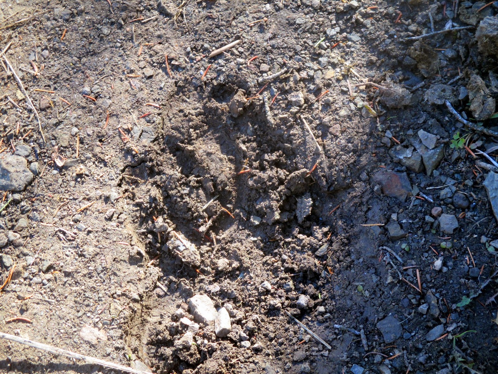 |
| Beart track in middle of trail! |
We hike up the hill again this
morning, armed with postcards to mail and Tommy’s package to send back
East. Right near the amphitheater, we
had to detour around a couple of cow elk who were sitting right in the trail in
the cool of the trees. Got everything
mailed, then a quick stop at the VC to double check trails for the day. We have information from Backpacker Magazine
that we didn’t further research, as well as the park flyer. We end up doing a slight combination of the
two, and include as well all the boardwalks through the hot springs from the
upper terrace down to the lower level.
 |
| The 'Narrow Gauge' travertine formation - dormant. |
We had thought originally of doing
the Beaver Pond Loop, but it would have been totally separate from the hot
springs and a mama grizzly and her cub were roaming up in the area last
week. In fact, the trailhead had an area
closed sign, but we went anyway because the park rangers at the VC didn’t say
it was closed! We took a different
trail, however, just to be safe. We were
in the trees – a good smelling pine forest – do Rick had the bear spray out and
available and we talked a lot! Saw some
unusual travertine formations that aren’t usually viewed because this is off
the beaten path. One called the Narrow
Gauge looks just like a railroad bed.
 |
| Orange Springs |
We were on a trail called the Howard
Eaton, but at the upper end of the Upper Terrace Loop Road, we jumped on to the
road to wind our way back down to the bottom.
We noted that there was NO traffic on the road this morning! (When we got to the road entrance, we knew
why – the loop was closed off!! For the
winter? Who knows? It made for a peaceful hike! Went passed several formations we viewed the
other day when we drove it.
Canary Hot Springs was a
favorite. We followed a long boardwalk
out to the viewpoint. This is a vent
that has dried up twice over the years and just became active again
recently. The new formations are
gorgeous and the amount they build up in a short time is amazing.
 |
| Upper Terrace view from Canary Springs spur |
 |
| Canary Springs and valley |
We wandered on down the various
stairwalks and boardwalks, visiting most of the major formations along the
way. We were dazzled by the intricate
detail and minute crystals that create the walls which hold in the various
ponds. The colors are created by microscopic organisms – different colors for
different organisms in different temperatures of water! And today we were able to add a little blue
from the reflections in the sky, although by the end of our hike/walk, a huge
cloud had blotted out the sunshine for over an hour!
 |
| Heading down the stairs |
As we came to the end of the walk,
we noticed a herd of bull elk resting in the shade across the road. And then I heard the bugle call – such a
strange sound, high and piercing, to come from a big massive animal! Pretty neat.
Rick heard them all night long in the trailer! I think I bury my head too far down in the
bed to hear much of anything!
 |
| Liberty Cap |
 |
| Ginger in front of Devil's Thumb |
A visit to the gift shop for a few
more postcards and some gifts, and then an ice cream cone for today’s
treat! Oh boy! We walked with our ice cream the tour of Fort
Yellowstone, noting the various barracks, officer quarters, hospital,
guardhouse, etc. for the Army troops stationed here from the late 1800’s until
1918. This permanent post allowed the
park staff to protect and maintain the park from threats of exploitation,
poaching, souvenir hunters, etc. The
buildings are well maintained and used for residences now by park
employees.
 |
| Officers Quarters from Old Fort Yellowstone |
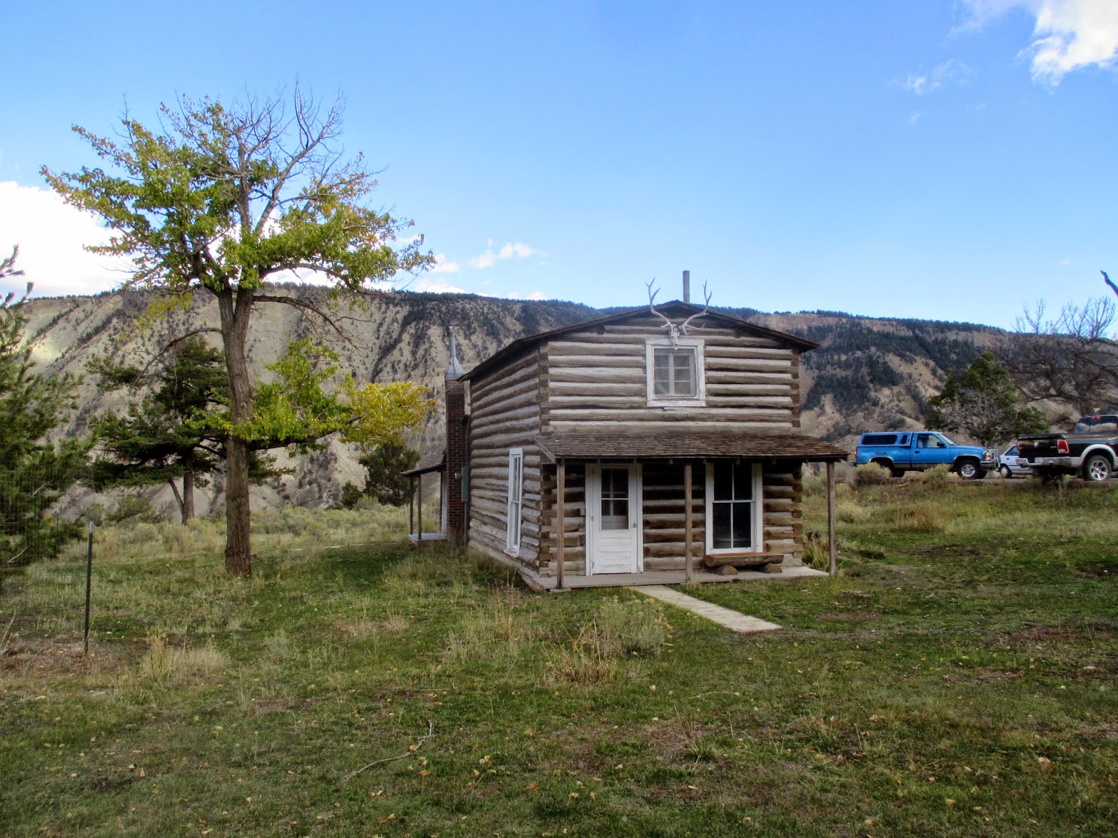 |
| Mail courier's cabin - He had the 'run' from Mammoth to Cooke City |
Back to the trailer around
2:45pm. Rick washed his hair and I gave
him a much needed haircut. Then an
afternoon of leisurely reading! A
campfire at night and an AWESOME moonrise over the mountain! Wow!
 |
| Tonight you get the sunset picture BEFORE the moonrise! |
WEDNESDAY, October 8
Driving Loop Tower-Canyon-Norris-Mammoth
81 miles
 |
Another friendly morning
buffalo picture! |
We took off around 9:30 this morning
to make the drive down to Canyon for the Grand Canyon of the Yellowstone
experience. .A retracing of our Beartooth Route for the first 18 miles or
so. On this trip over the Blacktail
Plateau, we didn’t see much wildlife. A
few buffalo maybe, but not much else.
Oh! Mule Deer – a rare sighting in the park or so it seems. But the morning was beautiful, and the one
herd of buffalo we passed were near a hot spring vent. Several were enjoying the heat, another was
wallowing on the other side of the road, and two ‘teens’ were engaging in a
little mock fight. Fun to watch.
 |
| Tower Falls |
After the Roosevelt-Tower
Junction, we headed south toward Canyon
and stopped at Tower Falls. Hard to see in the morning light, as the
falls were in the shadows. I am having
trouble with my Canon camera (the other died at the Habitat build) as to
focusing. It seems to do its own thing at
times and pictures end up our of focus OFTEN!
I am getting frustrated at times with it. Anyway,
Tower Falls is neat because of all the limestone spires surrounding it,
hence the name.
 |
| Coyote on the road |
From Tower Falls, the road continues
another 15 miles down to Canyon Village.
This section of the park is prime grizzly country as it travels through
a barren section of hillsides climbing toward Dunraven Pass, just under Mt.
Washburn. The pass is nearly 9,000
feet. We saw no grizzly, but we did find
a coyote ambling down the road. He
didn’t appear to be too spooked by the cars.
 |
Fire ravaged area across from
Dunraven Pass |
 |
| Yellowstone River right above Upper Falls |
Once we got to Canyon Village, we
head on down to the furthest viewpoints for the falls and canyon – Artist Point
on the South Rim of the canyon. This is
the classic view of the canyon and the Lower Yellowstone Falls. (Because of a bend in the river – Uncle Tom’s
Point – you can’t see both the Upper and Lower Falls at the same
time….anywhere!). The north side of the
canyon was bathed in sunlight, accentuating the myriad of colors. The south side in dark shadows. I’m not sure the sun ever hits the lower
falls this time of year. We were there
around 11:30 and watched a little bit,
but it didn’t look overly possible.
 |
| Pano of canyon wall at Artist's Point |
 |
| Classic pose in front of Lower Falls from Uncle Tom's Trail |
 |
| Lower Falls |
We drove back up along the North Rim Road, a narrow one way path with
several viewpoints. The most well known,
Inspiration Point, no longer affords a view of the Lower Falls. Over 100’ of the viewpoint collapsed during
an earthquake in the past 10 years or so.
You can barely see the top of the falls from a point just before the end
now. Disappointing, but geology in
action!
 |
| Construction along Norris road |
At this point, Rick
suggested that maybe it would be a good idea to head back to Mammoth via Norris
and check out the road construction issue for ourselves. There is a 7 miles stretch just north of
Norris that is undergoing major construction.
Park Service advise is high clearance only. We want to see if we can do it with the
trailer, or if we should take the long way around tomorrow in getting to
Madison.
 |
| Broad valley between Norris and Mammoth - Mt. Benson |
Well, long story short. We’ll take the long way tomorrow. We could do it, but with the possible half
hour delay as well, there is no reason to subject the trailer to the
conditions. So I am glad we did the
drive today, to see a few more hot spring formations, a wide wide valley, and
most spectacular, the drop down the Gardiner River into the Mamoth Basin. Awesome.
 |
| Drop down into Mammoth |
 |
| Gardiner River below Mammoth |
Back to trailer. I had wanted to
hike up to the top of the knoll opposite the entrance to the campground, so I
took off on a short little stroll. Great
views down on the cottonwood colored community for the year round residents and
the little school. The surprise was the
lush green field and pristine tennis courts and basketball court below me! Wow.
Back down the hill, I ambled through the campground looking for letters
and patterns to photograph. I found
U’s!!! Rick helped me wash my hair and
after dinner we had another campfire.
Another beautiful moonrise, but this time we were already inside the
trailer, as it didn’t come up until 8:30pm.
I heard an owl hooting much of the night.
 |
| See the speck of white in center? That's our trailer at Mammoth Campground! |
 |
| Another Sunset before the Moonrise |
THURSDAY, October 9
Mammoth Hot Springs to Madison (via Canyon
Village) 63 miles
Norris Geyser Basin – 29 miles
 |
| Same herd of buffalo each day near Tower Junction! |
An early morning! But then again, when you crawl into bed at
9pm, read until 9:45 and then go to sleep, it isn’t any surprise that you are
ready to get up early!! I crawled out of
bed at 6:15, made a cup of instant coffee, and worked on a prayer drawing for
awhile while bundled up. The temperature
in the trailer was 39 degrees when I got up.
Rick was up at 7am, and by 8 we
were pulling out of the campground, trailer in tow.
 |
| Sunlight on new lodgepole forest near Dunraven Pass |
Our drive to Madison was smooth AND
we were rewarded with a glimpse of a grizzly bear. It was a distance out in a field, but…we saw
it!! Other than that, we saw a number of
buffalo again as we cruised our way on now familiar road! We arrived in Madison around 9:30am and were
assigned site #C-77. The pull throughs
are fairly short, but we got situated in a nice site among the trees. This campground takes reservations, but there
are plenty of empty spaces. Of course,
there are over 400 sites here! The water
has been turned off at the spigots, but all the bathrooms have washing sinks
available.
 |
| All cozy at Madison Campground |
 |
The frost on trees was
awesome driving down. |
Rick messed around with the furnace
for awhile. We haven’t used it since our
initial shake-down cruise 2 ½ years ago!
He FINALLY got it working! Not
sure we will use it or not, but at least it is available. The forecast low for tonight is around 35
degrees.
 |
| Gibbon Falls |
We grabbed a slight snack and then
took off to drive BACK up the highway to Norris again. This time I drove while Rick could look for
animals. Our goal was to explore the
Norris Geyser Basin. We stopped first at
Gibbon Falls – a beautiful umbrella shaped waterfall. Plenty of water still flowing this time of
year! The Gibbon Valley is broad and
beautiful as the river meanders through it.
Prime wildlife area. Right now
the grasses are all golden colored and the ribbon of blue water through it is
striking.
 |
| Clydesdale Forest! |
We stopped at Artist’s Paint Pots
and took the ¾ mile loop trail to view the various thermal features there. The trail cuts near a previous thermal area
where the trees are all dead and rimmed with white ‘feet’ at the bottom – the
calcite deposits. Rick said they looked
like the feet of Clydesdale horses! How
true!
Paint pots are so named due to
several features that had blues and greens, reds and yellows. No geysers, just a lot of bubbling, steam
vents, and fissures. I especially like
the mud pots. And it is a little
unnerving to be walking across ground that you can hear water moving around
under you. In one place it sounded like
the bathtub drain suddenly coming unplugged.
 |
| Paint Pots area |
 |
| Deep blue paint pots! |
 |
| More colors in Artists Paint Pots |
The Norris Geyser Basin is large,
with two trails making a figure 8 through it.
We opted to take the longer Back Basin loop at about 1.6 miles. It took us past a variety of steam holes, hot
springs gurgling and bubbling, a few mud pots, and several geysers. None of these geysers erupt on a regular
basis, but Steamboat Geyser, located here, is the world’s tallest, with
eruptions reaching 300’ in height. The
last major eruption of
 |
| Vixen erupts right in front of us! |
Steamboat occurred on September 3 of this year. Too bad.
We missed it. Steamboat did treat
us to a constant spatter of water 5-10’ in height, however. AND a lot of steam! The treat of the day was Vixen Geyser, which
doesn’t even warrant a spot on some of the main geyser lists. Just as we rounded the corner of the
boardwalk, Vixen started to spout water.
It continued for over 10 minutes (I don’t really know how long, because
we didn’t stay more than 5-6 minutes watching it!) The water probably reached 20-30’ at times,
and a couple big bursts sprayed water over the boardwalk area. Fun to watch.
I thought it was stopping several times and then it would pick up
again.
 |
| Pools at Norris Basin |
 |
| Deep colors of hot springs waters |
Views to the mountains north of us
were wonderful from the basin. The trail
wandered on and off boardwalks throughout.
At one point in 2003 the basin was closed to foot traffic in places
because the surface temperatures were reaching 200 degrees and the boardwalk
was heating up and people were getting hot feet! The biggest thing we probably learned about
all the thermal features is that they are EVER changing. What erupts today may never erupt again. What bubbles today may blow up tomorrow. Who knows!
We arrived back at Madison around
3pm and spent a leisurely afternoon reading, etc. Dinner and early to bed again! Tomorrow?
OLD FAITHFUL AREA!
 |
| Ginger and Steamboat Geyser |
 |
| Panorama of Porcelin Basin at Norris |
FRIDAY, October 10
Old Faithful Geyser Region
37 miles
 |
| Firehole Falls |
Brrrr!! We put both sleeping bags on top of us last
night - probably a good thing because it was 33 degrees in the trailer this
morning when I got up. I had been
reading in bed for about a half hour and waited uintil Rick stirred and rose to
use the bathroom. He was going to turn
the furnace on for me. It had still been
fussy last night. Well, it was still
fussy this morning! We never did really
get it to work right. Ended up running
the propane stove a little to warm things up, which actually worked just as
well as the furnace!
We made it a leisurely morning
wrapped up in our blankets and heavy shirets, reading, working puzzles,
etc. Finally some breakfast (two pots of
French press coffee!) and around 11:30 we are ready to head south toward Old
Faithful and the geyser basins.
 |
| The swimming hole on Firehole River |
How fortunate and blessed we have
been this week in terms of weather. Yes,
it is cold at night, but it is mid-October at 7,000 elevation! What do we expect? But the days have been sunshine and temps in
the mid 60’s or so. Indian summer at its
best.
Our first excursion is the Firehole
Canyon Road which winds through a narrow canyon, walled with volcanic rock,
through which the Firehold River tumbles and falls. The FireholeFalls are a torrent of water
through a wide drop in the river bed. I
can’t believe how much water there is for late in the year. Where IS the source for all this water? The river is a favorite of fly fishermen and
we pass dozens on our journey to Old Faithful area. Still within the canyon we stopped again at
the ‘Swimming Hole’ – a calm spot in the river where the NPS allows
swimming. It was a pristine spot.
 |
| Giant Prism Pool at Mid-Geyser Basin |
 |
| Fire on the river! |
Back on the ‘main road’ – we pass
through some broad valleys, again marked with the winding river and acres of
golden grasses. With the blue sky and
puffy white clouds, the colors are beautiful. The river is dotted with steam vents - it truly looks like a river on fire in many
places.
 |
| Awesome colors at Mid-Geyser Basin |
We stop at Midway Geyser Basin and
walk the half mile loop to get a look at Giant Prismatic Spring – it is over
200’ wide. You really can’t get a sense
of the deep turquoise color in the center and the orange micro-organisms
growing outward from the edge like tendrails unless you can see it from the
air. I was enchanted with the
reflections of the sky in the surface.
Also at Midway we saw Excelsior Geyser – but it is in a dormant
state. Huge and bubbles gallons of water
and steam that roll down the bank and into the Firehole River.
 |
| Another reflected pool at Mid-Geyser Basin |
 |
| Old Faithful blows |
On up to Old Faithful, marveling at
the ‘smoking’ landscape as we drive up.
There are vents everywhere!
Buffalo roam and fisherman fly!
We grab a quick bite of lunch from the truck and head toward the Visitor
Center. The next two hours are magical
moments of timing: Old Faithful is due
to erupt in 10 minutes. We take the 3
mile loop hike past geysers that normally erupt every 14 hours or 7 hours. We saw them both ‘blow’. Incredible timing. Thank you God.
 |
| Calm behind Old Faithful geyser - Firehole River |
Our goal was to take the boardwalk
path about 1.5 miles down to Morning Glory Spring – one of the most
photographed ‘holes’ in the park. We
then followed the old road, now a bike path, back up to the Visitor
Center. We
 |
| Heart Springs with Castle Geyser erupting in distance. |
saw dozens of deep springs,
often bubbling lightly, some fiercely.
Vents with steam. We saw the
Castle Geyser erupt from across the river, and then were able to view it up close
bubbling away. We saw
 |
| ??? |
Riverside Geyser
erupt, as well as Beehive and Grand. The
grand geyser is the tallest predictable in the world. It didn’t shot that high was us, but the
eruption lasted over 10 minutes. Formations of cinter created Mammoth Hot
Spring like terraces, in other places cone shaped geysers. Grotto Geyser was a favorite with its myriad
of holes, out of which the water gurgled.
It erupts unpredictably, but froths a lot. Riverside Geyser sits right down along the
river’s edge (duh!) and shoots a fan of water across the river. It has a well developed cone base and often
had a tinge of a rainbow forming in the shifting sun/cloud patterns. Many of the geysers were surrounded by the dead
trees shrouded in white, or at least with the white shoes of the Clydesdales. It was an awesome hike!
 |
| Grand Geyser blows |
Back at the complex, we wandered
into Old Faithful Inn, a National Historic Site (gosh, I could have gotten a
stamp there too!) What a marvel of construction and design. Four stories high in the main lobby, all open
balconies and stairwells, laced with a tree-like structure. Tours were being given. We stopped in the gift shop briefly to pick
up a few postcards.
 |
Massive clock in
Old Faithful Inn |
Back to the trailer to enjoy soup
for dinner and a quiet evening. Rick has
promised me breakfast out tomorrow morning in West Yellowstone if we get up and
moving a little faster! We can do that! Tonight is our last night of ‘boondocking’ –
I can’t say I will be disappointed to be able to connect to internet, power up
my devices, and enjoy the microwave and electric heater again!!
SATURDAY, October 11
Madison CG to Bozeman, MT
105 miles
I think we are getting out of
Yellowstone just in time. It was COLD
again last night! When I got up this
morning at 6:30a, the trailer registered an even 32 degrees. I put the water going on the stove and headed
down to the bathroom, hoping I wouldn’t encounter an bears or such at that
early hour in the dark. The campground
was VERY quiet! I left the stove going
for about a half hour and it warmed things up to 45 degrees. But….we hear the forecast is for storms
coming in and possibly snow!
We were hitched up and on our way
shortly after 8am. Due to the cold, we
couldn’t use the dump station (it doesn’t open until temps are well above
freezing!), but Rick had emptied the rest of the water tank. Not much was left.
 |
| Madison River Valley to West Yellowstone |
The drive into West Yellowstone was
beautiful with the rising sun behind us.
It is more of a valley than I anticipated. The Madison River winds along under some
steep rock cliffs – one almost looked El Capitanish! Lots of fishermen were out braving the cold
weather to wade in the river – pretty dedicated since most of it is catch and
release! I kept my eyes sharp trying to
find the elusive moose since that is the only LARGE mammal we have failed to
see. No such luck.
We gas up in West Yellowstone and
then find the HomeTown Café for breakfast.
A good basic meal. Highlight was
the interest in our trailer given by a gentleman from California who is up
installing modular buildings in the park.
He was interested enough for Rick to give him a quick tour as we were
leaving the restaurant.
 |
| Gallatin River Canyon |
The drive on up to Bozeman was
beautiful. Mostly cloudy overcast skies,
so I didn’t take very many pictures.
Thick forests, windy rivers, and a slight pass as we shifted from the
Grayling River to the Gallatin River valley.
Plenty of wide valleys marked by golden grasses, red willows, and a
yellow-orange shrub we couldn’t identify.
An occasional cottonwood still in color, but most of the aspens were
white and leafless. We didn’t pass under jagged snowy peaks, but rather
followed the Gallatin down a deep canyon marked by convoluted canyon walls,
spires of erosion, and castle like formations.
We followed Route 191 right through
Main Street of Bozeman and to the junction with I-90. Sunrise Campground is right at that exit on
the Frontage Road. We found it without
problem, checked in, paid NOTHING as he said the bill was going to the Habitat
office. We will make a donation to the
Affiliate. It was interesting as the guy
said one of his family members (I can’t remember who) was the recipient of one
of the first Habitat houses built in Bozeman years ago. Perhaps it made him very receptive to our
stay – I don’t know! But he was
certainly helpful.
 |
| Hills just south of Bozeman |
First things first: a shower!!! Boy did that feel good! Then we did a little grocery shopping at
Wal-Mart, got the oil changed in the truck.
We picked up a rotisserie chicken for dinner and enjoyed that while we
did two loads of laundry. I finished reading
my book and got caught up with pictures and blogs, although had trouble getting
connected to the internet for awhile. (Fixed….just
rebooted the computer!)
Around 7 the wind started to blow
and then the rain came. The forecast is
for nearly an inch of rain in the Bozeman area.
Oh boy! I am so glad we are cozy
in our trailer with electricity!!!


No comments:
Post a Comment