TUESDAY, April 23
ALPINE, TX to ROSWELL, NM (262 miles)
Living Desert State Park, Carlsbad, NM (Pictures)
This will conclude my TEXAS Blog! We have left the state!
Smooth pack up this morning and we are on the road by 8:30am. The skies are fuzzy - we heard sirens earlier and we think maybe a grass fire or something to the southeast, but later we hear on the radio that the high winds have stirred up big dust storms throughout west Texas. Good thing we took our 'scenic' drive yesterday, because today would be even worse! We could hardly see the mountains right next to us driving back north toward Fort Davis!
 |
| We are back in New Mexico! |
The road from Fort Davis to Interstate 10 is also marked scenic on the map, and we give it higher ratings! It follows along a creek part of the way, much greener vegetation, interesting canyon side creeks. A windy little sucker, at which point I tell Rick that Google maps said the straight route through Fort Stockton to Pecos was ONLY 4 miles longer than this 'direct' route! Oh well, the other would have been REALLY dusty because there is nothing to block the wind out there.
 |
| Roadrunner |
From Pecos north to the New Mexico border, we are back in the typical west Texas flora and fauna: flat, creosote flats, occasional prickly pear and yucca plants. Grasshopper oil drills here and there. We leave Texas officially around 11:30 am, turn back the clock an hour as we reenter MOUNTAIN TIME ZONE!! AND I finish the fifth nativity camel before we reach the border! All 5 ready for Christmas.
 |
| Golden Eagle |
Into Carlsbad, gas up, and then lunch in the parking lots of a Beall's store!
 |
| Lena the Javelina |
We have decided to travel on up to a trailer park in Roswell (reservations made by phone!) so we have time to stop at the Living Desert Zoo & Gardens State Park north of Carlsbad. A $5 entrance fee each is more than a bargain. We spent 3 hours poking around a mile-quarter outside trail. Plants all identified, different environments, all the animals are rescued and healing, or rescued and unable to return to the wild. We saw a javelina (finally!), cougar, bald and golden eagles, hawks, snakes, Mexican wolves, owls, porcupine, turtles, prairie dogs, bison, and elk. Maggie Oso (the resident artist black bear) apparently was napping and didn't show her face. Visiting in the middle of the afternoon wasn't the best time to see most of the animals, but we did pretty well. I especially enjoyed the succulent greenhouse, filled with cacti and other succulents from all over the world! We also saw a roadrunner in the aviary. Purchased some red yucca seeds to plant at home - we are thinking of xeriscaping the west side of the front. We never water it anyway and the grass is horrible!
 |
| Cougar |
 |
| Closeup of Ocotillo blossom |
Seventy more miles up to Roswell, NM. Flat, sometimes dry, sometime irrigated land. Wheat, alfalfa, and pecan orchards. Near Roswell we see some huge dairy farms. Later learn that there are 94,000 cows in the county and 30 dairies. Roswell is the biggest producer of mozzarella cheese in the world! And I thought the town was just known for its UFO Museum! We find our Trailer Village RV Park, check in and get settled in a site under a tree. We are here for three nights, with two days for exploring. Jed is not free for a visit and will be gone over the weekend, so we are going straight to Randy's on Friday. Tonight is suppose to be close to freezing - another cold front moving through. Heating up again by Friday. Part of the reason why we chose NOT to go up into the mountains to Cloudcroft.
 |
| Patterned succulent - unidentified |
 |
| Turtle |
MONDAY, April 22
FORT DAVIS and MCDONALD OBSERVATORY
Click HERE for the photo journal
Up and ready to roll by 8:01! However, the beginning of the day didn't go very well. As we were at the Stripes getting gas and coffee, I remembered I hadn't grabbed the confirmation code for our tickets to the observatory. So...we stopped back at the RV Park enroute out of town (fortunately, we had to pass right by it!)
Ten miles up the road, I grab the camera to take a picture, and get the 'beep' and 'no memory card' message. I had left the memory card in the computer after downloading pictures last night. Of course, the computer was at the trailer. So....Rick turns around and we drive BACK to the RV Park again, I grab BOTH of my memory cards and we are on our way again. This will cut down on our exploring time somewhat at Fort Davis, but I would have been crushed to have not been able to take ANY pictures.
 |
| Mountain views between Alpine & Fort Davis. |
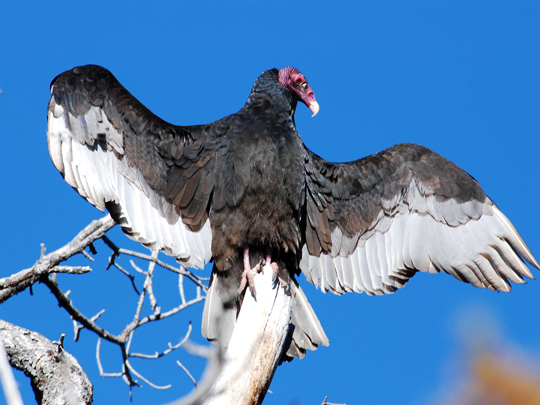
It is a beautiful morning, but the day is forecast for WARM! We pass a couple interesting mountain formations, still a little curious about the designation of the area as the "Alps" of Texas. I guess when most of the state is relatively flat, these are peaks of some sort! However, our idea of mountains is a little different than that of Texas apparently! We did see some more bigs vulture birds sunning themselves on the fences today!
 |
| Fort Davis was on the main road to protect travelers |
Into Fort Davis - it is only 24 miles away - and down the road a short bit to the Fort Davis National Historic Site. I get my passbook stamped, my final stamp for the state of Texas. We did pretty well. Hit 6 out of the 13 sites in the state! This is one of the best preserved examples of the military outpost forts. The site was nearing ruins when the federal government made it a historic site in 1963 and restored some of the buildings. We had about an hour to walk around and explore. A bugler plays during the day at set times, reminiscent of the set calls during military life that established the schedule of the fort. We were amazed at the tiny size of the garrison cells, the barracks for enlisted men, etc. The
 |
One of the officer houses with
cliffs in background. |
commanding officer lived in a pretty posh house compared to the rest of the troops! The fort is set beneath a backdrop of Rocky cliffs. The southern peak is called Sleeping Lion Mountain. The view to the east is a vast expanse.
 |
| Visitor Center at McDonald Observatory |
Sixteen miles on up what is a 75 mile 'Scenic Loop' (we'll discuss that oxymoron later!) we arrive at the turnoff for McDonald Observatory. We had signed up on-line for the 11am Guided tour and Sun Viewing Show. The latter was mostly in the auditorium using links to telescopes that were currently focused on the sun. We were able to learn alot more about solar flares, prominences, spots, etc. Interesting, but our guide was a little hard to understand, so you had to work and focus to get the information.
 |
Rick controls the dome
rotation at 2.7m Smith |
Our guided tour took us to two of the larger telescopes on the mountain. There are a number of additional scopes of smaller size. The first one we visited was the 2.7m Smith telescope, built back in the 1960's. It was the second major telescope built on the mountain, the first being in the early 40's. Because we were on the tour, we got to go right into the dome chamber, poke buttons to move the telescope up and down, and then Rick got to use the control to rotate the dome so the window lined up with the telescope lens. Guides aren't allowed to open the window during the day, so we couldn't do that. But Rick had fun moving it around! I got to poke the button that shut the whole thing down! The Smith scope is a standard primary and secondary mirror system, with mounted cameras on the sides, and the ability to send light our side chambers, down to the spectograph, etc.
 |
| HET - silver geo dome! |
Then we drove in the shuttle over to the other peak and the site of the Hobby-Eberly Telescope (HET) which was installed in the 1990's I think. The structure is totally different. The mirror is actually 91 separate hexagon mirror panels, together comprising a 10m spread. There is no secondary mirror, rather fiber optics channel the light into a spectograph system. Much of the construction of this telescope used common everyday parts. It is based on a geodesic dome design - pretty cool.
 |
The one mountain that was scenic.
Excuse the 'spots'!! |
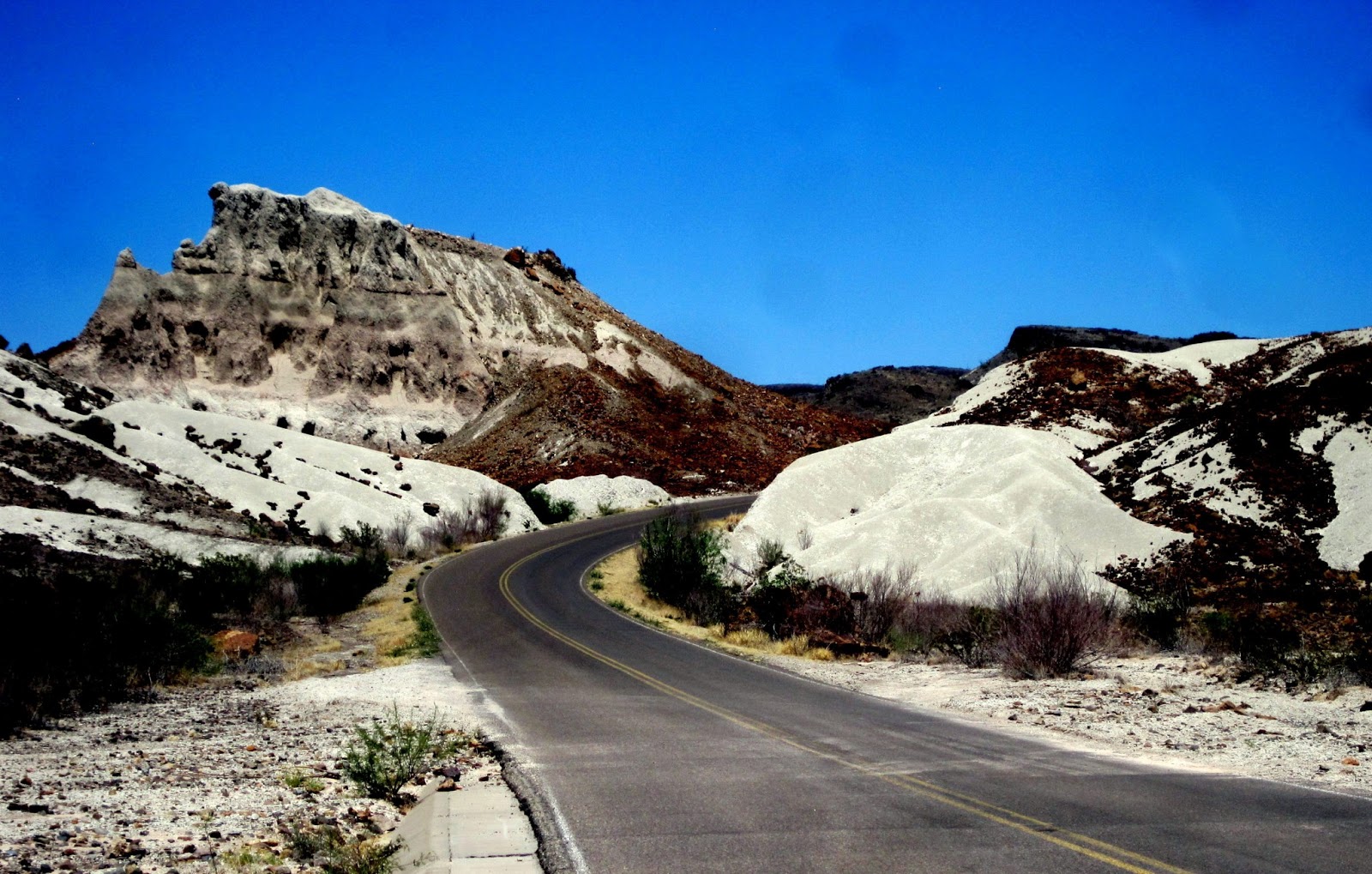
We grabbed a bite to eat, spent a little more time in the exhibit hall and gift shop, and then took off to explore the rest of the scenic drive. What a bit of a disappointment. As Rick put it as we pulled back into Fort Davis an hour later, "That was probably the least scenic Scenic Drive I have ever driven!" Other than a couple 5 minute glimpses of some unusual mountain peaks, most of the 60 miles was dry grass, dead or dry oak trees, barren hills and vast plains. It was NOT what we expected! But just as we thought maybe we should turn around, one of those nice mountain views appeared that lured us beyond the halfway point!
 |
| Bloy's Camp Meeting site |
About 10 miles from Fort Davis, we came to a little settlement of scattered, all metal buildings. A historical marker came into view so we stopped. This is the site of a cowboy church revival that has been annually held since the late 1800's!! Begun by....a Presbyterian pastor. Now about four different denominations all join together.
Back to Alpine by 3:30, we gas up for tomorrow, cool down the trailer (it was an even 100 degrees inside) and cool up shrimp stir-fry for dinner. We tried to go swimming, but found the pool was closed. Laundry and another classic sunset.....
 |
| Sunset as reflected in the window of an RV as I walked back to our trailer! |
SUNDAY, April 21
KICK BACK DAY!
 |
| Alpine Presby Church |
Today can be described quickly.....LAZY and warm! It felt good to not have a schedule for the morning. It took me 2 and half hours to finish yesterday's blog on Big Bend! It is going to be warm - in the high 80's today.
We drive into town to attend church at the little Presby church we passed coming into town on Friday. Service was at 11am. We were greeted, introduced, and welcomed....
 |
| Crewel banner in narthex |
 |
| The church was still decorated for Easter |
profusely!! Invited to the potluck after church 3 times BEFORE the service ever started. I felt at home when I saw two little boys carrying the acolyte candles up front (with sticks exactly like ours) - dragging a little brother with them! The choir was quite good for a small church and they sang at least 4 times! Pastor is a middle age woman who has a vision disability ...she had really large print script for the scriptures, sermon, etc. Did a good job. The church was started back in 1890's, has replaced a building due to fire, in a town of 6,000, elevation 4400', high mountain desert climate. Felt very comfortable! We stayed for the potluck, a goodbye celebration for an older lady moving to SC to be with family. A nice resolution for her plus the singing of Happy Trails! Rick sampled all three versions of cobbler on the desert table and then announced he wouldn't need any dinner!
A visit to Thriftway store to replace some of our groceries. Not as cheap as the HEB stores, but not as bad as the ladies at church made it sound!
Rest of afternoon....we talked on phone with family, read, drew scribbles, etc. A very relaxing day!! Oh....I did walk down to the doggie park to take a couple pictures. Rick and I got a kick out of the 'decor' the other day:
 This has been a really nice park. Well maintained, etc. I also went out to take some more cactus pictures because everything is just plain blooming in glorious fashion. I will close for the day with a shot of a rainbow cactus, so called because of the colored bands on the fleshy part. The flowers look like a burst of sunshine with the rainbow!
 |
| You can't see the colored bands very well here, but the flowers are SO pretty! |
SATURDAY, April 20
BIG BEND NATIONAL PARK
Click HERE for today's photo journal
(Be prepared....lots of pictures. Many with blurry circles in the sky - I think my camera has dust in it!)
 |
This is an internet picture...but it
gives you an idea! |
Today was a long, but great day! Big Bend is NOT an easy place to get to - not on the well trod road! We left Alpine shortly after 8, gas and coffee, and on the road to the park, about 70 miles to the northeast entrance station at Persimon Gap. I drove this first section through open, rolling hills, amid rock mountains. Lots of prickly pear, yucca, and today? Mexico prickly poppy alongside the road. As we neared Persimmon Gap, we saw vultures on the fence posts. At first I thought it was a stuffed bird stabbed on the pole, but then we saw more! Full wings spread, they were enjoying the morning sun. The ones we saw are mostly black headed birds. Pretty weird!
 |
| Woodpecker |
 |
| Two-tone prickly pear |
At Persimmon Gap we stop to gather a little information and trade drivers. I have to have the camera ready to go through the park! We saw a little woodpecker trying to get through the window of the VC, plus some gorgeous cactus blossoms out front. Got recommendations for trails, roads, etc. (and verification that the dirt Maverick Road won't be an option to make a loop later in the day!) Basically our route for the day looked like this:
We felt like we pretty well covered it all!
 |
| Drooping Juniper |
 |
| Driving up the Chisos Basin road |
The Chisos Basin road climbs up through a natural opening from another drainage and then at the Lost Mine Trailhead crests to drop down into the basin. We stopped at the trailhead to walk about a mile up to the Juniper Canyon overlook. It was hazy in the distance, so the view wasn't stellar, but still a good chance to stretch the legs. I picked up the natural guide at the beginning of the trail, so we learned the identity of a few more plants along the way, including the Drooping Juniper, which looks like it could use a good watering all the time. Unlike the more familar southwest alligator juniper, this one has a bark more reflective of a cedar tree.
 |
| Casa Grande |
Towering over the trail is the massive Casa Grande chunk of rock. While not the highest peak in the basin, we thought it was certainly the most impressive. From the basin side it looks like a solid square of stone, but from the trail side, you could see the large pillars of rock.
From Juniper Canyon overlook, you can see down to the Rio Grande and across to the mountains of Mexico. Rick was able to find the river with the binoculars. I mostly found cactus to photograph and gazed back up at the mountain peaks of solid rock. The trail was busy - it is one of the most popular in the park. It is also frequented by cougars and black bear, but we didn't see even a sign.
 |
| Juniper Canyon view |
 |
| Ocotillo bloom |
Down into Chisos Basin to the Visitor Center there, a passport stamp, and purchase of a couple drinks. We are hungry! We lunch in the shelter area, watching little birds scurry about and surrounded by ocotillo and cholla cactus - all in bloom.
 |
| Window View |
The actual Window Trail is nearly 5 miles round trip and a good climb back UP to the basin, so in the sake of time, we opt for the MUCH shorter Window View loop, which takes us out to a point where you can see through the gap to the western parts of the park beyond. This is supposed to be a great place during the sunset as you are looking due west.
 |
| Tuff Canyon |
We leave Chisos Basin and head on through the park. There are a number of short drives we could have added, but we want to get down to the river. We will take Maxwell Scenic Drive down to Castolon, the site of an old army post and a historic, yet still active, community based on agriculture.
 |
| Layers of volcanic ash. |
From the west side of the mountains we can look back through the Window and see Casa Grande. Pretty neat. Then we wind DOWN, through sotol and prickly pear, creosote and mesquite. We pass through an area of heavy volcanic layers - marked with white tuffstone, yellows, and reds. The desert seems more arid over on this side. Just before Castolon, we pass the solitary and majestic Cerro Castellan - a monolith mountain of layered ash.
 |
| Cerro Castellan |
Castolon has a vivid history - from native settlement, to bandits and the army, to an active trading post with the Spanish community of Santa Elena right across the river (the border crossing here is NOT open). You sense you are somewhat 'at the end of the road' as the visitor traffic is not as heavy, life seems a bit more laid back! We learn a little more and then push on the last 8 miles to the literal end of the road and the trail into Santa Elena Canyon.
 |
| Visitor Center at Castolon |
 |
Rio Grande as it emerges from the canyon -
Chisos Mountains in distance. |
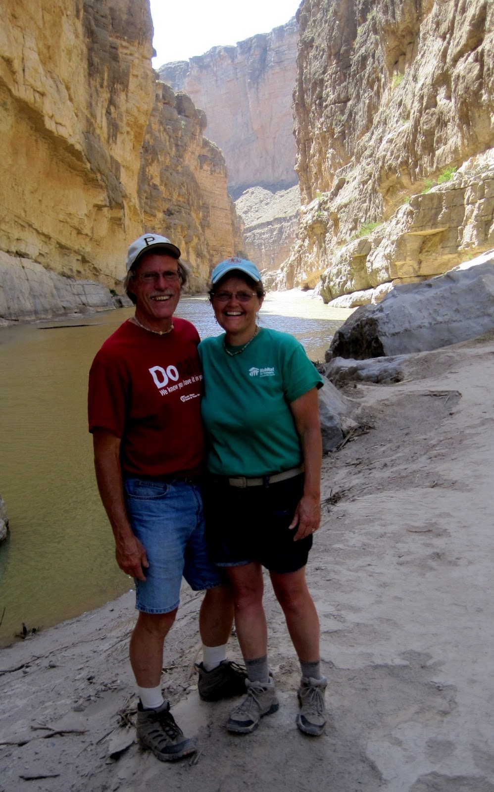
The road along the river literally touches the banks in a couple places and a good leap would take you across into Mexico. The Mexican side, however, is flanked by massive cliffs, probably a couple thousand feet in height. They are an impressive wall of stone, towering above a tiny thread of green. We learned that this section of the Rio Grande is mostly fed by a major Mexican tributary, since New Mexico and El Paso regions drain most of the river water before it reaches here. I was confused until I checked the map later, because the Terilingua river enters at this spot and it looks like a much larger river bed than the Rio Grande! (It was also completely dry!)
 |
| In the canyon depths |
The Santa Elena trail cuts across the Terilingua wash, climbs up around rocks and then slowly descends to the river level in about a 3/4 mile journey. It is lined right now with blooming
 |
| Inside the canyon |
prickly pear, honey mesquite, profusely blooming palo verde (which seemed alive with bees and an intoxicating scent), and a type of grass plant which we thought had the stocks of bamboo with the plume of pampas grass. It was bloody hot....we managed to time this hike to the one three hour period when the trail was totally in the sun! Not until we reached the river channel in the canyon itself did we have respite. I can't imagine what it would be like on a truly hot day! (We were only forecast for the mid 80's here). The shadows of the high cliffs on the water were neat. Even the quietest of conversations echoed on the walls. I didn't want to leave the quiet cool of the canyon to reverse our trail, but alas.....it had to be done. The big drink of water back at the truck tasted very good.....as did the ice cream sandwiches we rewarded ourselves with at the little store in Castolon enroute out!
We crank on the air conditioner, retrace the 30 miles back up to the main road, and head home to Alpine, via Terilingua and Study Butte. We had thought to get an RV site there originally. After seeing the town, we are so glad to make the 80 mile drive back up to little Alpine!!! Home around 6:15 to shower, enjoy the thawed burritos from Hobbs, and watch another stellar sunset! A good day!
 |
| A few more clouds in the sky tonight added swirls to the setting sun. |
PS. I have absolutely no idea why my blog appears sometimes in blue text and sometimes black. It is programmed for black!
FRIDAY, April 19
Johnson City to Alpine, TX 357 miles
Click HERE to see more pictures
 |
| Wildflower seed farm |
Travel day today! We pack up the trailer, try to grab a coffee from the Valero across the street but they are out of coffee, and head out of town. Rick finds a little cafe as we leave Johnson City where we run in and get a coffee! A beautiful morning to head west on Hwy 290, passing the LBJ Ranch, Becker's vineyard, the road down to Luckenbach, etc. The eastern sun was pretty on the flower fields of the wildflower seed farm. We stopped in Fredericksburg at the German Bakery to make a couple more purchases. They make GOOD bread!
From Fredericksburg on to I-10 we are on new highway! Still rolling hills, oaks, lots of green, and flower lined roadsides. Only difference is the bluebonnets faded and the day was marked with YELLOW! Pale yellow (primroses I think) and deep golden yellows, tall black-eyed Susan yellows and short little yellow carpets. And this continued ALL day! Occasionally fields of the purple verbena, but mostly a yellow day!
 |
| Lunch spot |
Gradually after merging onto to I-10, the oaks fade and the vistas are filled with what looks like sage, mesquite, and prickly pear! The hills, however, seem to continue! At one point in the middle of nowhere (between Sonora and Fort Stockton there is pretty much NOTHING!) I sense a flatness to the vista, but that was short-lived.
 |
| In the middle of nowhere |
We pulled over at the exit for Ozona to pull under the shade of a tree to eat some lunch. The air was cool and we sought the sunshine to eat! I found a few flowers, but mostly trash. No one was picking up this section of highway, that's for sure. It was a mess!
I really like the old water pump windmills and we saw plenty of well worn examples during the day. As we neared Fort Stockton we also spied hundreds of modern wind turbines on the mesa tops.
 |
| Wind turbines on the mesas. |
Gas AGAIN in Fort Stockton (we did not get very good mileage today with all the up and down plus a bit of a head wind this morning) and then we cut south on Hwy 67 to the town of Alpine. We have gradually climbed all day. Rick said it was like each hill took us just a little higher than the last. Johnson City was 1200' and Alpine is 4400'. Fort Stockton is elevation 3000', so we did some good climbing in the last 60 miles!
 |
| Are those mountains? |
As we headed south, we found our horizons again have....MOUNTAINS! Yes, real mountain skylines!! This area is called the Alps of Texas. Rest assured, not quite the same as the Little Alps of Wallowas or Switzerland, but compared to the rest of Texas, these are mountains!
 |
| Lost Alaskan RV Park |
We are thrilled with the little town of Alpine, population 8,000. There is a university located here, plenty of shops, motels, etc. We have lots of stuff to do! First on the agenda is to find the Lost Alaskan RV Park and get settled. We arrive around 4pm. The park has a pool, playground, sunset viewing, stargazing spot (enclosed with open roof), and all the normal amenities. Plenty of big pine trees. Should be a good spot for four nights.
Tomorrow? BIG BEND NATIONAL PARK!!
 |
| Is this a Texas size sunset? |
THURSDAY, April 18
Austin, Capital City of Texas
Click HERE to see more pictures
Wow! What another FAST change in the weather. We went to bed last night hot and muggy. We left the fan blowing. We had windows open and never put more than a sheet over us all night. When I got up at 6:15 am, it was still 75 degrees inside the trailer. As I sat working for the next two hours, the temperature in the trailer DROPPED 12 degrees, the rain began, and the winds came. Just amazing!
Because of the weather we weren't in any hurry to get going this morning. The skies are forecast to clear later in the day. We did change into long pants instead of shorts and I ended up wearing my hooded sweatshirt most of the day!
 |
| Terrace on top of Mt. Bonnell |
 |
| View west from Mt. Bonnell |
We finally left around 10, heading the 45 minute drive into the west side of Austin. Our first goal is Mt. Bonnell, at 775' in elevation the high point of the city. There are 99 steps to the top from a parking area, and a beautiful terraced area at the top. Views were good inspite of the cloudy weather.... and the occasional raindrop! We could look down upon LadyBird Johnson Lake (dam formed), across to the tall buildings of the downtown area, or across to the mega mansions on the western heights. We scurried back to the truck when another sudden but short deluge of rain came down.
 |
| ElePooPoo Products |
Rather than drive back to the expressway, we decided to follow the Scenic Lake Drive south. It was tough to follow in places as it wound around, but we eventually located Redbud Road and the bridge across the lake. From there we follow a winding and hilly narrow road past large estates and a rather wealthy neighborhood! Came out at a large city park. We drove down to Congress Street to find the famed SoCo section of town - a funky enclave of small boutiques, galleries, and food wagons. Many of the food wagons were not open in the cold, so we finally opted for Home Slice Pizzeria and a spot at the bar to escape the cold. Rick had a spinach pizza slice and I a spinach salad.
 |
Love this pic of Diana as
she came down the tower!
Yes, it was windy! |
We spent the next couple hours poking through some of the shops in the SoCo district. One store in particular was Ten Thousand Villages, which I recognized as a fair trade vendor that Judy Wilkins uses for her purchases. We checked out the whole place, but got a big kick out of the Elephant Poo paper products. "We are number one at number two!" is their slogan!!
 |
Even the bathrooms at the wildflower
center are glorious! |
Arrangements had been made earlier in the day to meet Katy's sister, Diana, at the LadyBird Johnson Wildflower Center at 4. I called her at 3 to say we were enroute already. She met us there. We had a good time checking out all the flowers, identifying, looking at the caterpillars at the insectuary, and enjoying the beauty. The center has a rainwater catchment system that fills three cisterns. It looked liked ancient Roman aqueducts in places! Due to time (and I have misread the closure time for this particular evening - a special event was to be held) we didn't go out on the trails, but you could see from the tower that there weren't ALOT of flowers currently blooming. The gardens are watered from the catchment system, but not the fields!
 |
| Entry cistern and aqueduct. |
 |
| Water Iris |
Told Diana we would take her to dinner if she could find an Asian or a Thai restaurant on the south side with her smart phone! Mission accomplished and we followed her up the road to IM Thai, at a shopping center right where met our road to return west! Perfect AND very good!!! Had a good chance to enjoy some more conversation and get to know her better.
Tough drive home into the setting sun, but we made it around 7:45. I ran over to pick up a soap dish at Dollar General (unsuccessful foray) and treats at Pan Mexicano at the Valero station (yes!) Sunset was spectacular - wish I had been outside of town where I didn't have telephone wires, etc. in my way!! Maybe tomorrow in Alpine! It is clearing off - and should be 39 degrees tonight! What a drop - grab the sleeping bag again!
Good conversation with Luke tonight as he was driving to Hermiston for Presbytery. Late to bed!
 |
| Sunset in Johnson City after a stormy day. |
WEDNESDAY, April 17
Texas B's: Byes, Baths, Bluebonnets, and Burritos
Click HERE to see more pictures!
Texas-size B's sum up today!
 |
| Blood Sisters Ginger & Denise |
BYE-BYES (IN BLOOD?). First an early morning goodbye to Bisou and Diana. They left around 7 for her to get back to Austin for a 9:30ish appointment. I got up in time to greet and goodbye, but not Rick. They were so quiet!! Then goodbye to Jim as he left for the college, and finally, after hitching up the trailer and checking the house one more time for the 'left behinds', we said goodbye to Denise. We took a final 'blood sisters' picture out in front, wearing our new Blood Bank shirts from yesterday! The Schneiders have been so INCREDIBLY gracious in hosting us for this prolonged stay. I'm terribly afraid we more than pushed the limit of "Guests, like fish, smell after three days!" But we had so much fun with them....and enjoyed San Antonio as well!
 |
| The trailer gets a bath! |
BATHS. I don't wish to mislead and have anyone think that we haven't bathed in awhile, but the bath is for the truck and trailer! Neither has bathed since we left home!!! Rick remembered passing a large 'do it yourself' car wash last weekend in Johnson City, so we went searching after making the hour long drive up from San Antonio this morning. We finally stopped and I ran into a beauty shop to ask. Got directions! For $5 worth of quarters (my job was to input quarters and turn the dial on the 'wands'!) Rick was able to clean both the truck and the trailer. The winds and dust storms of Hobbs, especially, had taken their toll. When we got set up at Roadrunner RV Park on the south side of Johnson City, we took the time to wipe down all the interior surfaces of the trailer. A light layer of dust still remained in many places!
 |
| Our spot at Roadrunner RV Park |
BTW....the Roadrunner RV Park is a well-kept secret. With our Good Sam discount, we are paying just $25 a night for full hook-ups, a shower house within 35 feet, high speed internet, and at least 5 TV stations from Austin. The helpful gal at the desk provided us with plenty of information concerning the area, day trips, etc. A clubhouse room with book exchange, game tables, and full kitchen. Laundry room with $1 wash and $1 dry! A hole in the fence allows access to a little strip mall right next door: market, hardware, dollar general, etc. Too bad we are only staying two nights! Only sad part was that we left our water pressure valve at home and needed one for this park. Had to buy another one! :( On the bath notes....we both tried out the showers tonight to rave reviews!)
 |
| Ginger finds a field of bluebonnets! |
BLUEBONNETS. Rick and I walked via a few backstreets down to the LBJ Historical Site Visitor Center and "The Settlement" trails. Enroute we passed some new flowers: winecups and another I still haven't identified. I found a patch of authentic TEXAS paintbrush (larger, more white on them). We saw black-eye Susan-like daisies, Indian blanket flowers (like I have in my garden), the prairie primrose and prairie verbena. And, of course, bluebonnets. As we walked around The Settlement area of the historic site, we came upon vast fields of the Texas state flower. Finally! A chance to just put myself in the middle of the field and enjoy! I still haven't found a spot where the bluebonnets and the paintbrush intermingle, but I shall!
 |
| Texas Paintbrush |
Oh yeah. The LBJ visitor center was pretty interesting as well! Well done displays. Again, this national park stop has reminded me of the good LBJ did in the fields of education, civil rights, poverty, the environment (massive additions to the National Park system) etc. Unfortunately, a little war called VietNam was probably more his legacy and people forget the rest. A really good section on the conservation efforts of LadyBird Johnson as well. Tomorrow we hope to visit the Lady Bird Wildflower Center in Austin.
 |
| A plate size burrito - stuffed full! |
BURRITOS. BIG ONES. Walking back to the trailer, we realized we were hungry! Rick had read in the clubhouse that the little Mexican restaurant across the highway had $3.99 burritos, so we thought to pick up a couple. We ordered two 'seasoned pork' ones to go, Rick asking for jalapenos on his. I figured I would add a little of the already cut avocado to mine. Well, they toss in a few chips and salsa as well, and the burritos were HUGE!!! I only ate 2/3 of mine and left the rest in the fridge for tomorrow. (Actually, they mixed up putting the J label on the foil and I ended up with Rick's jalapenos! I just about went through the ceiling on the first bite! We quickly took care of that problem!) We might have to go back again before we leave....maybe breakfast on Friday!
It has been cloudy and overcast all day. Temps in the high 70's, slight breeze. VERY humid feeling and sticky. A storm is supposed to come in tonight and perhaps cool things down. We'll see. Just found a text from Katy's sister Diana asking about possibly rendezvous tomorrow. That would be fun too! Stay tuned!
 |
| Fields of bluebonnets lined the trail at the Johnson Historic Site Settlement area. |
TUESDAY, April 16
Corpus
Christi to San Antonio, Packing Up!
Not too exciting a morning today to report! We arise, breakfast at the hotel. I should report Rick dined on two TEXAS
shaped waffles (they were quite large) and filled with blueberries. He was in heaven! And stuffed! We watched the morning’s events of the Boston
Marathon tragedy on TV. Second time we
have sat in a hotel lobby, breakfasting, and watching of a disaster. The first was the Columbia re-entry breakup
while at a tennis tourney in Boise. Our
thoughts and prayers are with all, especially any from Baker who might have
been in attendance.
 |
| Loading on to the ferry |
We packed
up and hit the ferry line right at 9am.
Rick was able to practically drive right on non-stop. Only two more cars after us and we were
moving! Speedy! Then a drive through the rest of the bay and
delta area – all flat and filled with pockets of water everywhere. Agriculture, refineries, etc….and no lake of
water!
We
enjoyed following the ‘evacuation route’ all the way back to San Antonio. Stopped to gas up at $3.28 just north of Corpus
and I drove the rest of the way back up to San Antonio. Uneventful.
 |
| Rick, Francis, & Ginger |
Afternoon
of packing up, and then the exciting bonding time with Jim and Denise of a trip
to the Blood Bank. We all gave up a
pint! Rick and I wanted to go
specifically this week so that we would be ‘in sync’ with the next draw in
Baker City. A smooth draw and we all
came home with red t-shirts!
Rick,
Denise, and I walked next door to deliver our gift to Francis and visit for a
short bit. She is such a sweet
woman! Sent us home with pizellis (the
waffle cookie!)
Jim
prepared some Texas chili tonight, which we enjoyed with the rye/wheat bread we
bought at the German bakery last week and fresh squash from the Farmer’s Market
on Friday. Too bad Dianna couldn’t
arrive in time for dinner!
Dianna
came tonight to pick up Bisou! She
stayed the night, but will have to get up early in the morning to get to work
in time in Austin. All will be leaving
early, however, as Jim has to work and Rick and I hope to be gone by 9. Good to get a chance to visit with her
abit.
MONDAY, April 15
Padre
Island National Seashore & Port Aransas, TX
Click
HERE to view pictures
 |
| Ginger dipping her toes in the Gulf of Mexico waters. |
Did I say
I would be sore today? I woke up stiff
in my….buttocks! By tonight the backs of
my thighs are so tight – I sit down ‘gingerly’ – no pun intended! Not my arm or shoulders – but my legs from
bending over to do all the hammering! Wow! Three hours of a Joshua Build were harder on
me than two weeks of Care-a-Vanners!!!
But….enough
of that! Today we ventured further south
into the region of Corpus Christi – not quite to the far ‘point’ of the state
of Texas, but close! We left around
8:30am, retraced our path from last Friday to I-37, and were out of the San
Antonio ‘loops’ within a half hour! The
road to Corpus was nondescript (exactly as Jim said it would be!). Mostly flat, agricultural with what appeared
to be sugar cane and more, and a few grass hopper oil drills. We understand it is an area of oil fracking,
but we didn’t see much of it. Just
before we entered the Corpus Christi region, we passed a large refinery
area.
 |
| Early view of Corpus Christi |
 |
Padre Island water
tank has turtles! |
We
decided our goal wasn’t so much to visit fancy places, but to experience the
Gulf Coast in its quirkier spots. We
drove straight through Corpus (amazed at the vast tracts of agriculture right
in the middle of town) and on over the bridge to Padre Island. The north end of the island is filled to
capacity with condos, highrises, hotels, restaurants, etc. Once you drive about 5 miles south, you abruptly
leave the congestion and entered the National Seashore boundaries with grasslands,
dunes, beaches and waterholes.
Upon
passing through the entrance station, we are
 |
| Security cams! |
amazed by the number of security
cameras tracking our every move. Later
we see a helicopter passing back and forth over the area. In asking at the Visitor Center, we find some
shenanigans had been taking place earlier in the day with some suspected drug
trafficking, so the authorities were out in force. (I think the cameras were there most of the
time, however!)
 |
| Rick along Padre Island Gulf Coast side |
The air
is pleasantly cool and moist while on the beach, but if you are in the lee of
the breeze AT ALL, it is hot and moist!
We took a walk for about a half mile north on the beach, mostly enjoying
the warm water and the cacophony of birds along the way. I tried to take enough pictures that Denise
will identify them all for me tomorrow night.
The beach was covered with a thick orange seaweed in clumps
everywhere. Padre Island is known for its efforts to restore the sea turtle populations. Huge ridley sea turtles nest here. The eggs are removed from the nest, incubated in a safe location, and the baby turtles are released in the summer, often to the cheers of thousands of on-lookers as they scurry down to the water.
 |
Ridley sea turtle laying eggs -
model in visitor center |
 |
Sculpture in front of
Marine Science Center |
We drive
north past the end of Padre Island and over the short bridge to Mustang
Island. It is a quick 18 miles up to
Port Aransas. Each small ‘break’ between
islands is called a pass. Just like a pass in the mountains, this is a pass
between the islands to the inner harbors.
A ferry will take us across Aransas Pass in the morning back to the
mainland. We decided we would rather
stay in a small fishing village of 3500 people instead of Corpus Christi and
300,000 people, so we find the Islander Hotel at a bargain $67 for the
night! We visit the Univ of Texas Marine
Science Center – a small operation – but interesting all the same. I guess I was expecting something along the
lines of the Hatfield Marine Center in Newport, so when I read about 7 aquariums I thought this would be similar. Indeed there were 7 aquariums, but each was
probably only about 50 gallons!
 |
| Our fine dining establishment! |
 |
| Rick preparing to eat his amberjack fish! |
While I
did a little shopping before the stores closed, Rick checked out the dining
venues. He came back to pick me up with
the elation of finding a quirky little fish market advertising Amberjack
fish. It was wildly decorated inside and
just offbeat enough to grab our fancy.
Besides, we are in an adventuresome mode and decided we had to try a
fish we have never heard of before! (Note:
I looked it up on the internet – amberjack fish can grow to 150 lbs, but the
under 15 pound range are the tastiest.
They are lean, white fish, and voracious predators among the reefs and
wrecks of shallow waters.) The coleslaw
and rice were good, but the meal was for the fish and we got a plentiful slab
and it was DELICIOUS!!! We topped it off by sharing another Southern treat - key lime pie! The ‘Ocean of
Seafood’ Market had stuff all over the walls and ceiling. It was a good ‘funky’ place and I liked it!
 |
| Fishing pier at Port Aransas |
After
dinner we drove out Beach Drive to a pier that went way out into the Gulf. Several men were fishing off the end. We got to talking to one young man from
Tyler, TX. He had quite a drawl! He had caught a huge redfish that he was
proudly displaying. We also witnessed
his friend catch a small hammerhead-like shark.
They threw the shark back. Rick
talked with the kid for awhile and then we left to watch a few surfers as we
ambled our way back down the pier.
Back to
the hotel for a little R&R!!! I discover I am able to connect to the internet in the room and don't have to go to the lobby! A
perfect day! G’night!
 |
| Ginger from the fishing pier at Port Aransas |
SUNDAY, April 14
Habitat
for Humanity Joshua Build
Click
HERE to view pictures
 |
| Posing in front of the Joshua Build trailer |
When Rick and I originally told Jim and Denise we
wanted to worship with them on Sunday, the message we got was “GREAT!
It will be a little different service that day.” Was it ever! And we were overjoyed to be a part of
it!
Basically
the church was enjoying a type of ‘retreat’ this morning where Worship was
Work, and Work was a form of Worship! We
started at 9am – some people involved with the Habitat Joshua Build, others
cleaning out landscaping, painting, or planting in the Community Gardens. Over 60 were working on the Habitat part,
however. We were a part of that
group.
Denise
took the opportunity to show Rick and I around the church prior to 9, and then
left for her BirdWatching trip to Houston area.
The sanctuary is unique in that it has no windows, and is in a ¾
round. The design is unconventional, but
positive. I shall include some pictures.
 |
| The entrance courtyard to the church grounds. |
 |
| Interior of sanctuary |
 |
| The pulpit. The minister goes here only to preach the sermon. |
 |
| The communion table is the central focus. A kneeling bench surrounds it. |
Mostly,
we worked for the next 3 plus hours pounding nails. I am going to be sore!! We worked with homeowners, youth, members of
other churches. Each ‘crew’ had a
Habitat boss. There were four
crews. We made every wall necessary for
the standard San Antonio Habitat floor plan for a three bedroom house. When done, all the walls were stacked in a
very specific order on a flat trailer, where they will be off loaded with a
fork lift and stored until ready for a build.
The head guy said they have about 15 houses worth of walls in storage at
the moment! They build NO walls on site
here. What isn’t built in Joshua type
builds, are done by prisoners at the Maximum Security Facilities or by high
school building classes at about 4 schools.
 |
| Rick and Katy's dad, Jim, get started on a wall. |
 |
| Ginger and Jim |
I talked
mostly with Homeowner Betty, who will begin construction of her home on May
4. She should be able to move in by the
end of the summer! She is excited!
Worship
took place around 12:45 in the shade of the giant live oak trees. Then lunch in the fellowship hall with our
Habitat guests, the homeowners, and visitors from other churches. Afterwards we went back down to move the
walls from the ground to the trailer.
 |
A smaller group moved all the walls up on the trailer after lunch.
These walls will build a 3 bedroom house! |
Rest of
day is quiet. Denise is gone until Tuesday afternoon. We talked with Moms, Luke
(a birthday call!), Katy, made salads, stir fry veggies, cooked beets,
etc. Did laundry! Aired out trailer! Prepared to head out tomorrow for Corpus
Christi – with no real plans on our part!!!
SATURDAY, April 13
Luckenbach, Texas to LBJ History....via the Becker Winery!
Click HERE to see pictures
 |
| The four of us in Luckenbach, Texas! |
Let's go to Luckenbach, Texas, with Waylon and Willie and the boys....! Today was a trip to the Hill Country of Texas with Jim and Denise! We finally got away by 9:45, after dining on chorizo, egg, and tater burritos, plus fruit, for breakfast! Then a stop for gas and a refund for me on the jicama I bought yesterday. I was charged for Jamaica something instead at 6.48 a pound instead of .98 cents per pound! I received a rebate for 9.36. A worthwhile pause in the day!
 |
| Trying on a hat! |
 |
| Live oak trees and the saloon! |
The town of Luckenbach, population 3, really exists along Sweet Grape Creek! Made famous by Waylon and Willie and their song, there is a dance hall, postoffice store, bar, and a few assorted old barn buildings. Two residence homes pretty much sum up the idyllic setting in the live oaks of the area. A man named Hondo established the town and put it on the map as a place for country music and local talent of the area. We arrived on Day 2 of a Three Day music festival, but it was very laid back, just like the village! Fun!!! I tried on a few cowboy hats, rimmed with beer caps, just for show! I had to laugh at one of the souvenirs - novelty sink stoppers! THAT was a first for me. Just what I want - a sink stopper with the Lone Star in the center!
 |
| Sink Stoppers! |
On up the narrow and winding road that runs from Boerne through Luckenbach and up to Fredricksburg to cut toward Austin and the Becker Brewery. Becker was a doctor who's wife contracted cancer and eventually died. He decided to do what he always wanted to do: make wine. The winery has grown and grown. As it is a Saturday, it was bustling with wedding parties celebrating, etc. Ran in to some close friends of Denise and Jim's. We purchased our wine tasting 'tickets', good for 6 different wines and a wine glass, for $10 each. In the meantime a wine tour was announced, so Rick, Denise, and I went on that. Short, but informative, and we got to visit the barrel rooms, the bottling station, and the 'library' - a sealed chamber where special events are held, and a sample of every wine made is kept.
 |
| Wine tasting tickets and glass! |
We ended up purchasing a CASE of wine - Rick and I bought 3 bottles, Schneiders the rest. Two bottles will go to Katy!! Jim watched what he drank as he was our 'DD', and I ended up giving Rick one of my tickets!! I did eat plenty of the little oyster crackers to balance out the wine!
 We continue East on the highway, Denise disappointed by the lack of wildflowers! It is just so dry in places. We do find patches of bluebonnets, and a few patches of paintbrush, etc.
 |
Along the Perdanales River, the entry to the
LBJ Ranch winds through a beautiful grove of
live oaks. |
 |
| Part of front porch and OLD oak tree |
Our next stop is in Stonewall, TX, to visit the LBJ State Park and National Historic Site of the Texas White House. It was really pretty interesting. Denise got an audio tour to listen to in the car while we drove through the grounds. Then we parked and went into the 'White House' to take a guided tour. You can't take pictures inside the house, so I don't have much to show for that. It was quite ordinary and unpretentious Ladybird lived here much of the time up until her death in 2007, 34 years after the death of LBJ. The kitchen has been left exactly as it appeared in 1963 on the day of Kennedy's assassination and the day LBJ became president, clear to pecan pies sitting on the counter which had been baked for the Kennedy arrival that evening.
 |
| Air Force One Half |
I didn't realize that LBJ spent so much time at the 'Texas' White House - 25% of his presidency was commanded from here. They said he used it to intimidate or coerce cooperation for a myriad of legislation. He brought individuals out to Texas and had a captive audience with them until they would do what he wanted! All in all, a really good NPS tour. We got a kick out of the small jet on display, which is how LBJ flew into the ranch: he called it Air Force One Half! A small visitor center (actually a waiting room for the house tours) emphasized Johnson's work in civil rights. Outside the home, all the small cement 'signatures' of Texas White House visitors have been relocated to what is called the Friendship Stone Garden. Evidently Johnson would have people sign their name in fresh cement and then use the resulting stone to pave the walkways.
 |
John Glenn visited in 1962!
|
It was now close to 4 pm and we were hungry! We drove on in to Stonewall to eat at a recommended little diner behind the Chevron station. Unfortunately it was closed, so we chose The Agave Restaurant on down the road. It proved to be ample and tasty food! Plenty of fish! I had shrimp and fish fillet fajitas and Rick a spicy fish dish.
Home in San Antonio by 6pm to a quiet evening - making a card for Francis, helping Denise post a video to a powerpoint, downloading pictures, etc.!
A GREAT DAY IN THE HILL COUNTRY!
 |
| Bisou poses for me. |
PS. Bisou and i have made peace. Now he just barks because he is mad at me for ignoring him and he wants to play! We had a great round of keep away this morning while Jim was cooking breakfast!
 |
| Mission San Juan Capistrano |
FRIDAY, April 12
Biking the San Antonio Mission Trail
Click HERE to view today's pictures
Oh what a beautiful morning....and entire day! Jim has to teach today and Denise has a group of pre-schoolers to take on a worm adventure at the 'nature park' where she volunteers, so.....Rick and I decide it is a great day to take a bike ride!! The weather is perfect - high 70's, yet still cool in the am. We quickly run down to the Farmer's Market at the bottom of the hill to pick up a supply of vegetables, return to the house to put them away, and then take off for Mission San Jose and the start of the Mission Trail.
 |
Bluebonnets along the
bike path! |
San Antonio has been working extensively on the RiverWalk/Bike Path trail system throughout town and points north and south. Bike exchange stations are located along the way - places where you can rent a bike and then leave it at the next stop. We finally figured out somewhat where we were going and made our way down, along the river, to Mission San Juan Capistrano (not the one of California where the swallows return every year!) This is the area where the acequias (aqueducts) diverted the river water to irrigate the mission farms. It is also where the City of San Antonio, in recent years, has done major riparian repair, planted thousands of grasses and wildflowers to restore and shore up banks, and installed a series of flood control measures to help bring the river back to what it once was. The result is a beautiful set of paths on both sides of the river, gorgeous and frequent parks, picnic tables, and benches, and easy biking! Each of the missions is approximately 3 miles apart, beginning with the Alamo up near downtown. Mission Espada at the far southern tip is therefore about 15 miles south of downtown - or past the I-410 loop that circles the city. Mission San Jose, our starting point, is in the
 |
| Yellowcrowned night heron |
middle.
The trees and river were alive with wildlife! Birds in abundance, turtles, and water fowl. Bluebonnets, Indian blanket flowers, tall wheat grasses, primroses, and other wildflowers. The music of the birds accompanied us all day long!
 |
| Turtles in the river. |
We found Mission San Juan Capistrano abuzz with construction activity. The parking lot had been moved, so the original produce farm could be restored and the acequia again provide irrigation waters for a working demonstration farm for the National Park Service. Should be exciting and fun to watch. The mission chapel itself was just reopened after a two year closure for restoration efforts. It is beautiful - solid white exterior which is according to original pictures and reports. No designs ever were painted on the exterior of this mission. The sky was so blue this time of the day - I loved the contrast it provided with the white for pictures.
 |
| Capistrano bell tower |
The Capistrano chapel itself was so narrow - Probably close to 15 feet. I think each pew was only about 6' in width! Only a couple portal windows.
 |
| Capistrano interior. |
Outside along a wall we found all the Stations of the Cross numbers - set in the ground and running in a continuous line from I to XIV. I got my NPS stamps and we talked to a ranger about the bike path further down - only to discover it was closed.
 |
One of the bridges I really liked
....with bluebonnets! |
 |
| Near the flood control wiers. |
So....back north on the other side of the river. Our trail was no longer paved, but it was a good surface and wound through a forest of trees alive with birds. Denise later identified many of them for me as she is an avid birder. I still have a few of the flowers to identify. We decided to ride past San Jose Mission and use the bike trail to visit Mission Concepcion.
We stopped about mid point along a section of flood control measures and where the acequia is diverted again for waters to flow to the mission farmland. A few pictures, including several of the bridge which I thought quite picturesque! More waterfowl, and then north where we eventually had to ride on a regular street for the final stretch to Mission Concepcion.
 |
| Concepcion interior |
This mission is in a state of renovation, hence scaffolding can be seen from certain angles. It is know for the fresco paintings still visible on some of the interior walls. It also is one of the largest sanctuaries - with the full European style cross architecture - and a dome over the cross section. We managed to get a few moments of peace and quiet in the church before a huge group of teenagers came in for a tour with the park ranger. It was NOT quiet then! (The youth tour bus was marked on the side of the bus: Buses by Bill! I took a picture for Mom R!)
 |
| Mission Concepcion |
Outside to visit a prayer garden and admire the building from the front....no scaffolding shows from that angle. Then a ride back down Mission Road to our truck at Mission San Jose. We will drive the 6 miles from there down to Mission Espada at the far end of the trail!
We stop quickly enroute to get a cool drink, discover we are at a 3.31 gal gas station and it is time to fill up the tank!
 |
| One example of the brick archways |
Mission Espada is remote and less frequently visited. The remains are primitive, although we really enjoyed the many arches marked by the red brickwork at the top. The bell towers are what make this chapel unique. I wish I could have gotten a picture of them with that blue blue sky!
 |
| Cool bell tower of Mission Espada. |
 |
Espada had windows
with potted plants! |
We left Espada around 2:55, and took freeways the entire way back to our exit for Jim and Denise's house north of town. It only took 20 minutes! Stopped at HEB for some fruit, a gift for Francis, and some wine. Finally back to the house at 3:45!! Jim has been cutting up goodies - he is cooking a Cajun shrimp dish for dinner - mild!! We visit, watch the news while I download pictures, and then enjoy a wonderful meal and glass of wine together, mostly telling Katy stories! :)
Plans made for tomorrow's adventures and then a game of Rummicube! Once again I am a little late at getting this posted and I haven't drawn a scribble in three days!! Oh well!
 |
| Front of Mission Espada sanctuary. |
THURSDAY, April 11
Mission San Jose and Mission Valero (aka The
Alamo!)
San Antonio RiverWalk
Click HERE to view pictures from today
 |
| Arriving at the Mission San Jose |
What a
beautiful new morning! Gone is the cold
chill and the sun is shining. It is
suppose to be a PERFECT day weatherwise!
Another
slight change in plans today as Denise finds she has a meeting she MUST go to
this morning, so Jim will be our tour guide for the day, as Denise will also
drive up to meet Dianna to pick up the grand-dog for the weekend (Dianna is
taking a bicycle ride!) We finally get
moving around 9:45 and headed downtown and beyond to Mission San Jose. Into the Visitor Center to get my passport
stamped and view a 20 minute film. The
film was very well done – from the perspective of the Indian mostly and the
changes the mission system brought to their world.
 |
View of Mission Nave and Bell Tower
from east side courtyard |
This is the most complete of the five San
Antonio missions – the complete plaza and wall system are still in place. We wander through the Indian quarters, the
convent area, and then into the mission church itself. The building is still decorated for Easter
Sunday with lilies in front. It looks
like everything has been all sparkled up for the holiday as the gold just
glistens!
 |
| Twin crosses from the front |
The bell
tower plays the Westminster Chimes which sounds a little strange coming from a
Spanish mission. Restoration is taking
place on the Rose Window, the most ornate of the decorations for the
church. On the lower corner of the bell
tower you can see some of the original decorative painting down on the front of
the building.
 |
| Altar wall of mission church |
 |
| Grist mill churns out flour. |
The
grainery was said to hold a year’s worth of food, and the grist mill located at
this mission provided flour for all five of the missions along the river in
this area (each about 3-4 miles distant from each other). There was a volunteer docent in the grist
mill who did a nice job explaining the operation of the mill. We could see the flour come out from between
the two stones. Pretty neat.
The
flowers, especially cactus, around the mission are beautiful. No bluebonnets, but many others!
Back to
the house around 12:20 to meet Denise for lunch before she heads out to
rendezvous with Dianna and exchange the dog.
I rummage for a few things from our trailer and Jim heats up some frozen
lentil soup. We all enjoy the rest of
the pumpernickel bread!
 |
| OK, so this is REAL touristy, but...... |
For the
afternoon we are bound for The Alamo, the RiverWalk, and the Mercado, a large
Mexican goods area. The Alamo (aka
Mission San Antonio de Valero) is operated through a concessionaire of the state – NOT the
National Park Service. You aren’t
allowed to take pictures inside, which is rather stupid since there really isn’t
much to take a picture of! A series of
state flags, each with the number of people from their state who died in the
battle. A number of artifacts ‘purported’
to be authentic from the event. I
enjoyed the gardens behind the mission building, especially some of the live
oak trees. One of them was absolutely
MASSIVE – convoluted, twisted branches arching everyone, some even touching the
ground. One tree much have provided
shade for an area 100’ square at least.
 |
The main trunk of the massive
live oak tree near Alamo. |
Before
leaving the Alamo area, we walked over to the Mender Hotel next door. An OLD inconspicuous building, but it had a
stained glass ceiling on the fourth floor reminiscent of the Geiser Grand. Teddy Roosevelt is said to have recruited his
Rough Riders in this hotel.
Just
across the street from Alamo Plaza are the typical tourist ‘schlock’ as Jim
puts it: Ripley’s Believe It or Not, Shooting Galleries, Wax museums, etc. Just pathetic!!
 |
| The River Theater stage area. |
 |
| Ginger on a RiverWalk bridge |
We walked
down a level from the street near the Hyatt Hotel and entered the RiverWalk
zone. The river takes a huge bend in
this area and beginning in 1930 efforts were made to fix it up in a special
way. With the Hemisphere Fair in the
1960’s, the River Walk really took off and development was huge. Arched bridges, waterfalls, flowers, and
towering cypress trees mark the outdoor sidewalk cafes, shops, and hotel access. We walked the whole loop, the second half of
which was far less crowded. Areas for
weddings, a river theater, and access to the Vallita – the little village that
grew just outside the mission walls.
Denise
met us downtown around 5pm at the Mercado (we rode a trolley
 |
| Denise and Jim at Mi Tierra Restaurant |
both ways down to
the Alamo area and back) and we spent an hour exploring the shops of this
Spanish/Mexican market. Picked up some
gifts and by 6pm when the shops were closing, we were ready to head across the
street to Mi Tierra and Katy’s FAVORITE restaurant. I know why.
There are more lights sparkling inside that restaurant! Silver and gold papel picado hang amidst
white and yellow lights. In other areas
the ceiling is covered with red and green lights. The back room, where we ate, has a HUGE mural
painted with the portraits of over 50 key figures in Hispanic history. Most of them have some tie to the San Antonio
region, but not all. I wish they had a ‘guide
to the mural’ at the tables. We had a
GREAT dinner together!
 |
The mural and part of the golden papel
picado room |
Back to
the house in separate cars to wrap up a super day with coffee and
conversation. Dianna’s dog, Bisou. doesn’t
like me very well and has an extremely high pitched bark. Denise finally sprayed water in his face to
get him to quiet down! I don’t know WHO
I remind the dog of, but it must be someone!
Time to
go to bed! A great day!!!
WEDNESDAY, April 10
San Angelo to San Antonio, Texas
Click here to view pictures
BRRRRR!!! Last night the weather turned in about 15
minutes. At one point it was warm in the
trailer, then suddenly it started cooling off and the wind picked up – rapidly!!! It was buffeting the trailer all over the
place! Rick went and got the heavy sleeping
bag out of the truck and by the time we went to bed we wanted it!!! It rained during the night – lightly at first
and then a few showers of heavy rain.
Thunderclaps a few times and more wind.
This morning it was around 36 degrees outside. Inside the trailer it was 46. I cleaned up a little water off the floor,
not realizing until Rick went to get dressed, that A LOT of water had dripped
from the air conditioner right into one of his tennis shoes. It was soaked!!! Best we can figure, the wind blew water into
the AC – even more came pouring out when he lowered the front of the trailer to
hitch up!!
 |
| Bluebonnets! |
It was
COLD all day. From sweltering yesterday
in near 90 temps to wearing a sweatshirt today in the car! We switched back to long pants when we
arrived in Fredericksburg to walk around!
It’s
official! We are in the Hill Country of
bluebonnet fame! We spied our first
field of the little lupine like gems with their white hats at 9:35 am. From then on, the blue carpet was a constant
alongside the road. Sometimes with the
pink or red of paintbrush, sometimes with light and dark yellow flowers. Shortly after the first bluebonnets, Rick saw
a dead armadillo on the roadside. Texas
for sure!!!
 |
| Brewery State flags hang |
We stopped
in Brady for gas and drinks, then on to Fredricksburg to stop for awhile, grab
a bite, and walk the downtown area. We
eat at the Brewery, enjoying the tortilla chicken soup and a small basil and
tomato pizza. Rick has a beer. It is still cold outside and the soup tasted
good. Fredricksburg was settled by
Germans and retains much of the original flavor. Now a tourist town of restaurants, the arts,
and small shops. We stopped and picked up a few items at the Christmas shop, and then I ran in to the German bakery to grab three loaves of bread to take to Schneiders: pumpernickel, sunflower, and rye wheat!
 |
Our breads - the pumpernickel was so dark
I thought I was eating chocolate bread! |
I managed
to get an entire camel stitched in the time it took to drive from Hobbs to San
Antonio. Four down, one to go!!!
We
arrived at Whisper Falls 11322 around 3:30 pm – no problem finding the place
and getting the trailer backed into the neighbor’s driveway. Set up for awhile here. Jim is gone for the day teaching, and Denise
shows us around and in general makes us feel very much at home.
 |
Schneider home in San Antonio -
surrounded by oaks |
 |
| Cardinal outside kitchen window. |
Evening
spent visiting and making plans for our tourism time!!! And now….it is time to go to bed! Big day tomorrow!
TUESDAY, April 9
Hobbs, NM to San Angelo, TX
Click
HERE to view pictures
 |
| The first of many oil grasshoppers. |
Today we
go to TEXAS! (The border is only 4 miles
east of us!) And another time zone –
this time for more than the 5 minutes we were in Central Time near Guadalupe
Mountain National Park!
I can
summarize our Texas travels so far quite simply: flat, windy and hot, oil grasshoppers,
wind turbines, and more irrigation than expected! We finally figure out that some of the fields
are cotton!
The wind
proves to be annoying all day today as we head south east, fighting a southwest
wind. So much for any decent gas
mileage! But more to the point, the road
quality wasn’t that great and it took some concentrated driving for Rick to
keep the truck and trailer on the good part of the road inspite of sudden wind
gusts blowing sideways on us! Weather is
WARM… downright HOT at times – San Angelo was 94 degrees this afternoon when we
arrived! Fortunately a cold front is
moving in and temps should drop nearly 20 degrees by tomorrow. (Same cold front that is dropping snow in
Colorado and Northern New Mexico.)
 |
| Our KOA campsite. |
We logged
just 200 miles today down to San Angelo, TX on Hwy 87. We thought San Angelo was a small town, and
later discover it has nearly 100,000 residents!
There are three reservoirs around town, and we camp at the KOA on Lake
Nasworthy, which is the only one that is over 50% full. Isy and Cathy are up at the State Park north
of us. We were going to stay there, but
the KOA was the same price for TV, wifi, and sewer, none of which we would have
had at the state park! Rare for KOA
prices to be competitive!!
Highlight
of the campground for me are the gorgeous cactus blossoms outside the
office. Deep orange colored. The office gal doesn’t know what kind they
are…only that they don’t bloom for very long.
We got lucky!
 |
| Cactus blossoms at the KOA |
We hole
up in the trailer for awhile this afternoon with the air conditioner
running. Then dinner (which I made
yesterday and it has been in the fridge) and a walk afterwards. We went out to the road and found tons of
cars are parked and people walking up the hill past the KOA. So….we joined them, not knowing where we were
going, but the mesquite was pretty and there wasn’t much traffic. Eventually we wound around a peninsula in the
lake, past some gorgeous Torrey yucca, ocotillo, and the lowering sun on the
lake. Right as Rick was ready to turn
back, I asked some walkers where the road goes, and they said it was a
loop! We would have turned around about
200 yards from the KOA!! We just couldn’t
see it! Glad I asked!
 |
Torrey yucca on the walk.
The blossoms can weigh up to 70 lbs! |
Tomorrow
we are in to San Antonio and a good visit with Katy’s parents! A leisurely morning, as we don’t want to
arrive before 3 and it is a little less than 200 miles.
G’night!
 We felt like we pretty well covered it all!
  From Fredericksburg on to I-10 we are on new highway! Still rolling hills, oaks, lots of green, and flower lined roadsides. Only difference is the bluebonnets faded and the day was marked with YELLOW! Pale yellow (primroses I think) and deep golden yellows, tall black-eyed Susan yellows and short little yellow carpets. And this continued ALL day! Occasionally fields of the purple verbena, but mostly a yellow day!


 We continue East on the highway, Denise disappointed by the lack of wildflowers! It is just so dry in places. We do find patches of bluebonnets, and a few patches of paintbrush, etc.


No comments:
Post a Comment